
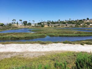
Hi! Have you ever explored a wetland before? Today, I would like to share a place that you would never expect to be so wonderful-Famosa Slough in Ocean Beach. First off, what is a slough? According to the dictionary, a slough (pronounced slōō) is a swamp or shallow lake, usually the backwater of a larger body of water with relatively low water circulation.
In other words, we can think of a slough as a wetland a little farther from the shore than a lagoon where the mouth opens to the Ocean. Another way to look at it is that a slough is the part of the estuary where fresh water from creeks and urban runoff mix with the salty ocean water transported by the tides.
Table of Contents
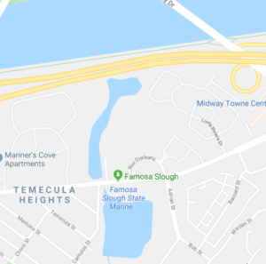
Where is the Famosa Slough?
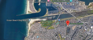
The Famosa Slough is located directly south of the San Diego River Flood Control Channel and is 6 miles north of Downtown San Diego in the lovely town of Ocean Beach.
Famosa Slough comprises 37 acres of wetland between the San Diego River Channel and the residential neighborhoods surrounding the San Diego Sports Arena.
The channel portion consists of 12 acres, while the southern section is 25 acres.
The primary water source comes from the Pacific Ocean that travels via the San Diego River Channel through the San Diego River estuary; and urban runoff waters from the surrounding neighborhoods.
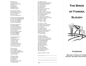
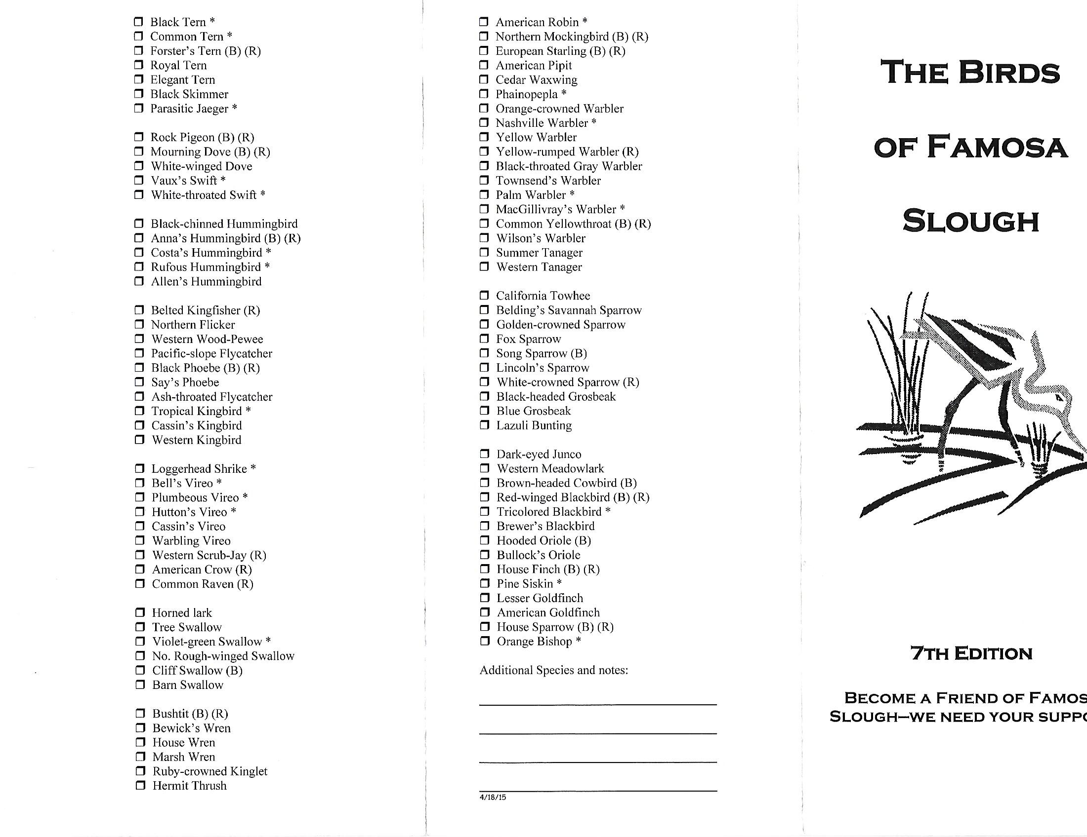
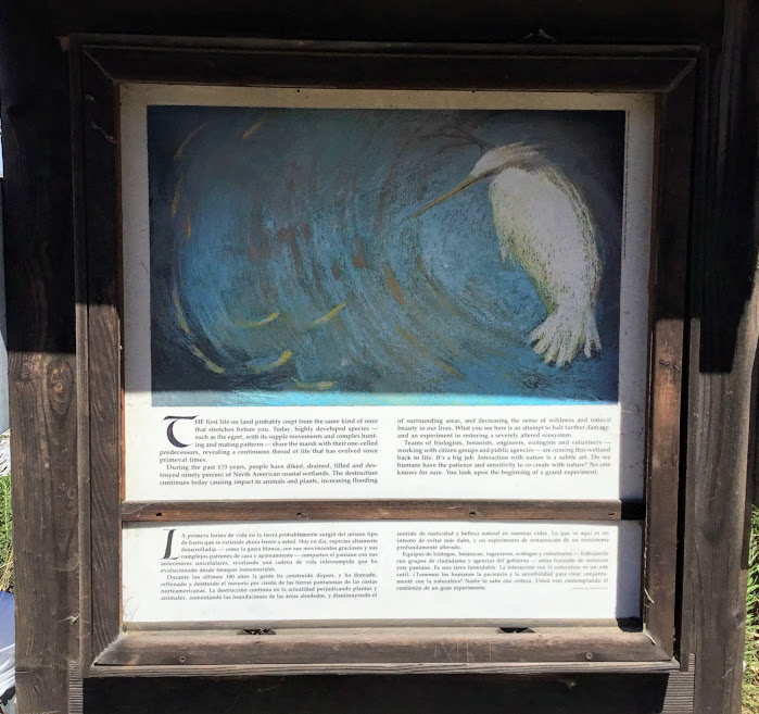
Famosa Bird Watching
Famosa Slough is an excellent site to go bird-watching! The guide below is accessible to the public and can be found at a kiosk on site.

Famosa Slough Hydrology
So let’s now talk about the water circulation pattern.
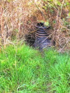
The water flows up the San Diego River Channel through the San Diego Estuary during high tide. It is guided toward a group of culvert pipes with flaps that allow the natural water to flow underneath West Point Loma Blvd.
These flaps on the pipes also keep trash and large debris from entering the Famosa Channel. The water will continue to travel through the channel and eventually end up in the slough’s southern portion.

When the tide is low, the reverse course is taken. The water in the slough is mixed with the fresh creek water and urban runoff and is circulated back through the Famosa Channel.
The water then continues through the pipes under the highway, back into the San Diego Estuary, extending into the San Diego River Flood Channel, and finally making its way into the Ocean.
Increased water circulation provides oxygen and nutrients to the plants and animals and cleans the slough of chemical and algae build-ups.
Did you know that plants produce a natural biofilter in estuaries? When the water travels through, the plants extract the nitrates and phosphates, which help clean the water, one of the many reasons wetlands are so critical.
State Marine Conservation Area
The Famosa Slough is a Marine Protected Area; therefore, nothing may be taken or removed within its borders except in habitat restoration and dredging projects conducted by San Diego.
Friends of the Famosa Slough
A wonderful volunteer organization, The Friends of the Famosa Slough, regularly has parties that go out into the slough to remove trash and non-native plants. They also host nature walks for the public.
Famosa Slough Habitats
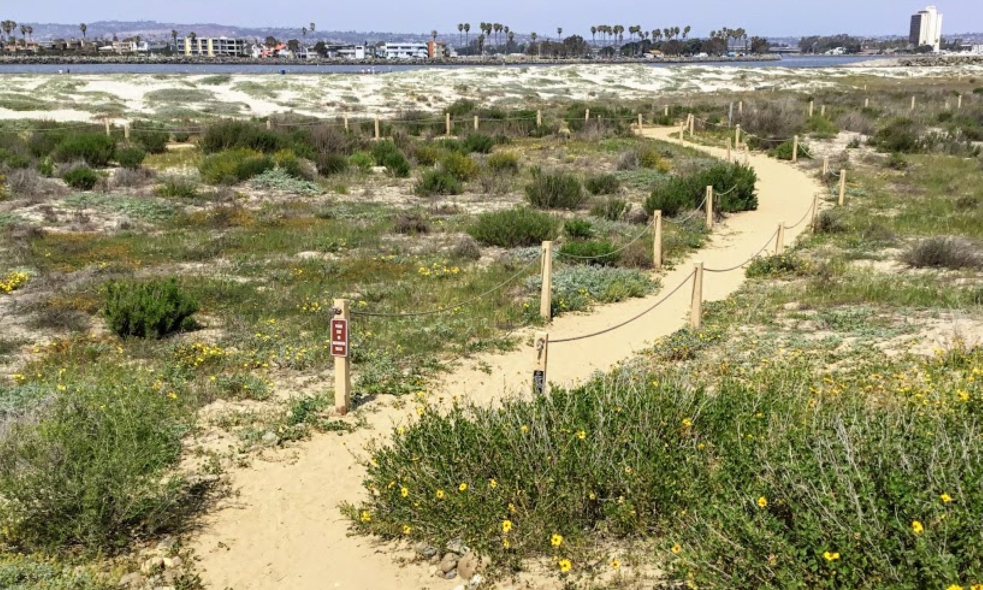
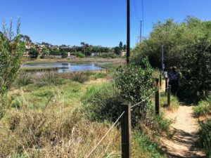
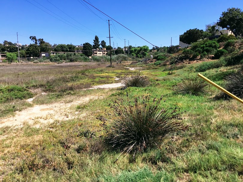
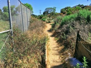
There are many habitats here at the Famosa Slough, so let’s get to walking and check them all out, shall we?
First, here we are at the starting of the southern end of the slough. Parking is available on the street within the residential neighborhood.
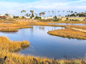
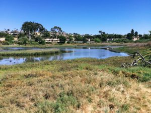
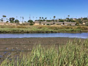
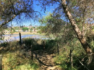
Salt Pool
As we begin our walk, please note that we have a salt pool. Do you happen to notice the islands in the middle of the salt pool? Well, there used to be a peninsula that was attached to these islands. But in 2005, the peninsula was removed, thus making the water circulation much more efficient. Also, these islands provide an excellent habitat for birds to nest on, as they are away from predators.
The salinity in the salt pool will fluctuate throughout the day, especially during a high/low tide day, not to mention if it is raining. Numerous storm drain outlets are empty here.
It is safe to say that the more south you go, the less saline the water. You can notice this by just what plants are present.
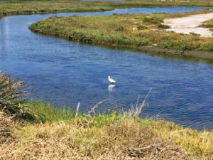
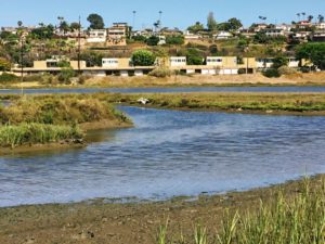
Mudflats at the Famosa Slough
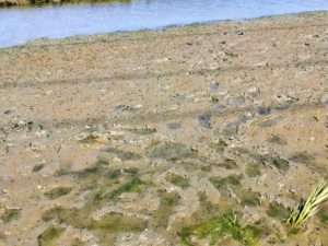
Mudflats occur when the tide recedes and are prime spots for birds to forage snails, worms, and other good things to eat.
Let’s have another look here.
Do you notice that there is a bit of water on the mudflats? The water still present is a tell-tale sign that the tide is low and coming back in soon.
Salt Marsh
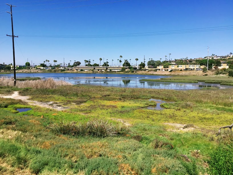
As we travel a bit south, we see a prime example of a salt marsh habitat. Here we have plants -halophytes that can live in high salinity areas. Plants that are seen here include:
- alkali heath
- pickleweed
- fleshy jaumea
- Spartina
- saltwort
Brackish and Freshwater Habitats
As we make our way south, freshwater and brackish plants are more prominent.
While my girls and I were on the trail, we found a volunteer picking up trash. He shared that they recently opened up the far southern portion to allow for better water circulation, as this spot used to be cut off from the salt marsh and was strictly freshwater.
Plants that are found here include:
- alkali heath
- prairie bulrush
- spiny rush
- cattails
- pickleweed
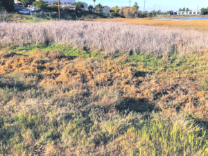
Salt Panne
As we make our way south, we come up with salt pannes- depressions in the ground, devoid of vegetation due to the high concentration of salts surrounding the area. Seeing that we are here on a summer day, I can only imagine that there would be a fair amount of water in the winter after a storm.
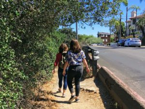
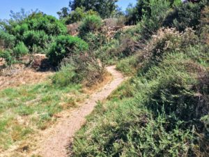
Willow Scrub and Disturbed Riparian Habitats
We had such a good time walking these trails up above the slough. With all the birds singing, you sometimes forget you are actually in a residential neighborhood.
A riparian zone is characterized by the interface relationship between hydrophilic plants and a water source. A hydrophilic plant is one in which its root system can emerge in water.
The riparian zone is disturbed here at the slough due to urban development. It is essential to mention that non-native plants love disturbed areas.
Some of the plants seen in this area include:
- black willows
- Brazilian pepper
- mule fat
- wild oat
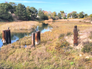
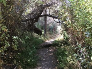
Most Southern Section of Famosa Slough
Here is where the most southern area of the slough and the riparian zone starts.
Furthermore, back in 2000, the City of San Diego created three water treatment ponds to pick up all of the trash, sediments, and pollutants that come with street-runoff water.
Since implementation, a third of an acre of new wetlands have been created, and the water quality of the Famosa Slough has improved considerably. Such great news!
Time to Go, Already?
In closing, I am so pleased that my girls and I stopped here and took a short hike. I especially like that there are benches spread out along the trail. What a fabulous place to come and birdwatch!
I find it so unique whenever I walk around a wetland, and I try to imagine what it was like 100 years ago. The Famosa Slough is the last of the original wetlands connected to Mission Bay. I am so pleased that some wish to keep Famosa Slough as pristine as possible-thank you, Friends of Famosa Slough!
And isn’t it great to go to one location and find so many habitats? The salt pools, salt pannes, salt marsh, brackish/freshwater marsh, disturbed riparian, and Willow Scrub let us not forget the mudflats. It is so much fun to watch the birds on the mudflats!
Please look at the video that I made to commemorate the day! I look forward to coming back here to go bird-watching in the winter. I would also love to compare the winter water levels and come back to check out the channel portion compared to the summer water levels. Maybe even explore the San Diego River Estuary to look at those culvert pipes. Oh, just one more thing to do!
Thank you so much for making it this far! Please feel free to leave any questions or comments below!

I have always had a deep-seated passion for the Ocean Environment which ultimately led me to receive a degree in Marine Biology. Living in the San Diego area for over 30 years, I have extensively explored the 70 miles of San Diego’s coastline, and I am here to share! Please use my website to your advantage and have a look around at all the wonders that the beaches of San Diego can offer you!
Wow! I am so amazed that one area can have so many unique niches in it! I think the bird and plant life alone would be worth the trip. Then you mentioned the trees that can be seen along the riparian zone and I was hooked…I love willow trees and black willows are one of my favorites! This place looks so beautiful and I can’t wait for my next California vacation to include this area!
Kara
Thank you for taking the time to comment! Yes, there really is a lot to see here and not many people are even aware of it. I mean I lived in the area for over 30 years and this was the first time that I got out of the car to explore, I can’t wait to come back in the winter after a big storm to see what the water levels will look like, not to mention all of the birds hanging out on the islands.Have fun on your next vacation!!
The time for that winter visit is now. Famosa Slough has a large number of wintering migratory birds. Yesterday’s highlight was about 100 avocets actively foraging as well as many of other species. I did not recognize any of the Famosa Channel in your video. It is on the north side of West Point Loma Boulevard. It provides very different wetland views and often different species of birds as well.
Thank you so much for taking the time to comment Jim! I have visited the north channel a few months after this initial post and was very glad that I did. I will need to update. I am looking forward to visiting again within the next few weeks.