Black’s Beach Cliff Collapse- I Was There!

Blacks Beach Cliff 2018 featured image

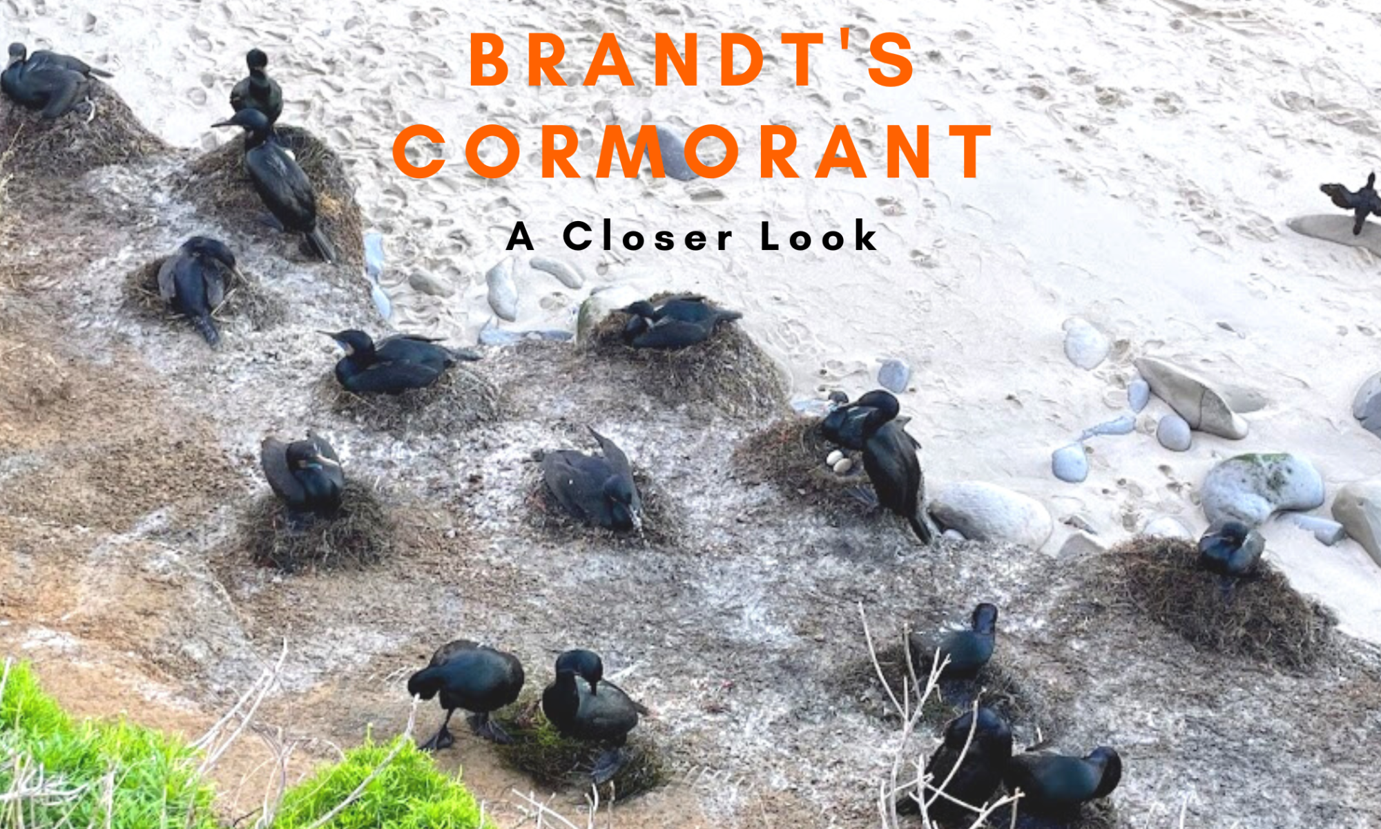
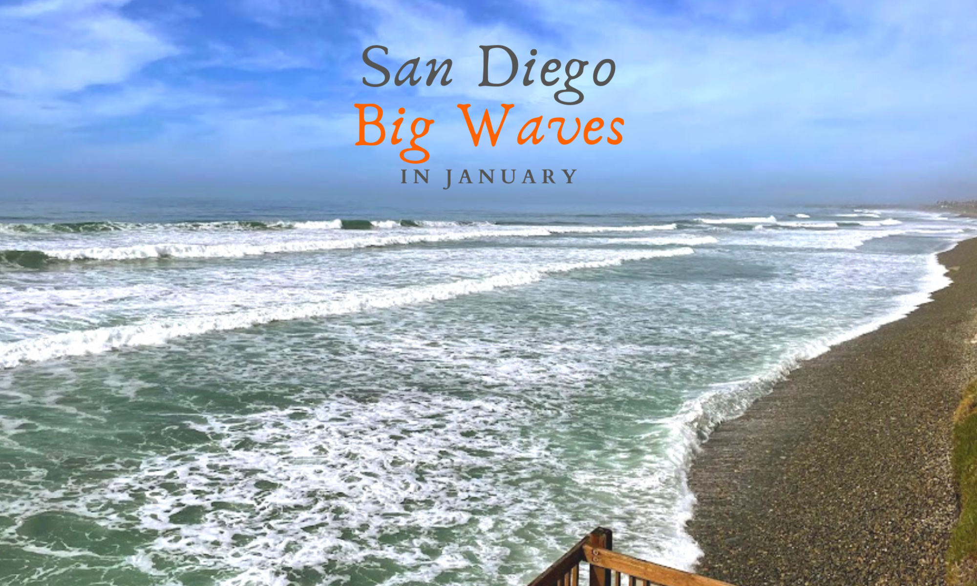
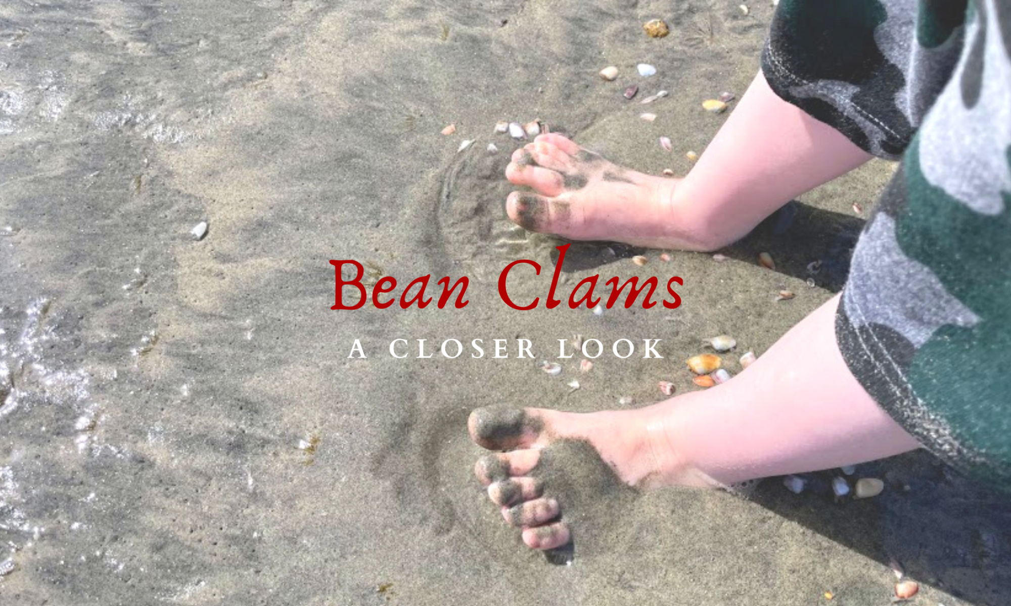
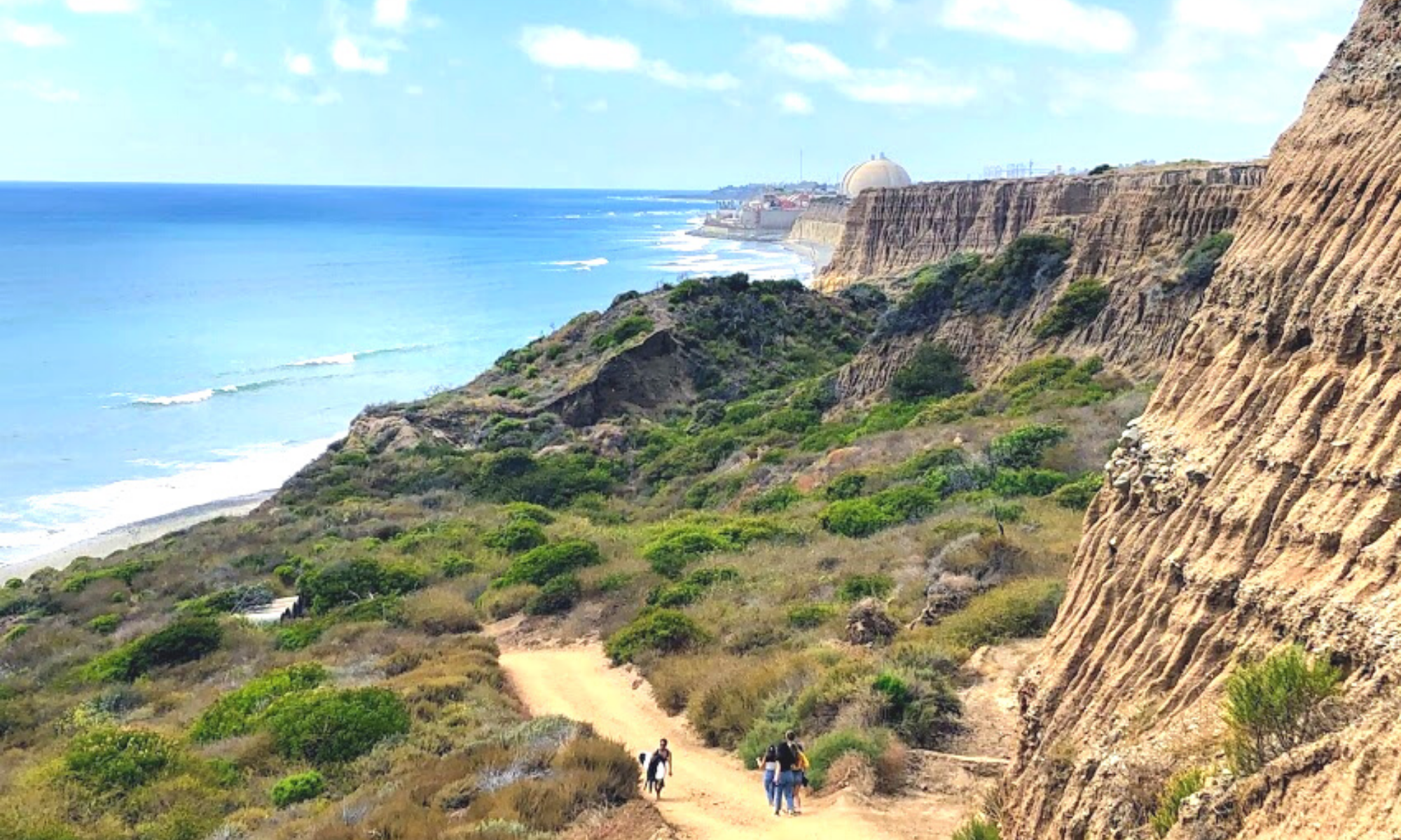
Guess what! I was there when the cliff collapsed at Black’s Beach! I was about a mile away, checking out the bean clams on La Jolla Shores Beach.  Would you believe I didn’t even realize what had happened at 1:29 p.m. until three days later? Yes, it is true, but I am here now and have photos to share. Viewing these incredible videos, let’s look at the January 20, 2023, Black’s Beach cliff collapse! I have also researched and included every past cliff collapse at Torrey Pines State Beach for fun. Finally, I look deeper into the cliffs’ geology and try to figure out a few clues on why the cliff collapsed.

I want to say right up front that I am not a geologist and am trying my hardest, so if I get anything wrong or slightly wrong, please feel free to tell me in the comments.

Continue reading “Black’s Beach Cliff Collapse- I Was There!”

The Brandt’s Cormorant- A Closer Look

Brandt's Cormorant featured image

Today, I would like to take a closer look into the elusive shorebird found on the coast of San Diego, Brandt’s Cormorant. This seabird, the largest cormorant species, is located only on North America’s Pacific Coast and feeds on the California Current. La Jolla is the best place to see Brandt’s Cormorants up close. I just happened to be in the area at the end of January this year and was pleasantly surprised to see a baby cormorant and two eggs!

The Brandt’s Cormorant is strictly marine but is known to enter San Diego Bay. It is fascinating that it does not enter Mission Bay or any of San Diego’s coastal lagoons. Their main colonies are on The Channel Islands of Southern California and Mexico’s Los Coronados Islands.

Let’s take a closer look at the Brandt’s Cormorant, shall we?

Brandt’s Cormorants Characteristics

Brandt's Cormorant scientific info breakdown

Identification

The Brandt’s Cormorant is a large, heavy-bodied, oval-shaped shorebird with a slender neck and hooked beak. The breeding adults are black with a purple sheen, have brilliant turquoise eyes, a very bright blue (gular pouch) throat patch, which fades after the breeding seasons, and whiskery white feathers on the head, neck, and shoulders.

Breeding adults jan black birds cliff ocean

Nonbreeding birds are entirely black, and the juveniles are dark brownish with a fluffy plume around the neck.

Continue reading “The Brandt’s Cormorant- A Closer Look”

Big Waves in January

San Diego Big Waves January featured image

So did you hear about the massive storm that Southern California endured on January 6th? Did you know that there also was a Full Moon on January 6th? It sounds like a perfect combination to me. There were reports of waves reaching the insane height of over 20 feet in some spots! Unfortunately, I wasn’t able to get to the coast to have a look on that incredible weekend, but I was available on the 11th. I looked at the surf report for the second week in January, and Wednesday the 11th looked like the best bet in catching a few shots of big waves with my camera; hurray!

Join me as I journey down the coast, first Oceanside, then Carlsbad, and finally ending my adventure at Swami’s in Encinitas.

Just How Big Were the Waves on January Sixth in San Diego?

The storm came onshore in San Diego early on Thursday,  January 5th. The National Weather Service anticipated widespread coastal flooding, heavy rains, high winds (20 to 30 mph), and massive surf.

Also, the storm has been described as a ‘bomb cyclone’ because it started as a low-pressure system that rapidly intensified into a massive storm that created a west-northwest swell. So needless to say,  W to NW facing beaches experienced the largest waves.

How massive were the waves, you ask?

  • Oceanside Pier- 7 to 10 feet
  • Carlsbad State Beach- 4 to 5 feet
  • South Ponto- 5 to 7 feet
  • Encinitas- 8 to 9 feet
  • Black’s Beach- 15 to 20 feet
  • La Jolla Cove- 18 to 20 feet
  • Mission Beach- 18 feet
  • Imperial Beach- 9 to 10 feet

Continue reading “Big Waves in January”

Five Free National Park Days in 2023!

Free National Park Days San Diego Featured Image

I have good news! This year of the Lord, 2023, there will be five days to visit National Park in the United States for free! Today I am only concentrating on the San Diego County area and a few other Southern California National Parks. Let’s go!

Which Five Days Are Free?

As you probably can guess, all five days are National Holidays.

  • January 16, 2023 (Monday)- Martin Luther King Day
  • April 22, 2023 (Saturday)- First day of National Park Week
  • August 4, 2023 (Friday)- Anniversary of the Great American Outdoors Act
  • September 23, 2023 (Saturday)- National Publics Land Day
  • November 11, 2023 (Saturday)- Veterans Day

I am unfamiliar with a few of these National holidays, so for fun, let’s take a closer look at them.

What is National Park Week?

This year, National Park Week is from April 22 to April 30. So what exactly is National Park Week? Well, due to a Presidential Proclamation- National Park encourages American citizens to get out into nature and appreciate the natural world. I like this sentiment!

Continue reading “Five Free National Park Days in 2023!”

Walking the Beaches of Solana Beach

Walking Solana Beach featured image

Hallelujah! I took the time to finally walk the beaches of Solana Beach on a glorious summer day. It was super hot inland, so I thought, what better time to go and check out the coast? I have wanted to go to Solana Beach forever, so here I am!

Solana Beach is situated between Encinitas to the North and Del Mar to the South, and the beach stretches for over 1.7 miles.

Solana Beach has also been a favorite hangout of juvenile great white sharks in the past couple of years!

Fun Fact- Solana is Spanish for “warm wind”

So here is a list of the beaches of Solana Beach that I had the pleasure of walking on, starting first from the North down to the South-

  • South Cardiff State Beach- Seaside Beach
  • Tide Park Beach
  • Fletcher Cove
  • North Seascape Surf Park
  • Del Mar Shores
  • Del Mar North Beach (Del Mar)

Let’s now look at each beach, followed by exciting facts highlighting each area.


South Cardiff State Beach- Seaside Beach

seaside beach beaches of Solana Beach

Seaside Beach is the very first beach on the northern boundary of Solana Beach. Two popular offshore surf breaks, Seaside Reef and Cardiff Reef, make South Cardiff State Beach a surfing mecca for locals and tourists alike.

Continue reading “Walking the Beaches of Solana Beach”

Free California State Beach Parking Pass? Yes!

California State Library Pass Featured Image

I wanted to stop by quickly to tell you that the California Library service offers the option of checking out a California State Beach Parking Pass!

Do you have a library card? Well, head over and check out a pass! If you do not have a library card, no problem! You can get a free library card at your local library (see info below).

 California State Library Beach Parks Pass Information

Visiting a State Beach in California can get pretty expensive. Purchasing an all-day pass can cost up to 20 dollars. Let’s take a look at what all entails concerning this free library parking pass program.

Continue reading “Free California State Beach Parking Pass? Yes!”

Top Gun: Maverick Filming Locations in San Diego

Top Gun Maverick featured image

So a couple of nights ago, I watched Top Gun: Maverick for the second time, and I had a brilliant idea! I want to present a few filming locations where the movie was filmed around San Diego. I will also give you a few fun facts and a link to Google Maps, so maybe the next time you are in town, you can visit the locations yourself.

Top Gun-Naval Air Station North Island

breakers beach coronado island san diego

Breakers Beach is a private military beach located on North Island, Coronado. I hate to break it to you, but that cute and intimate military bar is not close to the shoreline; that was just pure fantasy.

Continue reading “Top Gun: Maverick Filming Locations in San Diego”

Bean Clams- A Closer Look

Bean Clams Eli toes featured image

Welcome back to my “A Closer Look” series! Today I want to dive deep and write about what I came across while walking Oceanside Harbor Beach last month (where has the time gone?) Let me set up the scene.

Oceanside Harbor Bean Clams beach low tide

So it was April 11th around 3:30 pm; if I recall right, high tide was going to peak at 5.6 feet, so it was probably a 1.0 ft. Anyway, the beach was packed with bean clams! I’m used to sand crabs, not clams.

The colors stood out due to the enormity spread across the shoreline.

So I thought I would take a closer look at bean clams, but there is limited information online.

Bean clams are an edible marine bivalve that the earliest San Diego natives, the Kumeyaay, would regularly collect.

But what else can I find out?

Let’s now take a closer look, shall we?

Continue reading “Bean Clams- A Closer Look”

Bird Rock Beach, La Jolla Uncovered!

bird rock uncovered featured image

So on the very last day of January, I witnessed the second-lowest tide of the year, a -2.08! This is a personal record for me, as the lowest tide I had experienced was -1.98 at the Cabrillo National Monument tide pools,  followed by a -1.34 at Sunset Cliffs. I was excited about what we were in for over at Bird Rock Beach, La Jolla. Join me as I show you what is usually covered by water.

Bird Rock Beach is located centrally within the South La Jolla State Marine Reserve (SMR), so I would like to overview the area briefly.

As a bonus, I have added a few more places we visited on this particular day, including several spots south of Bird Rock Beach in South La Jolla. The view was beautiful, and I wished I could have explored the tide pools!

Unfortunately, I could not walk around the tide pools and explore with a broken finger, but I did get some incredible photos!

Oh, how I love La Jolla!!

Ready? Let’s go!

So, Where is Bird Rock Beach, La Jolla?

Bird Rock Beach google map link
Click on the photo for a map link.

Bird Rock Beach is the center of the South La Jolla State Marine Reserve (SMR) and, in my opinion, one of the best tide pool beaches in San Diego. In all honesty, Bird Rock is only accessible during a very low tide, so calling it a beach is a bit of a stretch, but let’s still go with it.

Continue reading “Bird Rock Beach, La Jolla Uncovered!”

WSL at Trestles in September!

world surf league trestles featured image

It was announced on January 18 that the Rip Curl World Surf League (WSL) Finals would be at Trestles this year! That’s right! In a one-day, winner-takes-all surfing event, Trestles will be where the Championship finals will take place in September!

The 2022 WSL Championship Tour kicked off at the world-famous Banzai Pipeline on O’ahu’s North Shore on January 29. The top men and women surfers from around the world competed together at this legendary surf break.

Never before have both men and women surf the Pipeline together while competing.

WSL Men and Women Surf Competition to be Combined

Trestles Surfboard WSL at Trestles
A surfboard resting over at Lowers

WSL will combine the men’s and women’s Championship Tours for the first time. As noted above, never before have men and women competed at the same time or won the same prize money.

Well, this year, that has changed.

The 2022 Championship Tour (CT) Season will start with 36 men and 18 women. Halfway through the season, the field will be reduced to 24 men and 12 women.

The top-rated wave riders will automatically qualify for the 2023 season, go on to the tour’s second half, and be joined by two men’s and women’s wildcards.

WSL Championship Tour-Surfing in Over Seven Countries!

Swamis surfing sign WSL at Trestles

Before the Finals take over at Trestles, the WSL Championship Tour will include ten regular-season events at some very exotic locations. I’m not familiar with many of these beaches, so I thought it would be fun to do a bit of a deep dive into each location’s waves.

I will be going over specific wave characteristics of each location, noting the type and direction of each wave, the ideal swell, tide, wind, season, and how big each site can ultimately get.

I’m not a surfer, so please be patient with me and feel free to offer any suggestions if any information is incorrect or slightly off, mainly which surf breaks are used in the Championship Tour.

Continue reading “WSL at Trestles in September!”

Why Did the Sea Lion Cross the Road?

San Diego sea lion featured image

Have you heard the adage, “Why did the sea lion cross the road?” We can thank the Marco Polo California sea lion who took the world’s stage on January 7 ,” for doing just that! Are you ok if I refer to him as Marco Polo? What makes it even more interesting is that this isn’t the first time this particular sea lion has been caught exploring the streets of San Diego!

So, where has he been? How do you think he got on the freeway?

Hopefully, I will answer all of these questions for you and more!

More?

Yes! I have found several other examples of wandering sea lions in San Diego.

Let’s now look at where this sea lion has been seen in San Diego.

CA sea lion la jolla bluffs
This is not Him, just an example at La Jolla.

Hey, Is That a Sea Lion on the San Diego Freeway?

Cholla Creek Sea Lion google map

(The red marker is the mouth of Cholla Creek- see arrows for where he was seen on the freeway)

So on January 7, San Diego drivers on State Route 94 were in for a super surprise!

When?– January 7, 2022, at around 9:40 am; captured by 10:30 am

Where? The eastbound side of State Route (SR)-94, near Interstate (I) 15 and just west of Interstate (I) 805 (see map). Three miles from San Diego Bay and eight miles from the ocean

Josefine Jandinger was driving eastbound SR-94 just west of I-805 when she saw two people standing in the middle of the freeway, coaxing a 200-pound juvenile sea lion toward the median. She couldn’t believe what she was seeing. Josefine took the video down below.

Kudos to the couple who dared to exit their cars and help in any way possible. You are the true definition of heroes!

Continue reading “Why Did the Sea Lion Cross the Road?”

Walking Shoreline Park at Shelter Island

shoreline park featured image

As my girls and I walked around Famosa Slough on a clear November day, we realized that we still had a couple of hours before picking my husband up from work. So we decided to go to Shoreline Park on Shelter Island at San Diego Bay. We have been coming here for years!

I love to watch the boats in San Diego Bay. But there are so many other things to pay attention to over here, for instance, observing the jets take off and land over on Naval Air Station North Island/ Coronado or shorebird’s dive-bombing into the bay. On a clear day, you can see the Coronado Islands of Mexico (Islas Coronado.)

And how about the smells? There is nothing better than the crisp smell of saltwater, is there? I find it so refreshing!

The sounds here on Shetler Island are just as unmistakable: sea lions barking, the wind blowing through the trees, and the water lapping on the rocks after a large ship goes by. You might even hear the chattering of green parrots. Did you know that a flock of green parrots live here on Shelter Island? More on these lively parrots later.

Let’s now look at what we saw and offered here at Shoreline Park/ Shelter Island.

#Click on any small photo to see a larger version.

Exploring Shoreline Park in November

shoreline park shelter island google map

button map shelter island shoreline park

Shoreline Park is a narrow band that stretches for one mile on the bayside of Shelter Island. Dogs are welcome here but must be on a leash.

Continue reading “Walking Shoreline Park at Shelter Island”

A Few Plants at Famosa Slough

famosa slough featured image

Last month, on November 23rd, my girls went to Famosa Slough because I wanted to check out and see how the plants were doing. I knew that the toyon and buckwheat were in bloom, but what other surprises were we in for? I can tell you upfront that I saw my first California boxthorn bush! Have you ever seen one in the wild?

So today, I wish to keep things casual, seeing that I have written more in-depth about almost all of these plants.

Please see the links down below if you would like further information.

A Few Famosa Slough Facts

Famosa slough map google maps

button-map-Famosa-Slough-Google-Maps

First and foremost, the Famosa Slough is a living wetland preserve and a Marine Protected Area, meaning nothing is to be touched or taken. It survives as a wetland by the tidal flow from the culvert pipes that connect it to the San Diego River Channel.

It consists of two sections: the Northern Channel, 12 acres, and the southern portion, 25 acres of mixed wetlands. The more south you go, the less saline the water.

I have been here four times and have written about Famosa Slough before, only concentrating on the southern section. Well, today, we explored both.

North Channel of Famosa Slough

famosa slough pano san diego saltmarsh

The North section connects to the San Diego River Channel north, with the southern portion just across the street.

Continue reading “A Few Plants at Famosa Slough”

First Day Hikes 2022

First Day Hikes 2022 Featured Image

Wow! I am so happy to write up this post in record time! You see, yesterday, I realized that the California State Parks uniquely celebrate the New Year. How is that, you may ask?
California State Park staff members, docents, and volunteers will show off the beauty and wonders of our gorgeous State Park system by leading the general public in First Day Hikes! Below is valuable information on each San Diego/ California State Park featured, plus a brief explanation of where and what is offered.
I will start north up at San Onofre State Beach and go south towards the California/Mexican Border.
It is supposed to be chilly on the coast today, with the high only 62 degrees, so please consider that!


First Day Hikes at San Onofre State Beach

Trestles November sand dunes water surfers

Where – Trestles Beach Trailhead on Cristianitos Road/ El Camino Real

Time- 2 pm

Continue reading “First Day Hikes 2022”

Pacific Beach Boardwalk on a Mid-November Day

Pacific Beach featured image

One of my very best friends, Paula, lived in Pacific Beach for a bit when we were both in college. I have distinct memories of visiting her apartment right off the Pacific Beach Boardwalk and close to Crystal Pier.

Fast-forward 33 years, and we are back!

Seriously though, Paula, her husband John, and I spent an hour together soaking in the sun, ocean, and wind while reminiscing. Check out what we experienced on this sunny but very windy mid-November day.

Where is Pacific Beach?

Pacific Beach map google maps

button map Pacific Beach google maps

Pacific Beach is found between La Jolla to the north and Mission Beach to the South.

Let’s now take a look at some of the day’s highlights!

parasailing-Pacific-Beach
The wind was just suitable for parasailing over North Pacific Beach!

Here we are looking out over North Pacific Beach from the Crystal Pier. If you follow the surf break straight ahead, this is where the Tourmaline Surfing Park is located (just south of Law Street Beach.) When the conditions are right, you will see many surfers paddling out past False Point (see map above.)

Continue reading “Pacific Beach Boardwalk on a Mid-November Day”