One of my favorite places to explore over the past 30 years is the Los Penasquitos Lagoon at Torrey Pines State Natural Reserve. Can I take you on tour?
Ok! Let’s go!
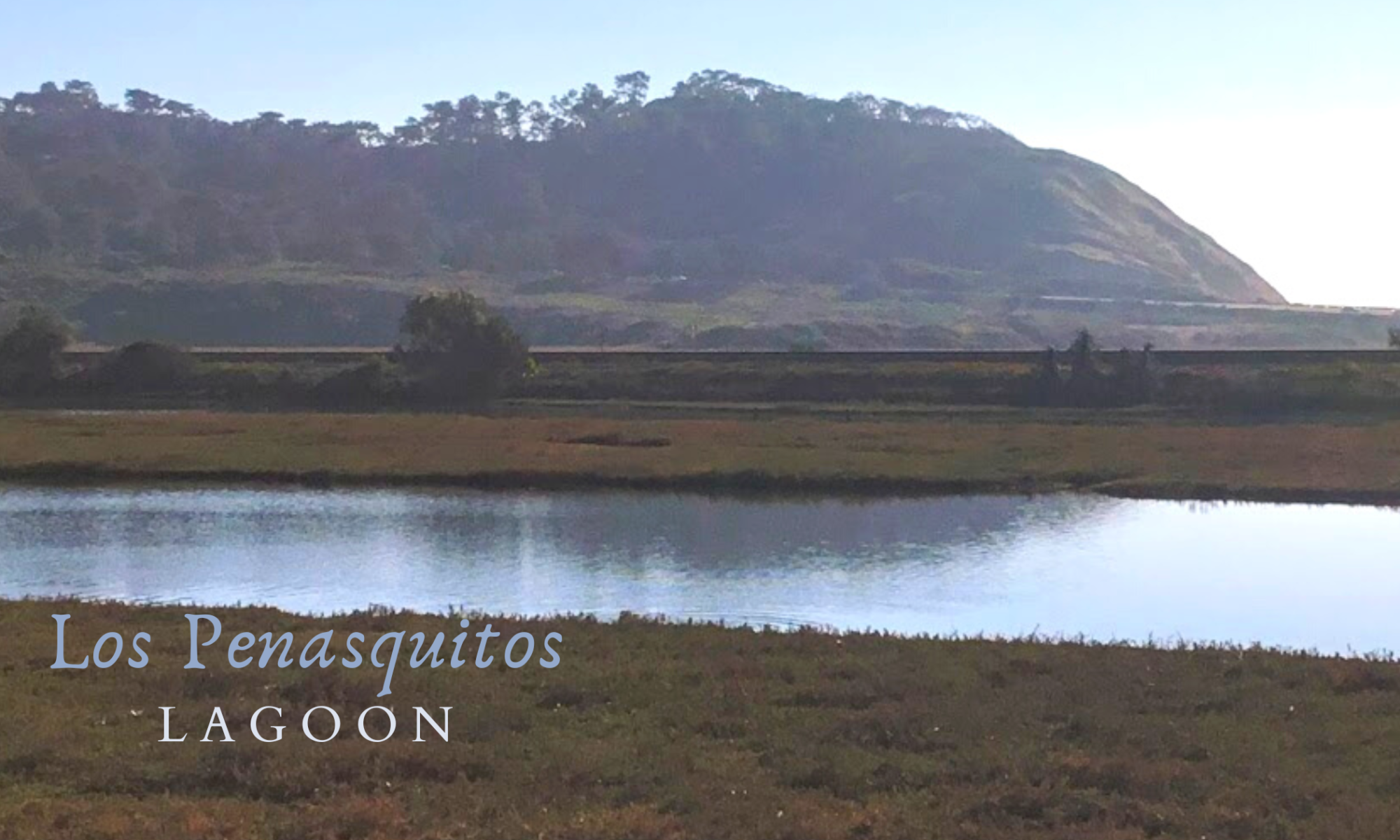
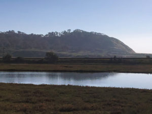
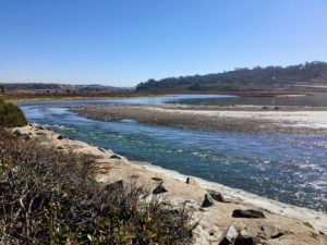
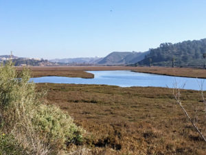
Located between Del Mar to the north and the border of San Diego to the south, the Los Penasquitos Lagoon is a 510-acre coastal salt marsh estuary.
—>San Diego Lagoons and Nature Centers<—
Meaning “The Little Cliffs” in Spanish, the Los Penasquitos frames the northern part of the Torrey Pines State Natural Reserve.
Table of Contents
The Los Penasquitos Lagoon is a Salt Marsh?
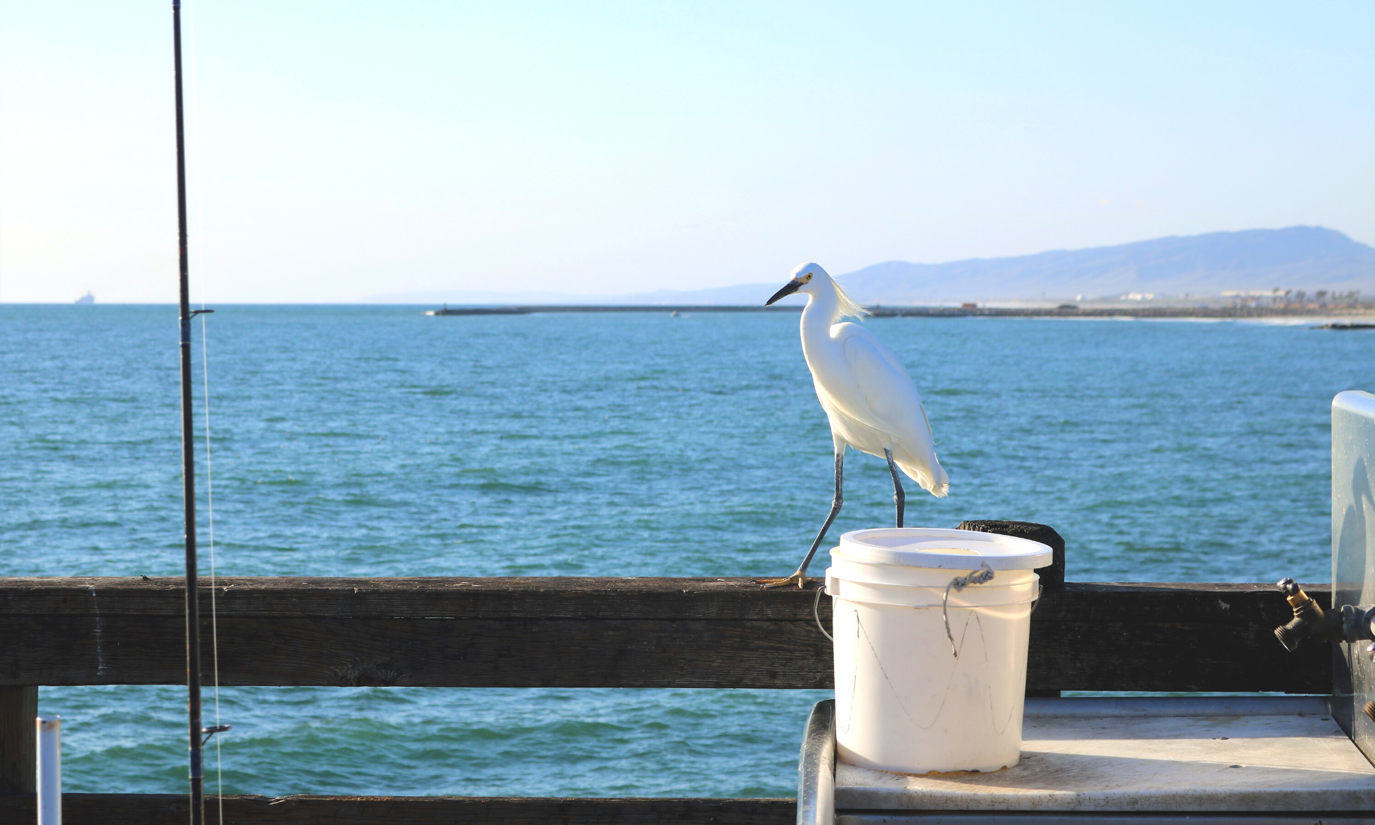
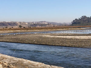
Los Penasquitos Lagoon is one of the last salt marshes in southern California. The lagoon supports many plants and animals, including seven threatened or endangered species.
Another interesting fact is that this lagoon also serves as a refuge for migratory birds that use the Pacific Flyway.
—>Best San Diego Birding Hotspots<—
Since joining the State Park System, there have been quite a few changes to help increase the overall tidal flow here at the Los Penasquitos Lagoon.
Let’s now have a look.

Places nearby– Torrey Pines State Beach
Torrey Pines State Natural Reserve
Activities– Hiking, bird watching
Los Penasquitos Lagoon History
Development within the lagoon in the 1880s and the 1930s has modified the lagoons’ hydrology process.
There are several reasons for how this eventually happened.
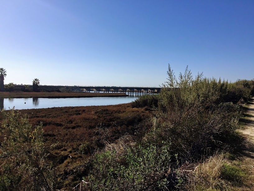
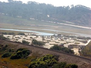
Sante Fe Railroad Track at the Los Penasquitos Lagoon
First, in 1925, the Sante Fe Railroad built a single-track roadbed causeway embarkment down the center of the lagoon for its Surfline.
Can you believe that this track is still in use today daily?
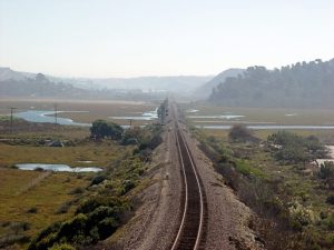
The embarkment severely restricted the normal historical lagoon drainage for the first time, ultimately changing the tidal flow.
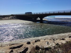
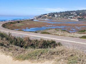
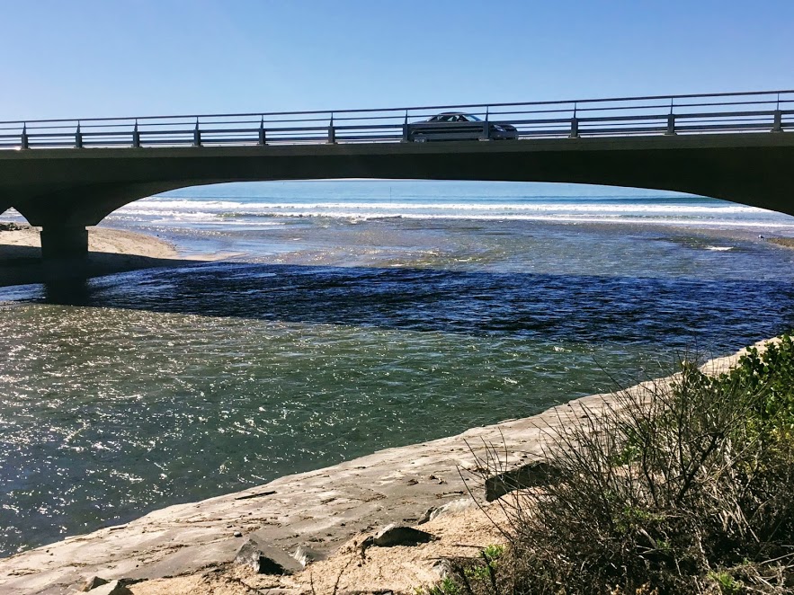
A New Highway 101 Bridge Over the Los Penasquitos Lagoon

In the 1930s, the Pacific Coast Highway, known as US Route 101, was expanded, the roadbed along the beach heightened, and a bridge built over the lagoon’s mouth.
The waterway under the bridge would continually get clogged with sand and debris due to the 72 wooden pilings. This debris, in turn, would impact the water flow between the ocean and the lagoon.
In 2005, a new bridge was built for uninhibited water flow.
Do you notice that there are only four cement pilings? Because of this, the lagoon being closed off by sand and debris doesn’t happen anymore.
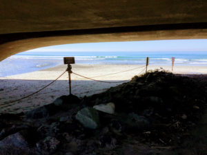
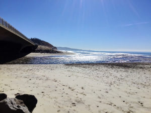
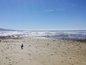
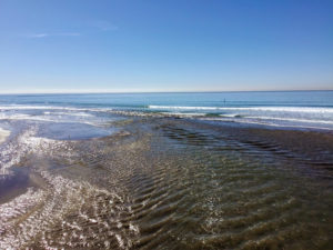
Due to the very low tide, the tidal flow out to the beach is more vital than usual.
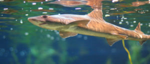
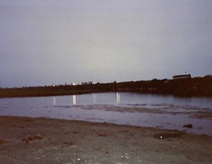
Fun fact- My husband and I would consistently come out here to Torrey Pines State Beach back in the early 1990’s when we were dating.
One of our favorite things to do was to go at night with flashlights. Looking for gray smoothhound sharks, we would shine the light into the mouth of lagoon. Their eyes would glow green with the reflection of light.
Let’s now look at the lagoon’s mouth from on top of the bridge on Highway 101.
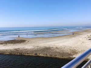
Do you see the metal pole sticking out of the water towards the left? That monitor keeps track of the tidal flow in and out of the lagoon.
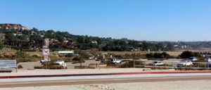
North Beach Entrance Parking Lot at Torrey Pines State Beach
In 1983 the Los Penasquitos Lagoon Foundation was established. The primary function of this foundation is to keep the mouth of the lagoon open, improve circulation, and restore critical habitat.
According to the Los Penasquitos Lagoon Foundation and the State Coastal Conservancy, the fully paved North Parking Lot in 1968 altered the lagoons’ hydrology (water circulation).
Could this lagoon ever catch a break? First, off the railroad, clogged bridge pilings, and finally a cement parking lot. All three structures wreaked havoc on the water circulation!
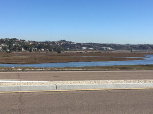
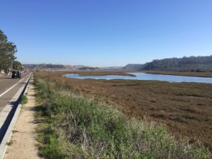
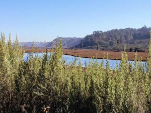
Continuing from the North Parking lot and following Carmel Valley Road, there is an unofficial path in which you may view the lagoon from behind a barrier. Let’s go!
Los Penasquitos Lagoon Trails
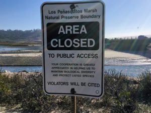
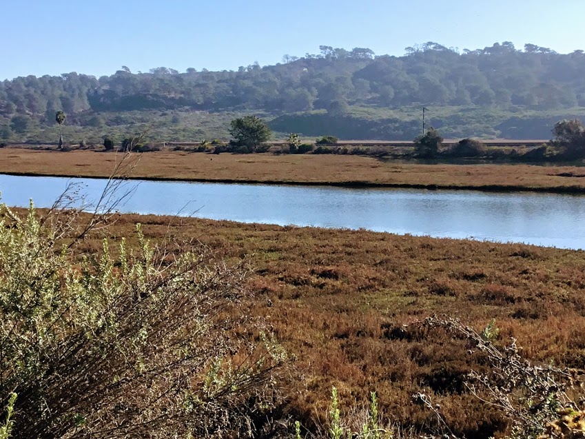
Although almost all of the lagoon is off-limits to the public, one trail- The Marsh Trail- is open to exploring!
To reach this trail, you must start at North Torrey Pines Road (HWY 101).
You will find the trailhead not that far south on the east side of the road. The trail winds around the western side of the Reserve, finally ending up in the industrial area of Sorrento Valley.
This trail is not a loop, so you must turn around and return, keeping that in mind. If you go to the end, the roundtrip would be about 4 miles.
There are many plants and animals to look out for, so keep your eyes open!
—>Los Penasquitos Lagoon Field Guides<—
My Special Place-Los Penasquitos Lagoon
Well, thank you so much for joining me on a tour of the Los Penasquitos Lagoon. As you can see, it is not enormous but has character.
Check back later as I plan to hike on the Marsh Trail shortly!
As I have previously stated, this lagoon has always held a special place in our hearts. I feel incredibly fortunate to have seen so many improvements and witnessed this lagoon’s transformation over the last 30 years.
The new bridge has a lot to do with this, so thanks to the new bridge! Thank you for allowing more water into the lagoon and improving the circulation.
Special thanks go to the Los Penasquitos Lagoon Foundation for their hard work and dedication to preserving and researching this environment.
I hope you may one day witness the Los Penasquitos Lagoon in person. San Diego has many beautiful places to discover, especially the coastline!
Please leave any comments or questions that you may have down below.
Until next time!

I have always had a deep-seated passion for the Ocean Environment which ultimately led me to receive a degree in Marine Biology. Living in the San Diego area for over 30 years, I have extensively explored the 70 miles of San Diego’s coastline, and I am here to share! Please use my website to your advantage and have a look around at all the wonders that the beaches of San Diego can offer you!
It looks like a nice place to go for a walk and take in a little bit of scenery. I do like to watch birds from time to time. Are there any bird huts located there to spy on them in the marsh?
Thank you for visiting Owain. I am not sure if there are any bird huts on the Reserve, especially at the Lagoon. I have read that on the Marsh Trail there are some big trees, so I suppose that would help with some cover to watch the birds in the marshland. I will have to get back to you after I try the trail out! Thanks again for your question. I do have a suggestion on where you can go that does have some natural barriers to observe bird up close. https://70milesofcoast.com/a-walk-around-buena-vista-lagoon
Great write up Coleen!
We are heading there now.