Wow! Do I have some exciting information for you all? Many of you may have somewhat of an idea of my complete, somewhat obsessive love of King Tides. For all others, a King Tide is when you have the highest and lowest tides of the year (click on the link for more in-depth information.) Most attention is given to the high tide, as people enjoy seeing how far the ocean will reach on land.
I love going to the beach during the lowest tides, so I can examine what is usually covered by the ocean and have rare access to beaches that are typically not accessible. And let me tell you, today is one of those days.
Yes! My girls and I explored two caves at the La Jolla Underwater Park!
Now I must say right up front that getting to these caves is no easy feat, and you have to have tremendous balance as there is at least a quarter-mile of rocks to walk over until you reach the semi-sandy beach over at Caves Beach.
Would you like to see what we saw?
Let’s go!
Table of Contents
The La Jolla Underwater Park
![]()
First off, a little background information for you.
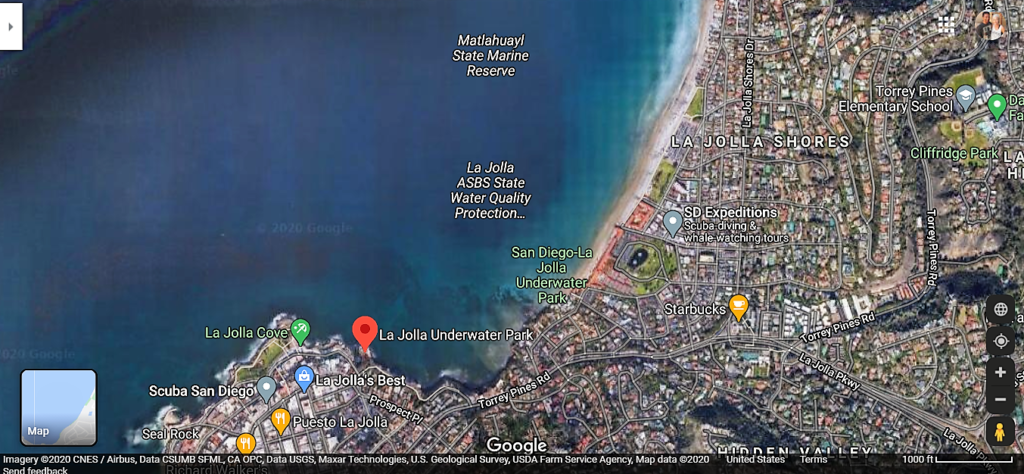
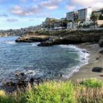
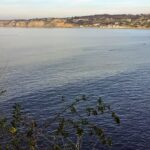
The La Jolla Underwater Park was established in 1970 by San Diego and covered over 6000 acres. The northern boundary begins at Black’s Beach (Torrey Pines State Beach), and the southern border is at La Jolla Cove.
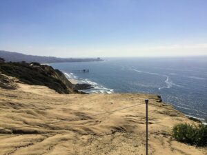
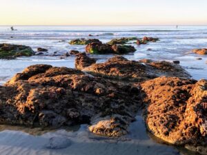
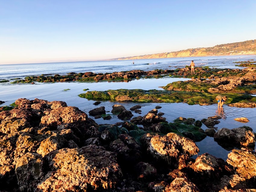
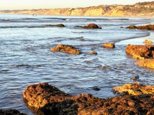
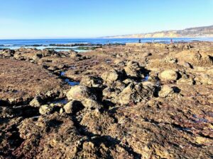
Below, I have provided several photos that showcase the park from varying vantage points, starting from the South to the North.
California State Marine Protected Areas
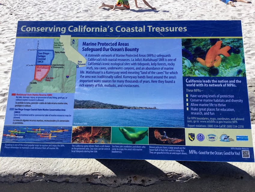
The La Jolla Underwater Park has two different State Marine Protected Areas. The first, the southern section, is Matlahuayl State Marine Reserve (MSMR), which spans from mid-La Jolla Shores across to La Jolla Cove and is designated an Ecological Reserve you may look at but not touch.
Fun Fact- Matlahuayl is a Kumeyaay word that means, “land of caves”, for which the area was once was called.
In other words, no take, damage, injury, or possession of any living, geological, or cultural marine resources is allowed.
There are buoys set up to help distinguish the boundaries. Absolutely no fishing is allowed within the buoyed section.
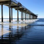
In the Northern section of the La Jolla Underwater Park, the San Diego- Scripps Coastal Marine Conservation Area (SMCA) (est 1929), a Marine Life Refuge, begins at the Ellen Browning Scripps Memorial Pier and continues to Black’s Beach.
Over at SMCA, some recreational or commercial take of marine resources may be allowed.
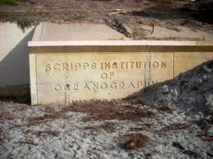
The Scripps Institute of Oceanography (SIO) is located hereabouts and takes full advantage of the Marine Refuge to research. Due to the proximity of SIO, both Scripps Canyon and La Jolla Canyon are the most researched submarine canyons in the world.
The map above shows that this region (the Marine Reserve) extends farther out west than the Ecological Reserve.
Fun Fact- Located just above the Scripps Canyon on top of the bluffs, is a San Diego Hidden Gem- the Scripps Coastal Reserve Biodiversity Trail. I highly recommend you checking it out!
The Two La Jolla Submarine Canyons
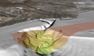
There are two submarine canyons located within the La Jolla Underwater Park:
- La Jolla Canyon
- Scripps Canyon
The La Jolla Canyon is found offshore around mid- La Jolla Shores Beach. Here, the beach gradually slopes and suddenly drops 500-ft (152 m) to the ocean floor.
The lowest depth of the La Jolla Canyon within the park is 600 ft (182 m).
I have been trying to find out the maximum depth of La Jolla Canyon but have failed. If anyone happens to know what it is, please leave a comment.
Scripps Canyon is a narrow gorge one mile long that is considerably shallower than La Jolla Canyon, with a maximum depth of only 500 feet. The submarine canyon starts at Black’s Beach.
Scripps Canyon is a top-rated diving site due to the canyon’s vertical walls being relatively close to the shore ( at a 40-foot depth.)
Both canyons join at 900 feet and continue seaward until a depth of 1600 ft (see map above).
Submarine Canyons Influence?
Because of these submarine canyons and the kelp beds close offshore, the wave energy is reduced here considerably, making this a prime beach for little children, launching a kayak, and going paddleboarding, snorkeling, or scuba diving.
Another great highlight is that it is not uncommon to see a rich and wide variety of sea life, including gray whales feeding very close to shore.
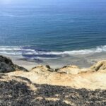
Starting Our Adventure at La Jolla Shores Beach
Ok, I should warn you that the tide needs to be very low and negative; at least 0, but a negative tide is the best.
La Jolla Underwater Park Ecological Reserve-Matlahuayl (SMR)
Have you ever heard the adage, nothing great comes to you easy? Yeah, that applies here.
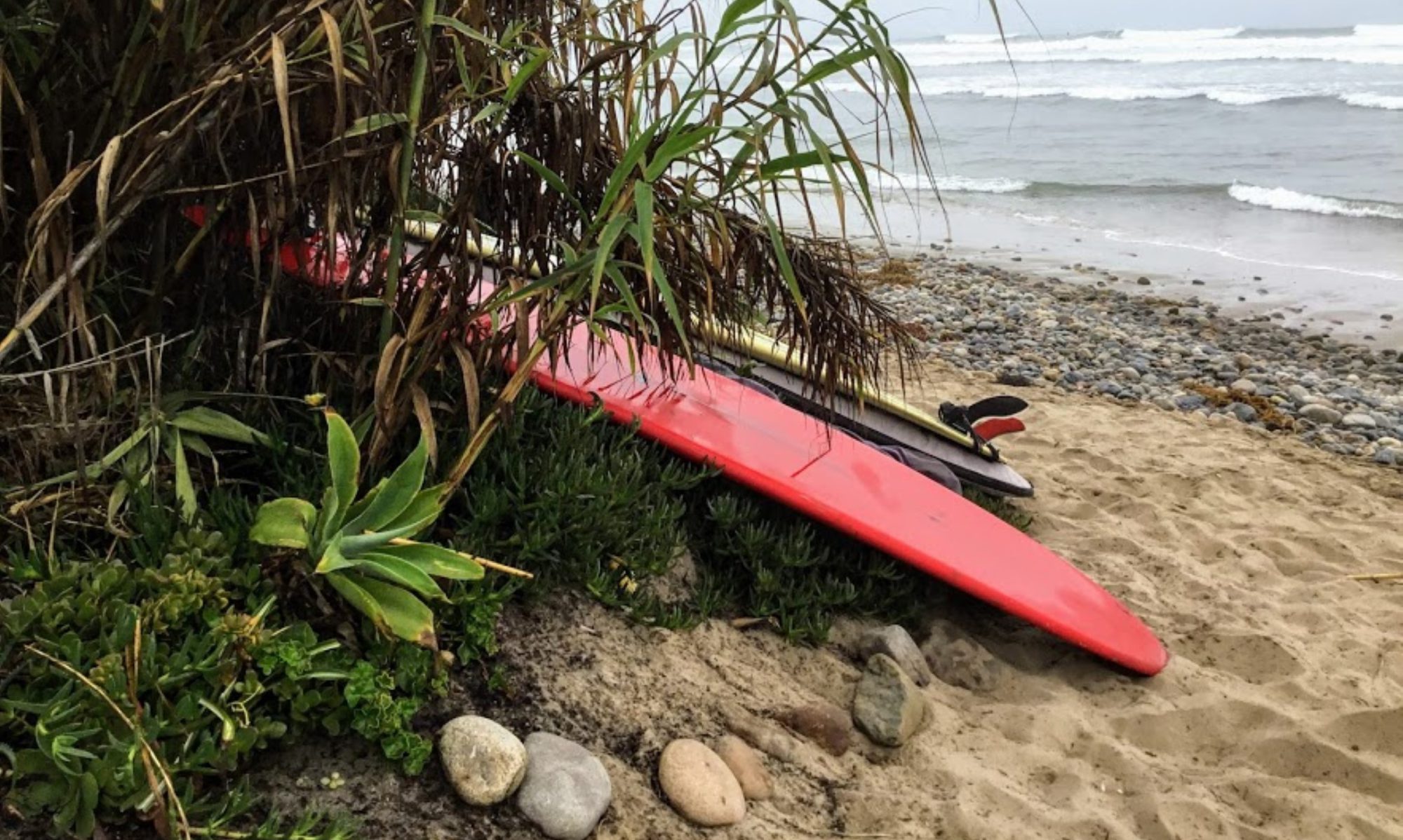
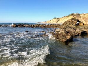
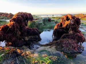
You must walk over many tide pool reef rocks to reach these caves. Most stones are very slippery due to the algae, so please consider that. Also, try not to step on anything living.
I prefer to be barefoot, as it is easier for me. But I did see several people wearing special beach footies, so there is that.
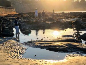
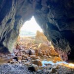
It was not an easy task; let me tell you. Especially having a backpack on, we could come upon two caves without falling once.
I can not tell you how excited we were as we were not expecting to turn a corner and come upon an empty cave.
Our focus had always been on Caves Beach, just south of where we were walking. We needed to see the Seven Caves of La Jolla, and we were determined!
So, while we were hiking over the rocks, we kept looking across. Distracted by our determination, I guess you could say.
So it was a complete surprise when we came upon these two caves, closest to La Jolla Shores Beach.
Seeing that time was slipping away, and we could see one more cave close by, we decided to stay put and explore.
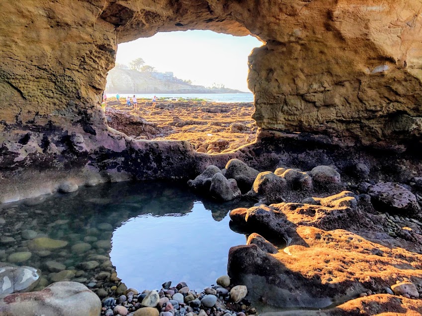
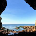
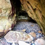
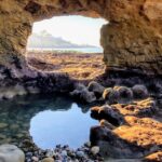
A Couple of Sea Caves at La Jolla Underwater Park
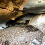
Here is the first cave we were able to see! I didn’t take as many photos as I would have liked because many people were around.
The inside was humid and smelled of minerals and salt. Thank goodness there were no beach flies present. We came upon a diver in her wetsuit inside of this cave. She mentioned that she made a memorable trip from Los Angeles because it was a King Tide day.
So if you are a diver, it may be easier to visit these caves than to walk over all the reef rocks—just something to keep in mind.
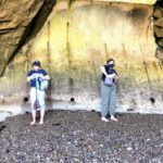
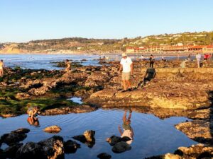
Here we are in the second cave, only about a five-minute walk from the first cave.
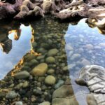
Looking closely at the third photo, you can see a couple of the Seven Caves of La Jolla across the water.
So what do you think? Pretty incredible, yes?
Before I leave you, I wanted to add a couple more dates if you would like to experience a King Low Tide at the beaches of San Diego in the New Year.
King Low Tide Dates for 2021
January 2021
- 11th at 2:27 pm- (-1.7 feet)
- 12th at 3:09 pm- (-1.8 feet)
- 13th at 3:50 pm- (-1.7 feet)
- 14th at 4:29 pm- (-1.4 feet)
February 2021
- 8th at 1:39 pm- (-1.3feet)
- 9th at 2:19 pm- (-1.5 feet)
- 10th at 2:55pm- (-1.5 feet)
- 11th at 3.28 pm- (-1.4 feet)
King Low Tide Dates for 2022
January 2022
- 29th at 1:44 pm- (-1.58 feet)
- 30th at 2:27 pm- (-1.93 feet)
- 31st at 3:08 pm- (-2.03 feet)
February 2022
- 1st at 3:47 pm- (-1.87 feet)
- 28th at 2:10 pm- (-1.64 feet)
December 2022
- 22nd at 2:46 pm- (-1.67 feet)
- 23rd at 3:32 pm- (-1.89 feet)
- 24th at 4:20 pm- (-1.86 feet)
- 25th at 5:09 pm- (-1.61 feet)
Until next time!
Other Helpful Posts- Can you tell that I love this area?
- La Jolla Shores Beach
- Top Ten Best San Diego Tide Pools
- Showcasing the Best Beaches of La Jolla
- Blacks Beach the Naked Truth
- Best Hikes on the San Diego Coast
- La Jolla Coast Walk Trail-Let’s Go!
- Let’s Take a La Jolla Coast Walk!
- San Diego Wheelchair Accessible Beaches
- San Diego Shark Sightings

I have always had a deep-seated passion for the Ocean Environment which ultimately led me to receive a degree in Marine Biology. Living in the San Diego area for over 30 years, I have extensively explored the 70 miles of San Diego’s coastline, and I am here to share! Please use my website to your advantage and have a look around at all the wonders that the beaches of San Diego can offer you!