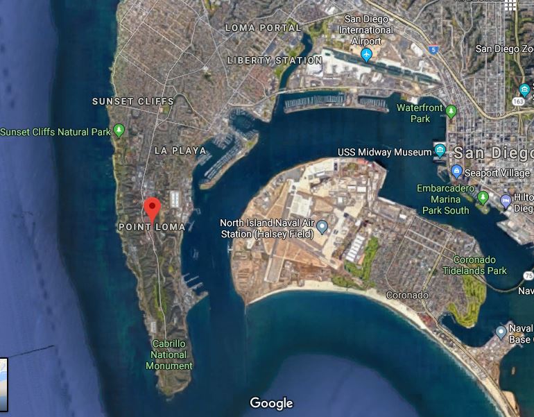
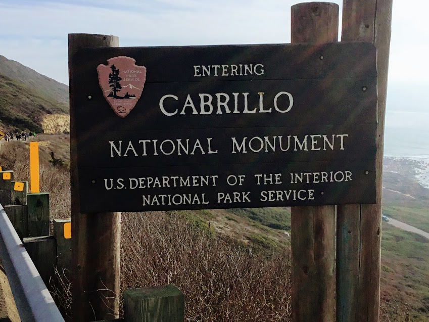
Situated at the end of the Point Loma Peninsula, Cabrillo National Monument has some of the most popular and easily approachable tidepools in all of San Diego.
After my latest trip this past New Years Day, on a spring tide, I whole-heartily agree!
Come and join me on a tour of the Cabrillo National Monument tide pools!
Table of Contents
The Cabrillo National Monument Tide Pools
Cabrillo National Monument
A Bit of Cabrillo History
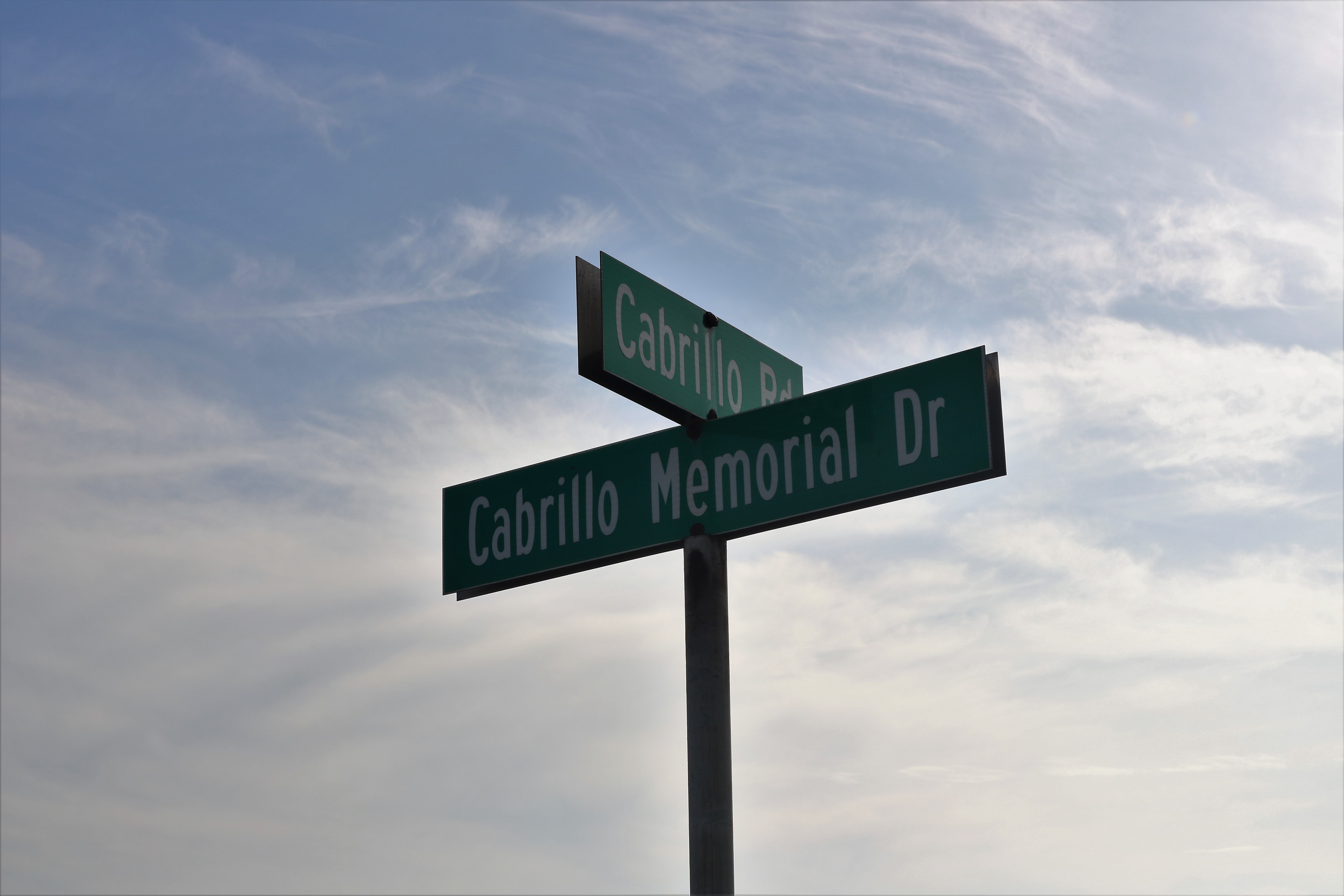
Cabrillo National Monument is at the southern end of the Point Loma Peninsula at 18000 Cabrillo Memorial Drive, San Diego.
Before we start let’s talk a bit about the history of this location and why it is so popular.

In 1542, Juan Rodriguez Cabrillo and his crew were the first Europeans ever to discover the West Coast of the United States.
Donated by Portugal in 1935, the Juan Rodriguez Cabrillo memorial statue looks down upon the entrance of San Diego Bay.
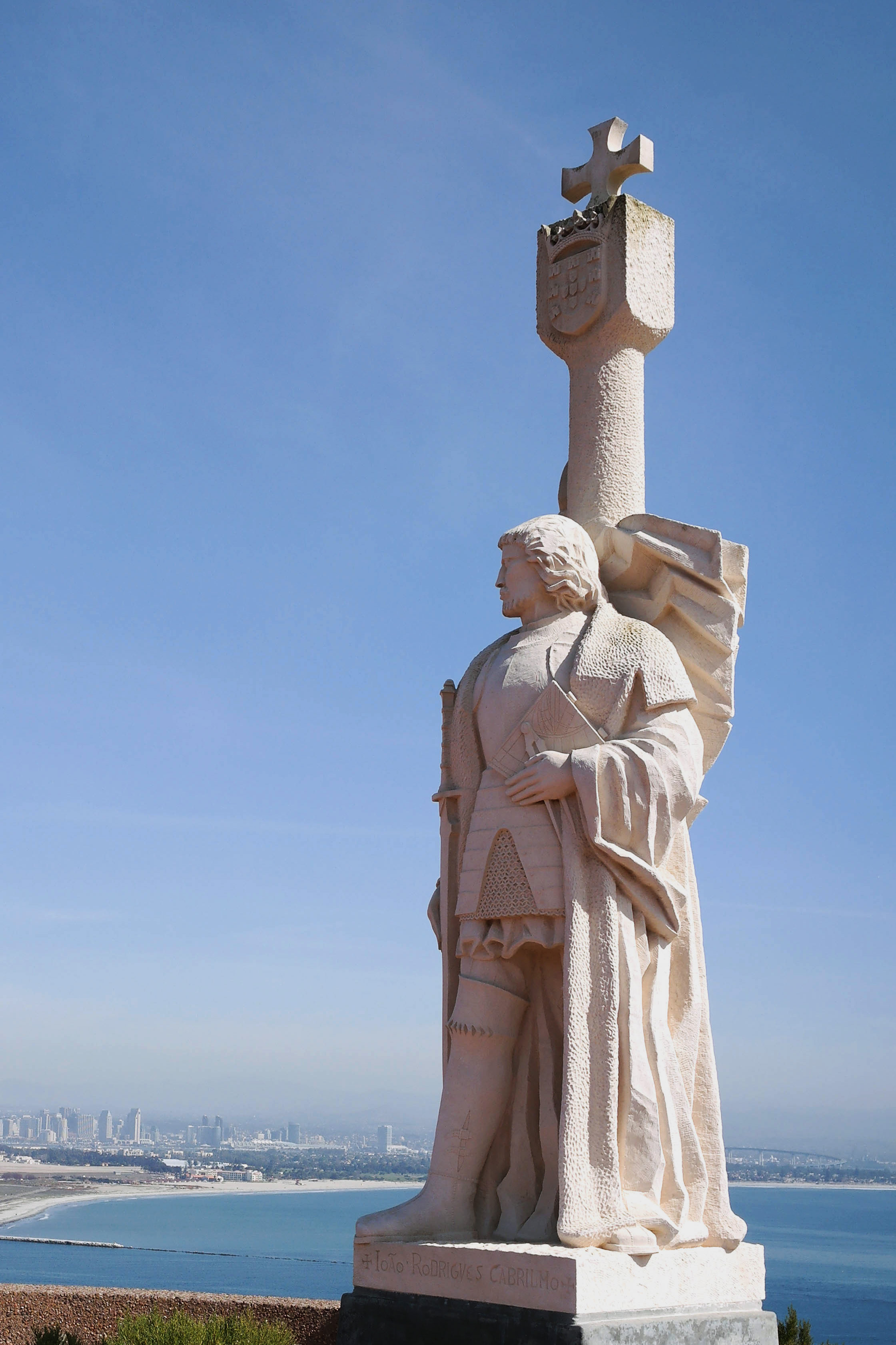
Fun Fact- Cabrillo set out from Navidad Mexico with three ships on June 27, 1542 to explore the unknown.
Consequently on Sept 28th, Cabrillo sailed into what is now called San Diego Bay.
Even more, he later landed at Santa Catalina Island on October 7th, San Pedro Bay on Oct 8th and finally Santa Monica Bay on the 9th.
First Supermoon of 2018 & Spring Tide

Cabrillo National Monument
On New Years Day 2018, I woke up with the intense desire to go to the Cabrillo National Monument tide pools in San Diego. Why, do you ask? Well, did you realize that on New Year’s Day 2018 there was a Supermoon?
What is a Supermoon?
Astronomers call this a perigean full moon, meaning when a full moon is closest to earth (1). The moon appears up to 30% brighter and as much as 14% bigger. Three to four times a year the New or Full Moon coincides with the perigee of the moon.
So how does this affect the tide pools?
When the Moon is full, the Earth is between the moon and the sun. Thus the gravitational pull of both heavenly bodies combined causes exceptionally high tides and extremely low tides.
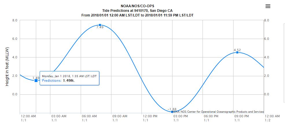
When the Moon is closest to Earth (2), is when the really high tides and really low tides occur. Mind you this has nothing to do with the season Spring. Instead, these are what you call spring tides- think of like a flow of water ‘springing forth’ or ‘springing back.’
Extremely low tides are an opportune time to go to the beach and look around at the tide pools. Let’s have a look!
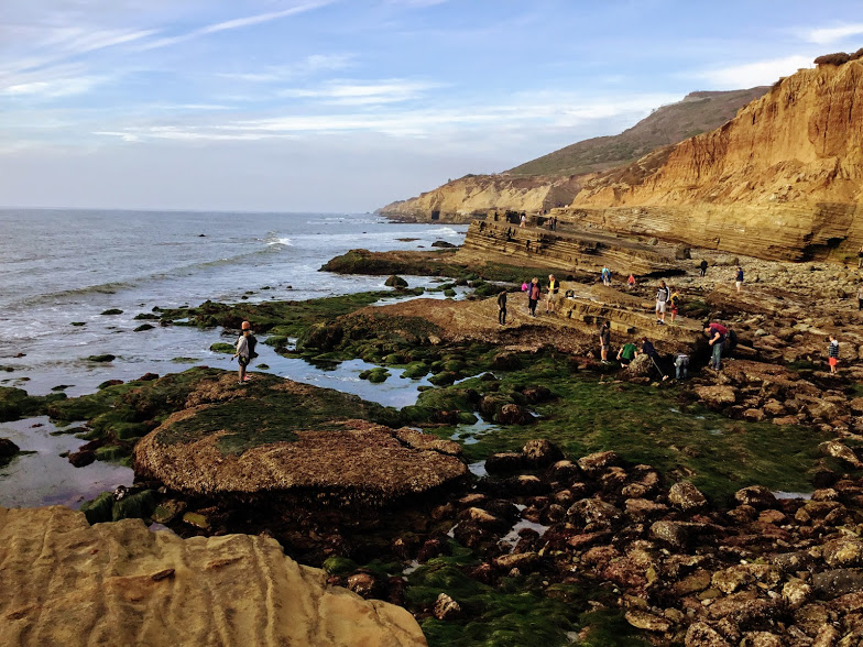
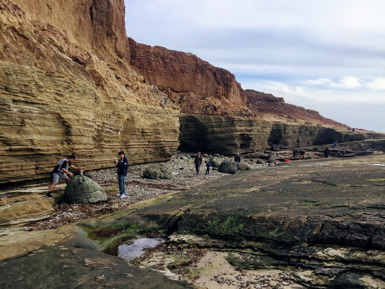
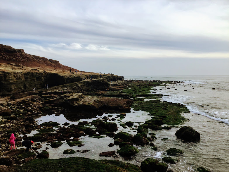
Cabrillo National Monument Tide Pools During a Spring Tide
Cabrillo National Monument
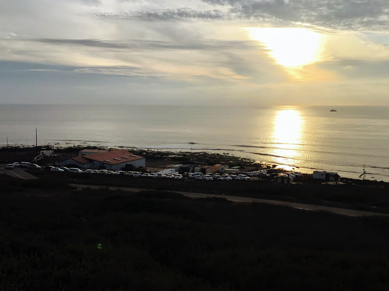
It seems that we were not the only ones with the desire to go to the coast today. Once we arrived at the Point Loma Peninsula, there was a line of cars a mile long waiting to get in.
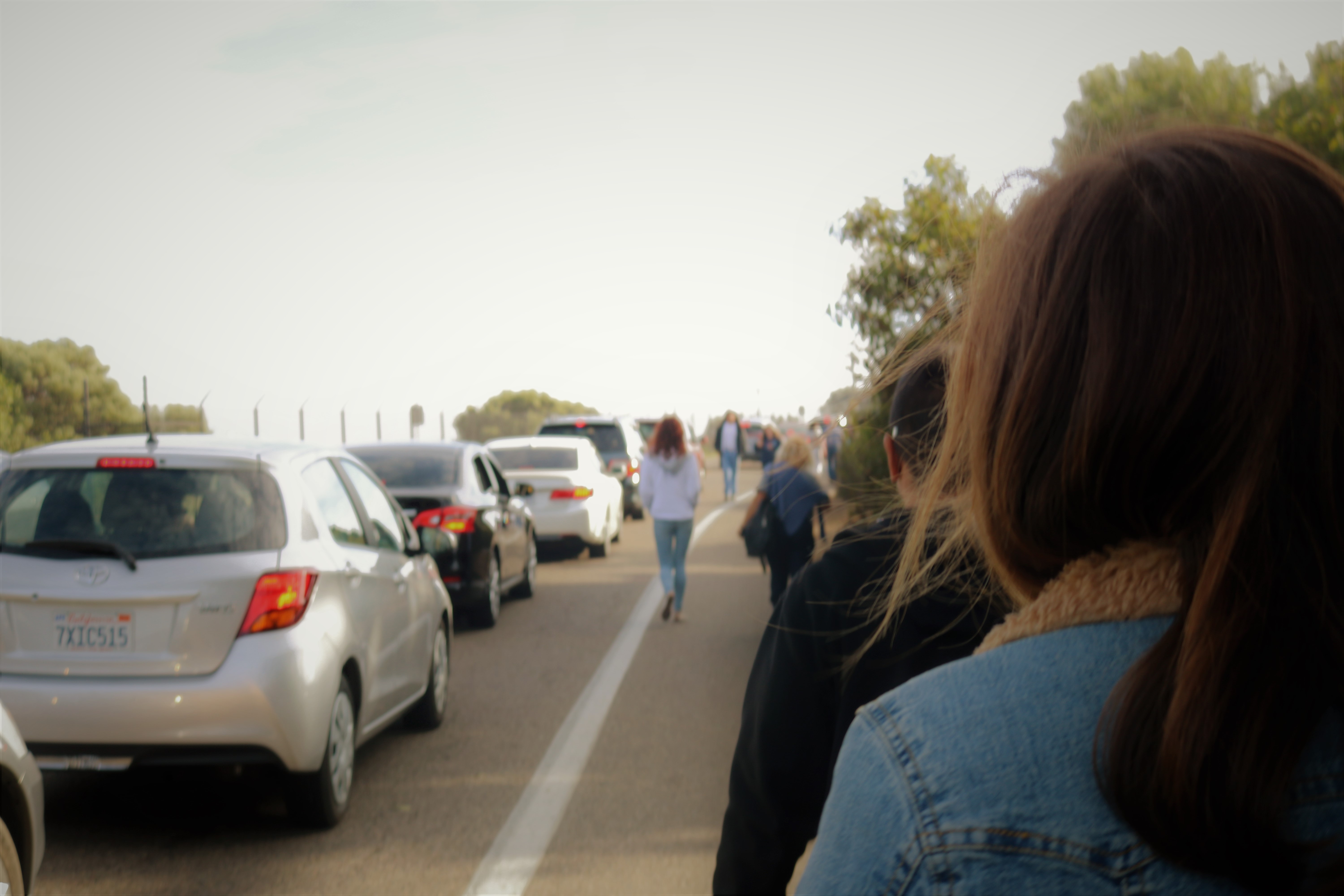
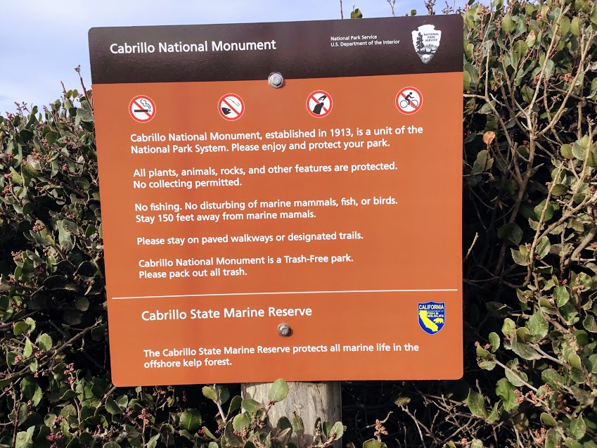
Parking on the side of the road is encouraged as signs were stating just that. The Cabrillo National Monument is very strict when it comes to visitors; no cars are permitted into the park if all parking lots are full.
Cabrillo Road, which is located just after entering the park, takes you down the tide pools. There are three separate parking lots to choose from that are situated right above the tide pools.
Last but not least, there is a ten dollar fee to enter.
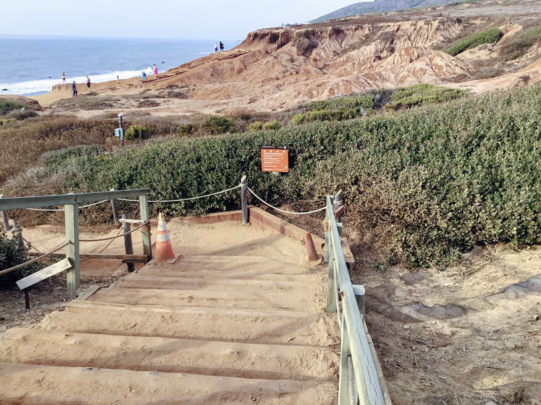
The Road To The Tide Pools
Cabrillo National Monument
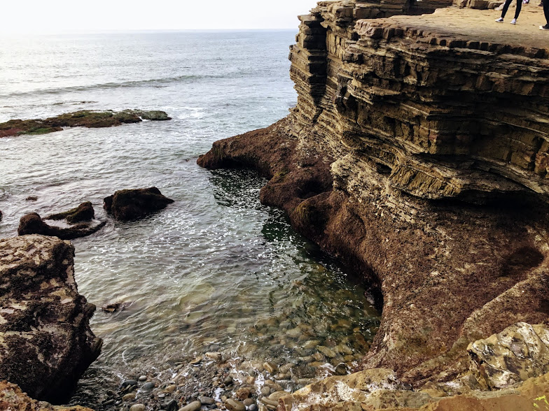
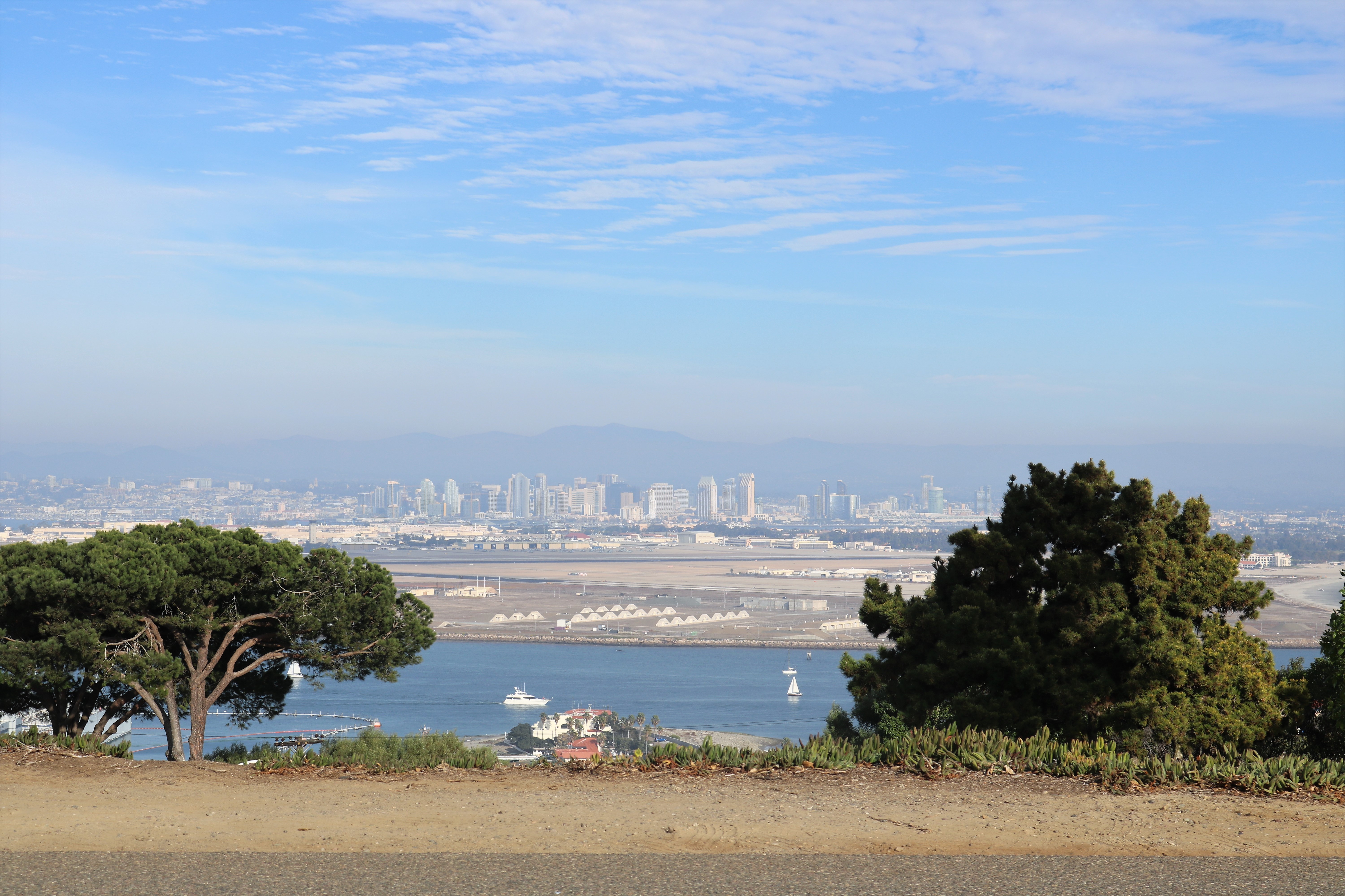
Cabrillo Road takes you down to the Cabrillo National Monument Tide Pools. Looking straight ahead is the end of the Point Loma Peninsula.
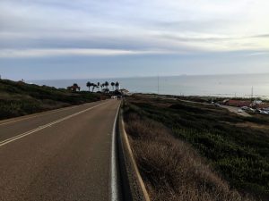
Here we are looking south toward Mexico.- when it is clear you can see the Coronado Islands in the distance.
Looking toward the right, you will be able to make out the first two parking lot options.
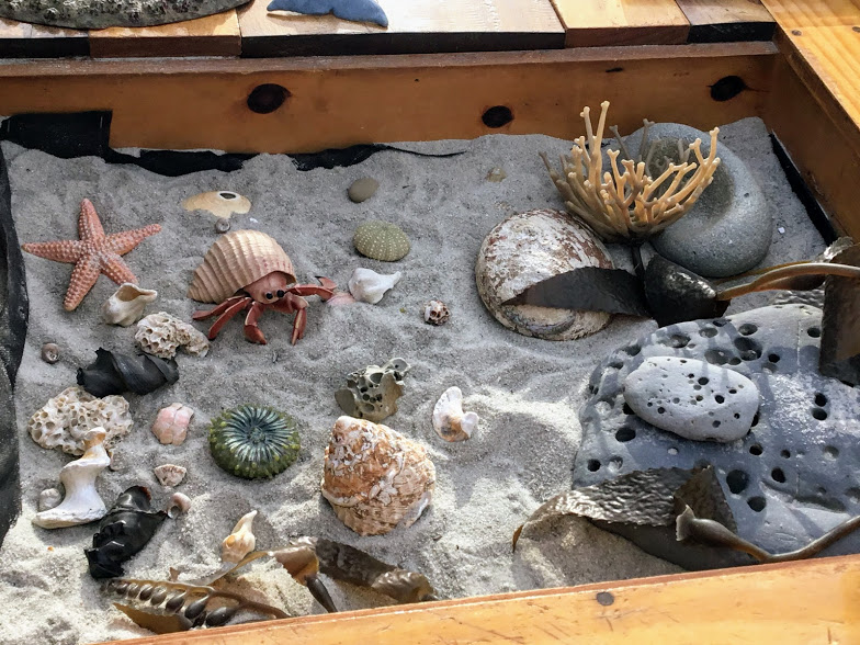
A Naturalist Station is set up with volunteers who will answer any questions you might have.
Down below is a link to a page that you can print out if you are interested, which has diagrams and information on what species you might come upon when investigating this shoreline.
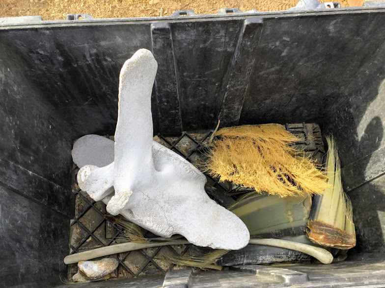
This box of Gray whale goodies was out for all to inspect. Here you see a vertebrate as well as the Gray whales distinctive blonde colored baleen compared to the usual white baleen found in other baleen whales.
Gray whales pass the Point Loma peninsula during their winter migration from Alaska down to the warm lagoons of Baja California in Mexico to give birth.
Remember to be on the lookout; a whale just might be passing by off the coast!
Fun Fact- Something to consider when looking out for whales is to notice if any whale watching boats are around. If you see one that has stopped, chances are they are next to a whale.
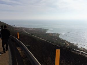
Looking back at where we started. Do you notice the whale observation booth on top of the hill to the right? It is a fantastic spot to sit and wait and to watch for the magnificent giants as they pass by the coast.

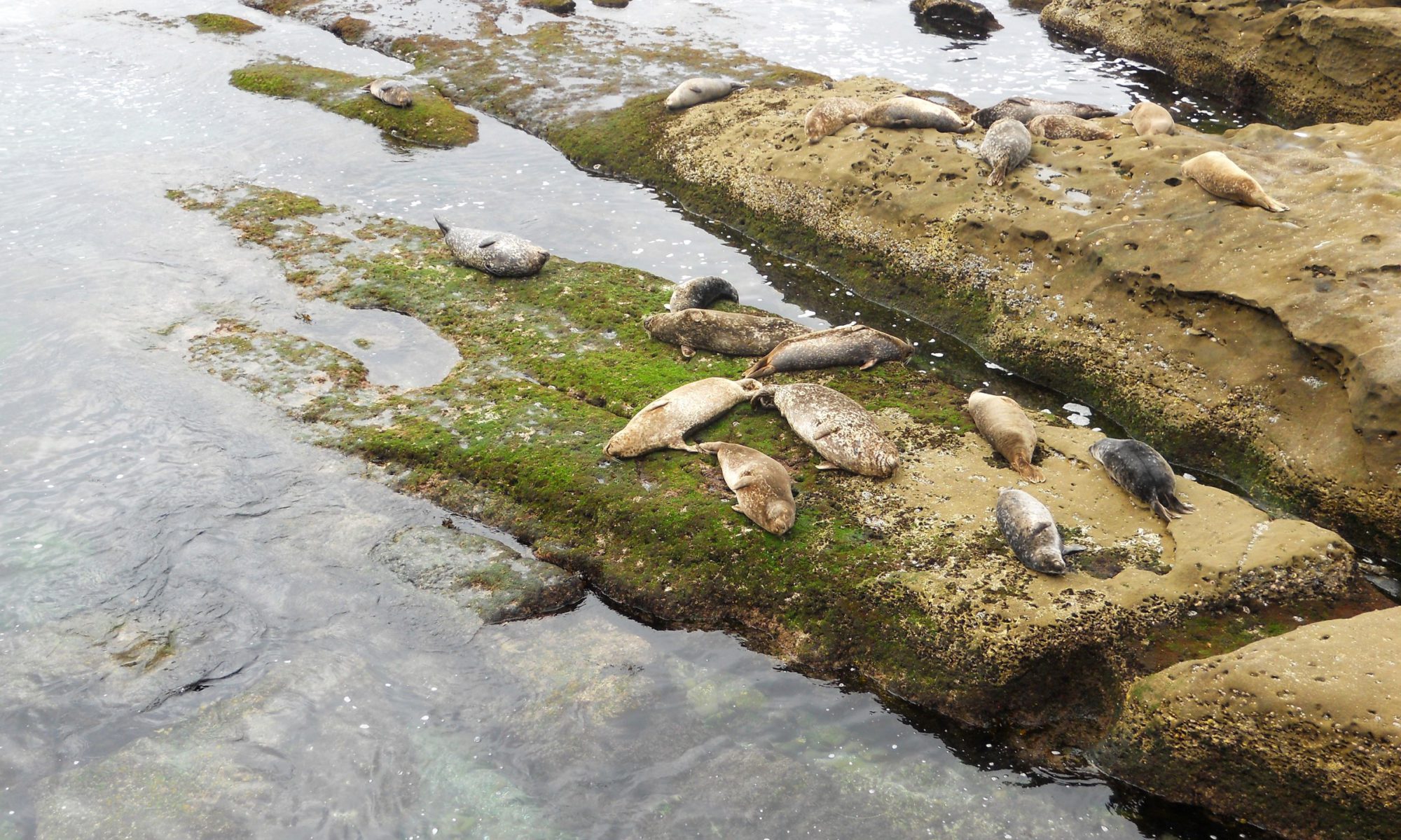
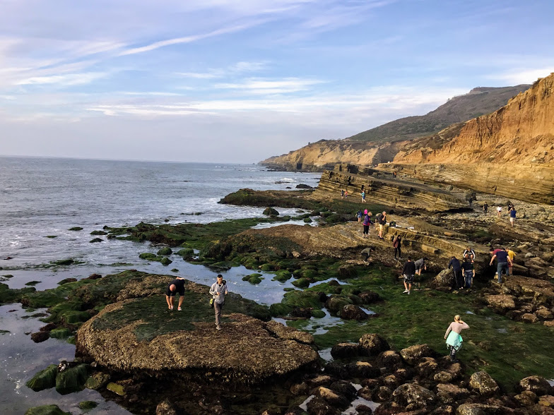
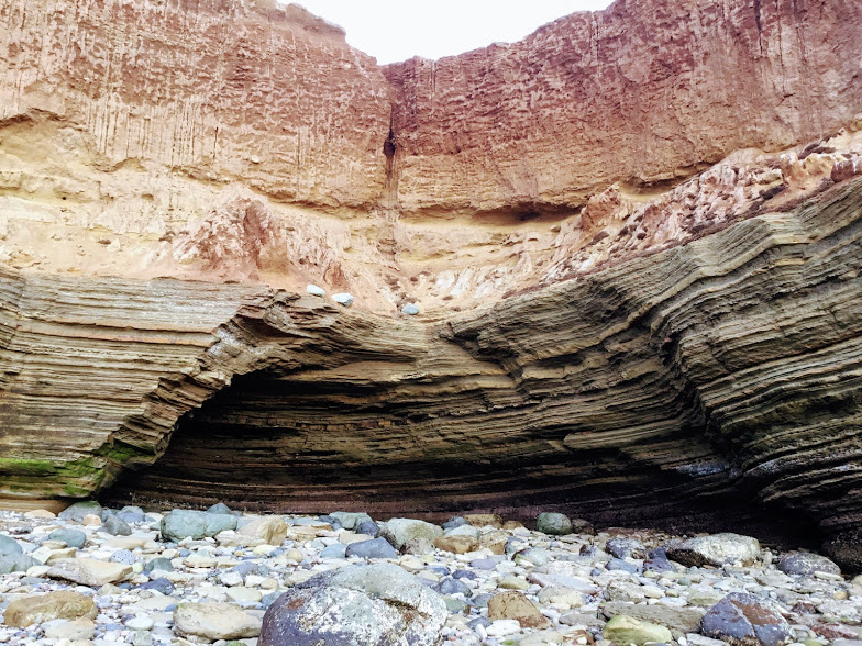
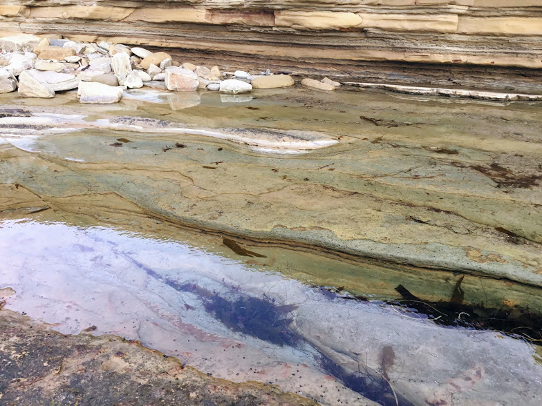
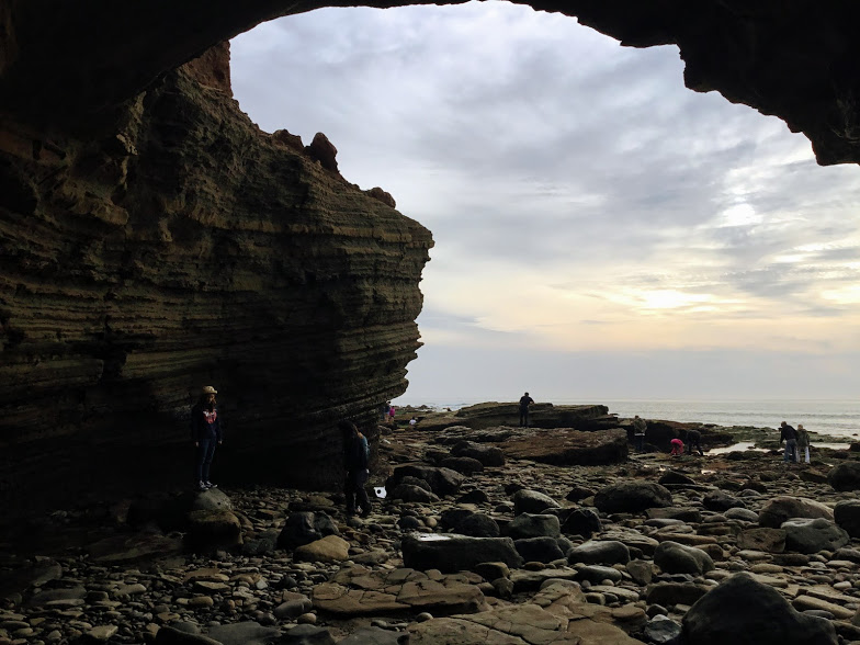
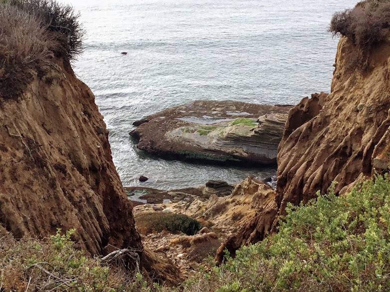
Rocky Intertidal Zone of Cabrillo National Monument
The shoreline of the Cabrillo National Monument is a rocky intertidal zone.
The intertidal zone is the part of the shoreline that is connected and influenced by the ocean; in other words, the area between where the high and low tides occur along the shore.
Species here are in ‘pools’ (depressions in the rocks), as well as attached to the rocky substrate of the sandstone cliffs, boulder fields, and tidal shelves, which also surround the area.
Rocky intertidal areas are some of the most diverse and extreme environments on Earth.
Let’s now take a look at each zone.
There Are Four Intertidal Zones
Upper Intertidal Zone
Also known as the splash zone, this area is closest to the shore and above the spring high tide line. You will find this area on the sandstone cliffs’ edge where pools of water collect.
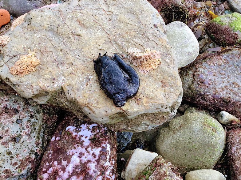
Here, small invertebrates such as Periwinkle snails, lined shore crabs, acorn barnacles, troglodyte chitons and various limpets inhabit.
MIddle Intertidal Zone
This section is covered entirely with water during the high tide. Thus the species that live here are exposed to the elements twice a day but only for a short while with the low tide.
Species that you will find here include the California mussels, aggregating anemones, limpets, chitons, California sea hares, snails, crabs, fishes, lobsters, and octopuses.
Low Intertidal Zone
This zone is only exposed to air during the lowest of low tides and is considered to be primarily marine.
Red algae, Dungeness crabs, sea stars, sea urchins and brown kelp live here.
Subtidal Zone
The tides do not expose this area at all. Here you may find larger fish, sea stars and larger sea urchins.
In this video, I pan over the four different zones to give you an idea of the location.
Next, let us now go and check everything out!
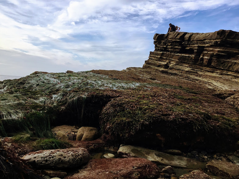
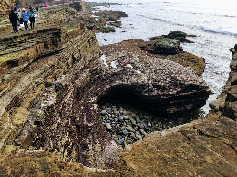
Upper Intertidal Zone
Cabrillo National Monument

Do you notice the flat tidal shelf? Many organisms can live with only a minimal amount of water provided in the “Splash Zone.”
Here we find a few tide pools that were left over from the previous extra high tide. 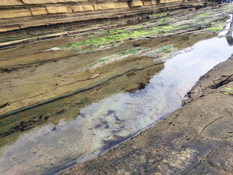

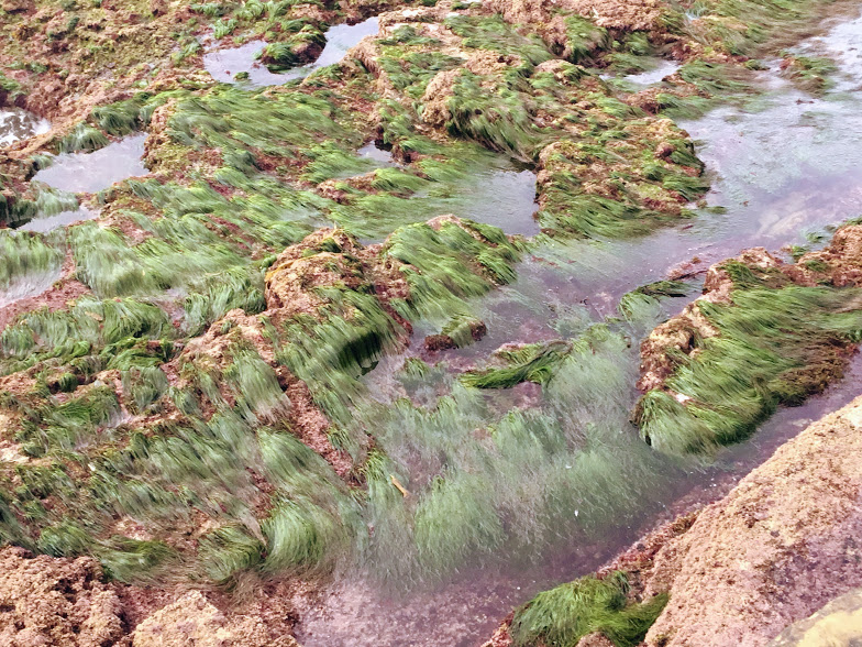
Middle Intertidal Zone
Entirely covered and uncovered with sea water with every high and low tide, the mid intertidal zone is one of the most unstable environment there is.
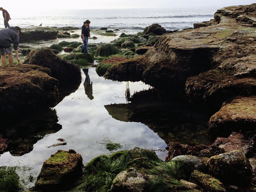
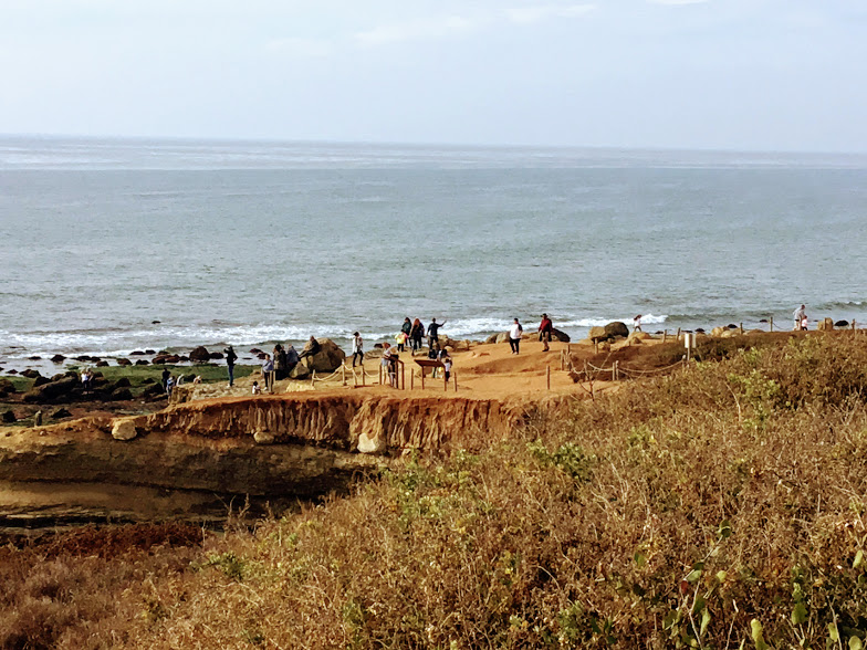
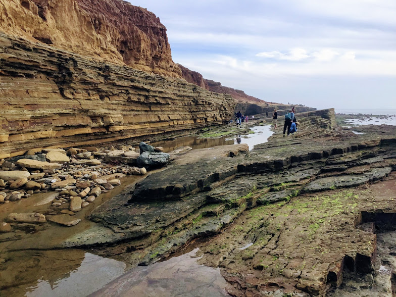
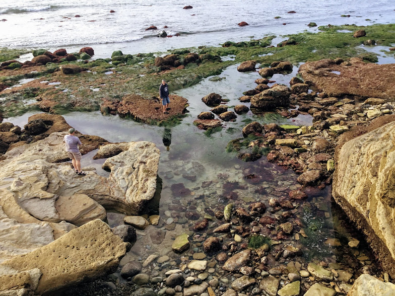
Low Intertidal Zone
The low intertidal zone is entirely covered with sea water except during a low spring tide,
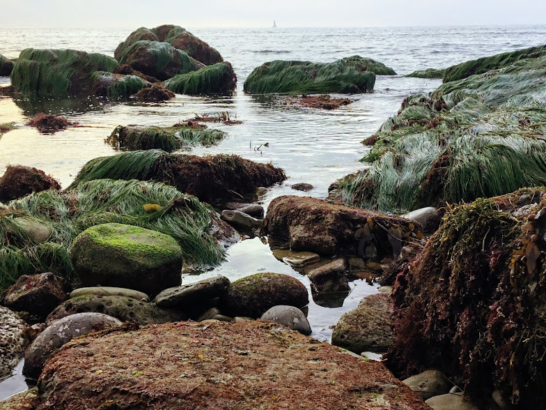

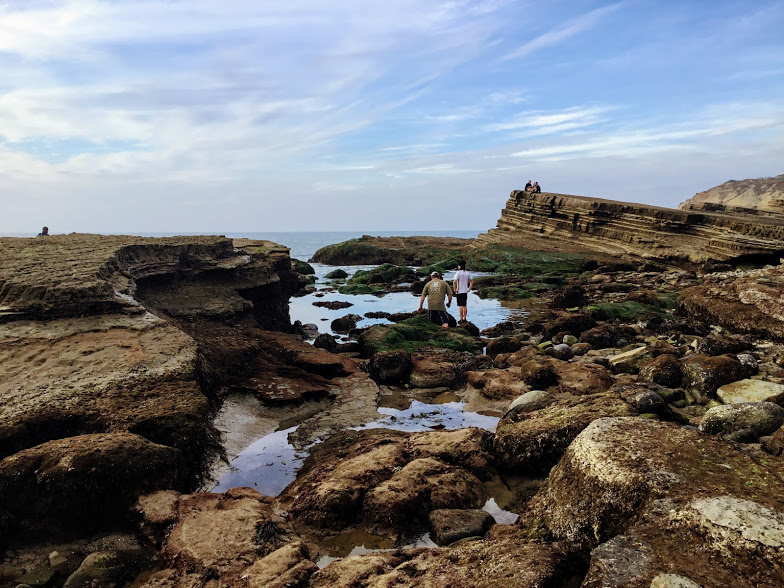
Here we have two people checking out the wonders uncovered by the low spring tide.
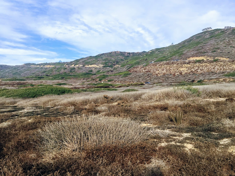
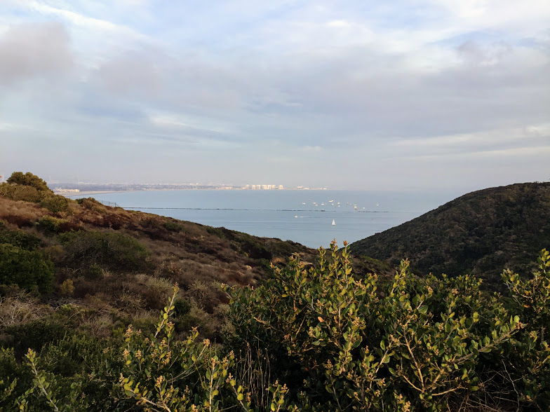
I hope you enjoyed your visit. We had a fascinating time for the simple reason that our trip coincidentally turned out to be huge thanks to the effects of the supermoon! It is now time to walk back to the car 1.5 miles away.
Walking Back to the Car From the Tide Pools
Cabrillo National Monument
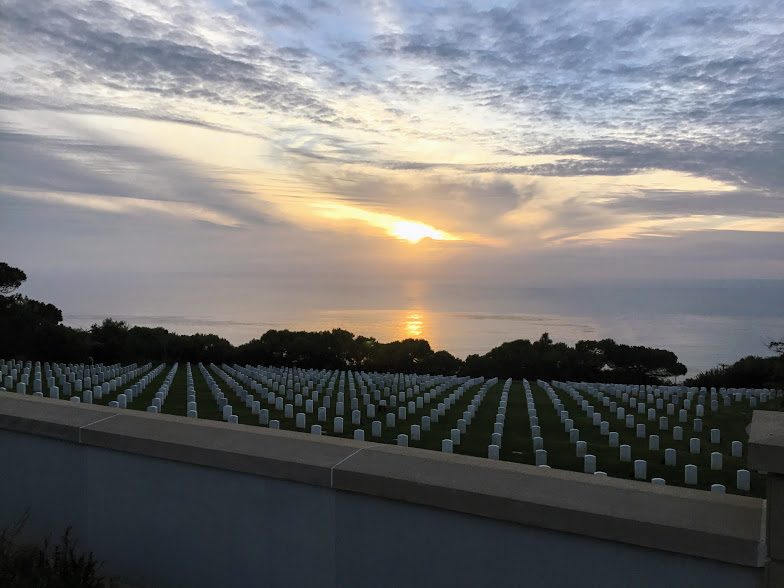
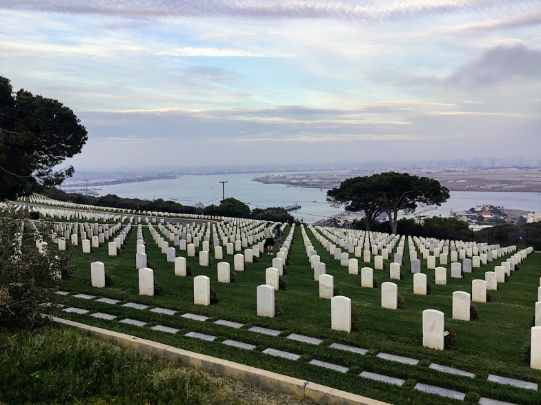
Fort Rosecrans National Military Cemetary
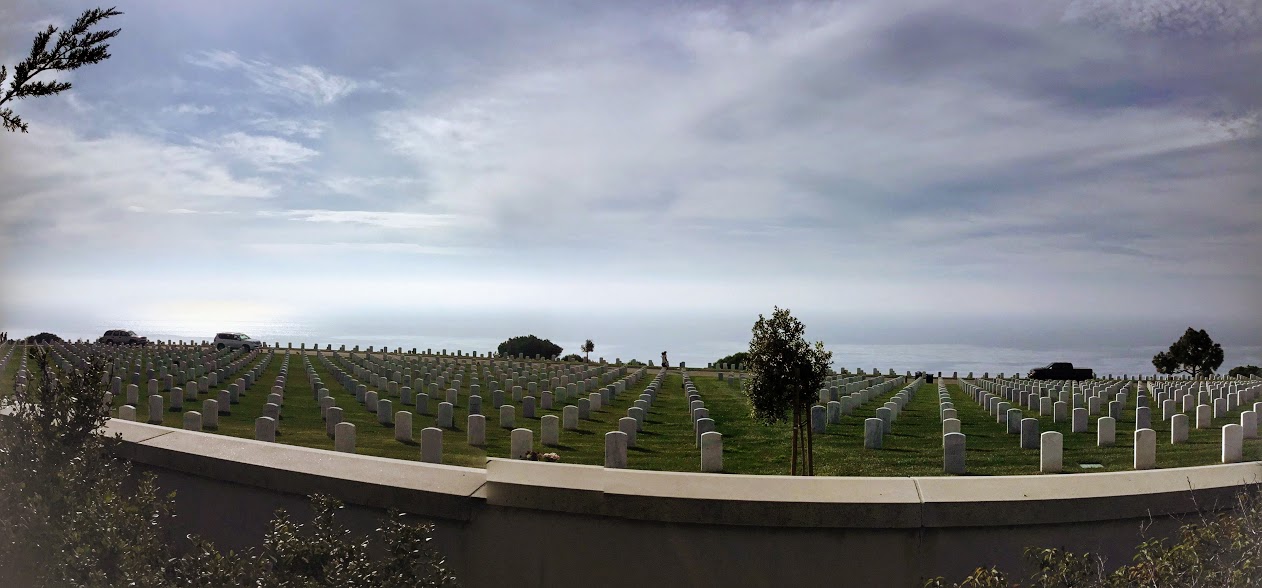
Located right before the Cabrillo National Monument is the Fort Rosecrans National Military Cemetery est 1882.
Over 117,362 graves are overlooking both sides of the Point Loma Peninsula.

Thanks for making it this far. So what did you think? Do you think I have persuaded you to come to San Diego and see the Cabrillo National Monument tide pools for yourself? I sure hope so!
Please leave any comments or questions you may have!
Until next time!
(1 )Moon: Supermoon. (n.d.). Retrieved from https://moon.nasa.gov/observe-the-moon/supermoon/?linkId=45255490
(2) Perigee Moon & Apogee Moon • R/space – Reddit. (n.d.). Retrieved from https://www.reddit.com/r/space/comments/4fz3ze/perigee_mo
Learn How To Make A Business Website For Free!
![]()
I have always had a deep-seated passion for the Ocean Environment which ultimately led me to receive a degree in Marine Biology. Living in the San Diego area for over 30 years, I have extensively explored the 70 miles of San Diego’s coastline, and I am here to share! Please use my website to your advantage and have a look around at all the wonders that the beaches of San Diego can offer you!
Oh my, such a beautiful place! I go down to Dana Point every other year for vacation and we’re always looking for new places to go in the San Diego area. Looks like I found my next destination. Thanks for the lovely photos.
Thank you for visiting Jamie! Dana Point is gorgeous as well!
Thanks for taking the time to give us a little history. I have to say it looks amazing. I wish I could have seen how amazing the supermoon looked up close. The video you took of the low zone is absolutely stunning. The military cemetery though sad how many graves there it is a nice looking cemetery. Nice article!
It really felt like a different world down there! I am so happy that we decided to go on this special day! The Cemetery also has a strange feel to it as well, kinda tragically beautiful. Thank you so much for visiting Melissa!
Hi there, first of all, what an amazing post, and some brilliant pictures, really enjoyed reading and looking.
I only have some few suggestion,
When you write
The first Supermoon of 2018=Extra Low Tide, for me it looks maybe a bit wrong with the = sign, maybe you could write is equal to:)
And at Cabrillo National Monument Tide Pools During a Spring Tide
There is a picture of something written, but you cant read it all because of the picture
But an amazing post again:)
Best regards
Benjamin, also from WA, and if you would comment on my page as well
https://beersforanyoccasion.com/top-summer-beers-is-it-hard-to-find
Thank you so much for your suggestions Benjamin, I really appreciate it. Thank you so much for visiting!
Hi. Thanks for this awesome post.
I am pretty sure you had to make a lot of research for that right?
Continue your good work , it was a pleasant reading it.
Sincerely
Hi Damien! Yes, it was a lot of research, but I enjoy doing it. It is as if I am at the beach while I am on the computer 🙂 I am glad that you enjoyed it. Thank you for visiting my site!
Great pictures. I spent some time in San Diego for a conference and unfortunately I did not know about this national park or the tide pools.
if I’m blessed again with returning to your area I would not deprive myself of this natural wonder. thank you for sharing t&IA area with us.
Hi Sylvie! Well, if you had your conference at the Downtown San Diego Conference Center, at least you got a glimpse of the Point Loma Peninsula in the background. 🙂 Thank you for visiting!
Well, considering I lived in San Diego for three years and never saw this place, I am officially bummed. On my next trip down I’ll most certainly have to check it out. I usually spend more of my time in northern San Diego, so maybe that’s why I missed it all the way down to Point Loma.
Now I have a new destination with friends when I’m looking for a bit of nature and relaxation near the beach.
Thanks for sharing!
You’re welcome, Dalton! we also usually stay more in North County. If I may suggest a closer destination for the next time you are back- https://70milesofcoast.com/swamis-state-beach Thank you for visiting!