
Guess what! I was there when the cliff collapsed at Black’s Beach! I was about a mile away, checking out the bean clams on La Jolla Shores Beach. Would you believe I didn’t even realize what had happened at 1:29 p.m. until three days later? Yes, it is true, but I am here now and have photos to share. Viewing these incredible videos, let’s look at the January 20, 2023, Black’s Beach cliff collapse! I have also researched and included every past cliff collapse at Torrey Pines State Beach for fun. Finally, I look deeper into the cliffs’ geology and try to figure out a few clues on why the cliff collapsed.
I want to say right up front that I am not a geologist and am trying my hardest, so if I get anything wrong or slightly wrong, please feel free to tell me in the comments.
YouTube Credit- Kent Ameneyro
YouTube Credit- Mark Hardy
Table of Contents
What the Cliffs Used to Look Like
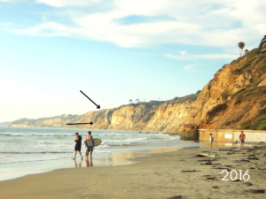
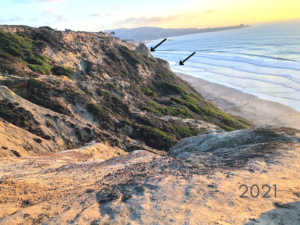
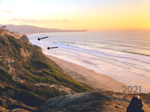
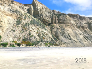
So, I looked through my years of photos to show you a few of the areas. The first photo was taken on Scripps Beach, just underneath the library. The second photo was taken above La Jolla Natural Park on the same day.
 1:29 pm
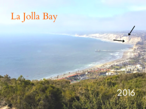
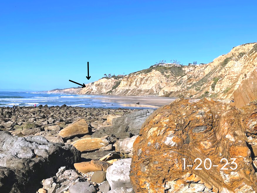
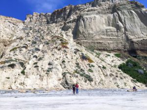
The two other photos above give you a better back-end view of the area. Both images were taken in January.
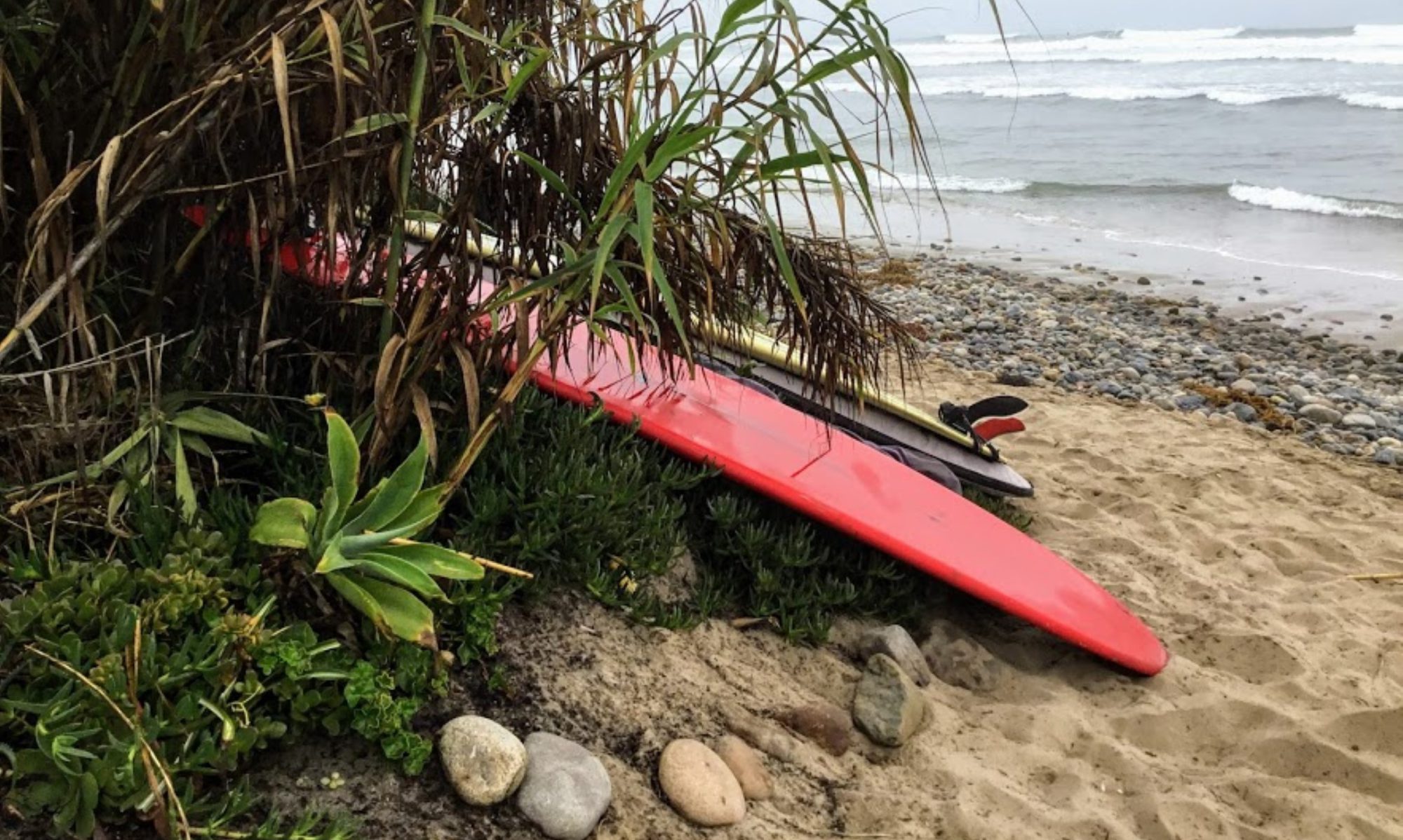
I Was There When the Black’s Beach Cliff Was Collapsing!
The above photo was taken about an hour after the initial cliff collapse.
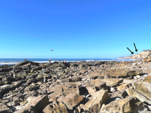
I photographed the helicopter going back and forth from the area. Again, I sure wish I would have known what had just happened! While looking around the Dike Rock tidepools, I noticed a Geology professor with a colleague looking over the bluffs close to the pier. I bet he sure wished he knew what had just happened as well!
What is the Geological Composition of the Sea Cliffs at Black’s Beach?
The sea cliffs at Black’s Beach are comprised of Eocene Age (56 to 43 million years ago) marine sedimentary rock mantled by Pleistocene Age (2.58 million to 11,700 years ago) terraces and alluvium deposits (loose clay, silt, sand, gravel). The Eocene rocks belong to a group of geological formations called The La Jolla Group.
From the oldest to youngest, you first have the Del Mar Formation (49 million years ago), the base formation of the La Jolla Group, and is dusky yellowish-green sandy claystone interbedded with medium-gray course sandstone.
Next is Torrey Sandstone (45 million years ago)- white to light brown with medium to coarse-grained sand, which erodes to make honeycomb formations. Therefore, Torrey Sandstone sits on top of the Delmar Formation and is younger. The boundary between the two is transitional, and both rock formations grade laterally into the Ardath Shale, which is soft, light olive-gray silty shale with a medium-grained sandstone layer in the upper half.
Ardath shale is dominated by a gradual slope compared to the vertical cliffs of sandstone and transitions to Scripps Formation at the southern end of Black’s Beach and continues just north of the Scripps Pier.
The Scripps Formation (42 million years ago) is mainly comprised of massive beds of conglomerate (rounded or subangular clasts) and light-colored sandstone.
The area where the landslide occurred is composed of Ardath Shale from the beach up with Scripps Formation lying on top.
I don’t know about you, but it blows my mind that these bluffs are made up of various types of sand and mud! I would think there would be landslides daily, but that is not the case.
Next, let’s deeply dive into past cliff collapses in this area.
Torrey Pines State Beach & Black’s Beach Cliff Collapse Past History
- 1889– Torrey Pines Park landslide- most enormous, measured 1700 feet along the cliff as well as several hundred feet inland
- 1917-1922– It was discovered during a Black’s Beach survey by Sumner and Ross (1930) that there was a massive failure with dimensions of 450 feet along the shoreline of 175 feet to the base of the cliff and about 200 vertical cliff face, between 1917 and 1922
- 1977– a landslide in front of the former Drell Family residence at the La Jolla Farms Area, with 45 feet of the backyard falling to the beach
- January 29, 1982– at 9:00 am, a large, massive landslide with over 1.8 million cubic yards broke off of the cliffs and hit the beach so hard that it was recorded on a seismograph at Black’s Beach south of Gliderport Trail (same spot)
- Interesting information- Where did all of the cliff material go? South Black’s Beach is extensively wide compared to where the collapse happened!
- July 22, 2008– 75 feet of bluff collapsed near Flat Rock
- August 20, 2008– a man lost his life after being hit in the head with debris near Flat Rock
- August 15, 2009– 30-foot section tumbled near Flat Rock
- September 2-3, 2009– collapse happened during the night, with garbage can-sized chunks of debris still falling off the next day.
- July 21, 2010– a 57-year-old beachgoer lost their life when the cliffs north of Black’s Beach fell upon him
- August 31, 2019– landslide occurred between Lifeguard Tower 1 and Flat Rock
- March 5, 2020– a significant rock fall in the morning
- May 2, 2020– a few small rockslides and one large slide cut off the lifeguards’ access road- Black Gold Road
- May 3, 2020– rock slide 200 yards north of Black Gold Road at 1:29 pm
- May 5, 2020– There is a large rockfall close to Black Gold Road, resulting in the closing of the beach
- December 31, 2020– large portion of cliff collapsed in front of several people, 1/4 mile south of Lifeguard Tower 1
- January 3, 2021– a large section of cliff, right before Flat Rock, crashed onto the beach in front of several people- thankfully, no one was hurt (hallelujah!)
- June 29, 2022 – a 150-foot-wide section of the cliff fell just south of lifeguard Tower 1- no one was around when it happened
Below, I have taken a closer look into the 1982 Black’s Beach cliff collapse.
The 1982 Black’s Beach Landslide- A Closer Look
- the massive landslide measured 750 feet along the cliff by 280 feet into the cliff
- the slide was so powerful that large boulders fell onto the beach into the water, thus cutting off the beach except at low tide
- before the landslide, groundwater was observed on the cliff face, as well as tensional fractures noted by lifeguards along the top
- the lack of internal fracturing within the translated blocks characterizes block-glide landslides.
- rupture happened at 140 feet elevation within the upper few meters of Ardath Shale
- The winter of 1981-82 had little rain and only a few storms
- exciting information- the night before the landslide, the seismograph registered a surface wave
What Causes Cliff Erosion?
The rock- cycle shows the metamorphic and igneous rocks exposed at the Earth’s surface are continuously subjected to mechanical and chemical weathering, eventually being reduced into loose sediments which are named based on the grain size of the dominant deposit- i.e., gravels, sands, or mud.
Both significant morphological (the physical characteristics of rocks) and environmental characteristics play an essential role in dominating the rate and style of cliff erosion, but what other factors contribute?
- subaerial erosion- salt crystallization from exposure to sea spray will increase the pressure alterations in the pore spaces
- wave undercutting/ extreme high tides
- precipitation/ increase in storms
- power of the Sun- the solar and gravity-powered ‘forces of destruction’ continually erode the land and dump the remains in the sea
- elevation
- beach width
How Beach Width Contributes to Cliff Erosion
In the study- Morphological Expressions of Coastal Cliff Erosion Processes in San Diego County, it was determined that subaerially (events occurring or formed on the earth’s surface) cliff erosion occurs more frequently on or near the earth’s shore on more expansive beaches with a high height elevation (Black’s Beach cliffs elevation in 300 feet). In the same way, decay is marine-dominated on narrower beaches with a lower-than-average elevation.
Other morphological features of the cliff face, such as nonspecific patterns and saw-style frontage, indicate mechanisms that control prevailing erosions in specific locations.
Overall, styles of erosion are highly conditional upon localized components such as geological composition, wave dynamics, and regional climate patterns.
What Caused the Black’s Beach Cliff Collapse? Subaerially Erosion vs. Marine Erosion
So, what is the difference between the two? Marine erosion occurs when the wave runup exceeds the beach’s elevation and reaches and contacts the cliffs’ base. With this, small rocks and sand mix with the water, thus increasing erosion from the bottom up.
On the other hand, subaerially erosion occurs above the wave impact zone and generally works from the top downwards. Faults and joints form an area of weakness, enhancing mechanical erosion and providing conduits for groundwater seepage, further degrading the sea cliffs.
So, after considering this, take another look at one of the videos and ask yourself, was this subaerially or marine erosion or in tandem with both?
Below are several references if you wish to go even deeper.
If you made it this far, thank you, and please feel free to ask any questions!
Until next time!
Helpful Posts
- Black’s Beach- The Naked Truth
- Torrey Pines State Beach
- Exploring Torrey Pines State Natural Reserve
- Five More San Diego Hidden Gems
Resources
- Reported California Landslides (arcgis.com)
- Atterberg limits analysis of Black’s Beach Landslide 1982 | SDSUnbound
- Landslide Types and Processes (USGS.gov1:29 pm
- Sea Cliffs, Beaches, and Coastal Valleys of San Diego County “d0e2312” (cdlib.org)

I have always had a deep-seated passion for the Ocean Environment which ultimately led me to receive a degree in Marine Biology. Living in the San Diego area for over 30 years, I have extensively explored the 70 miles of San Diego’s coastline, and I am here to share! Please use my website to your advantage and have a look around at all the wonders that the beaches of San Diego can offer you!