A Few More Unique San Diego Beach Hikes

Woman viewing ocean railroad tracks

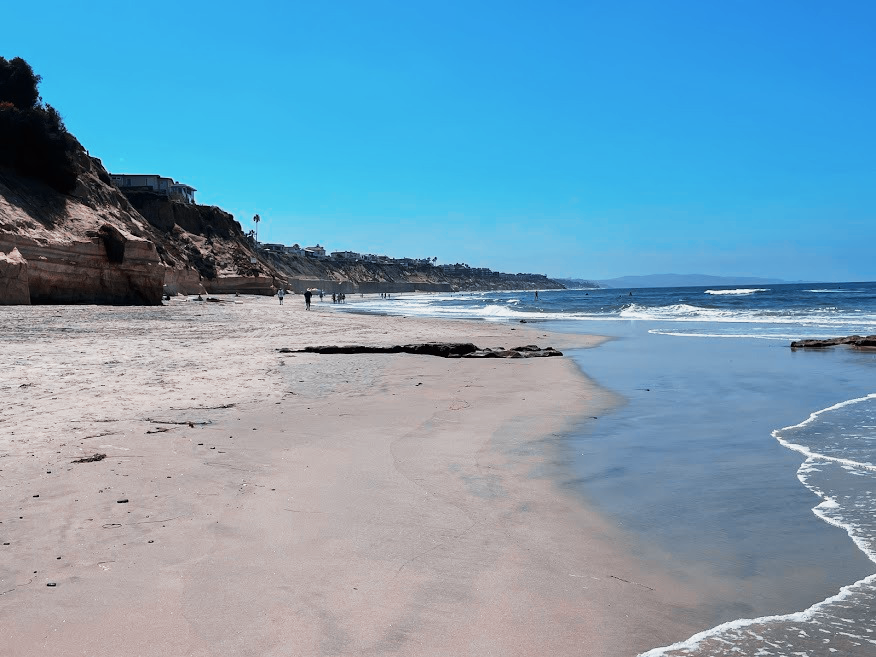
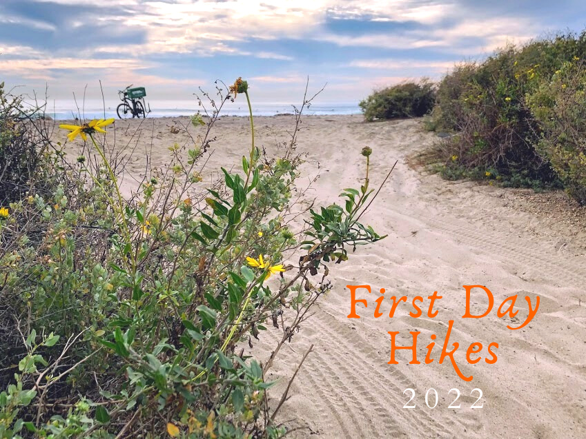
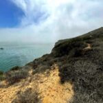
Are you looking for a relatively easy hike at the beach in San Diego? Well, look no further! I’m always up to checking out the coastline, so I’m excited when I find a new trail to explore! Today, I will showcase four new trails- The Bayshore Trail, the Rio West Trail, the elusive Broken Hill Trail, and another popular offshoot of the Trestles Beach Trail. Ready? Let us look at a few more unique San Diego Beach hikes.

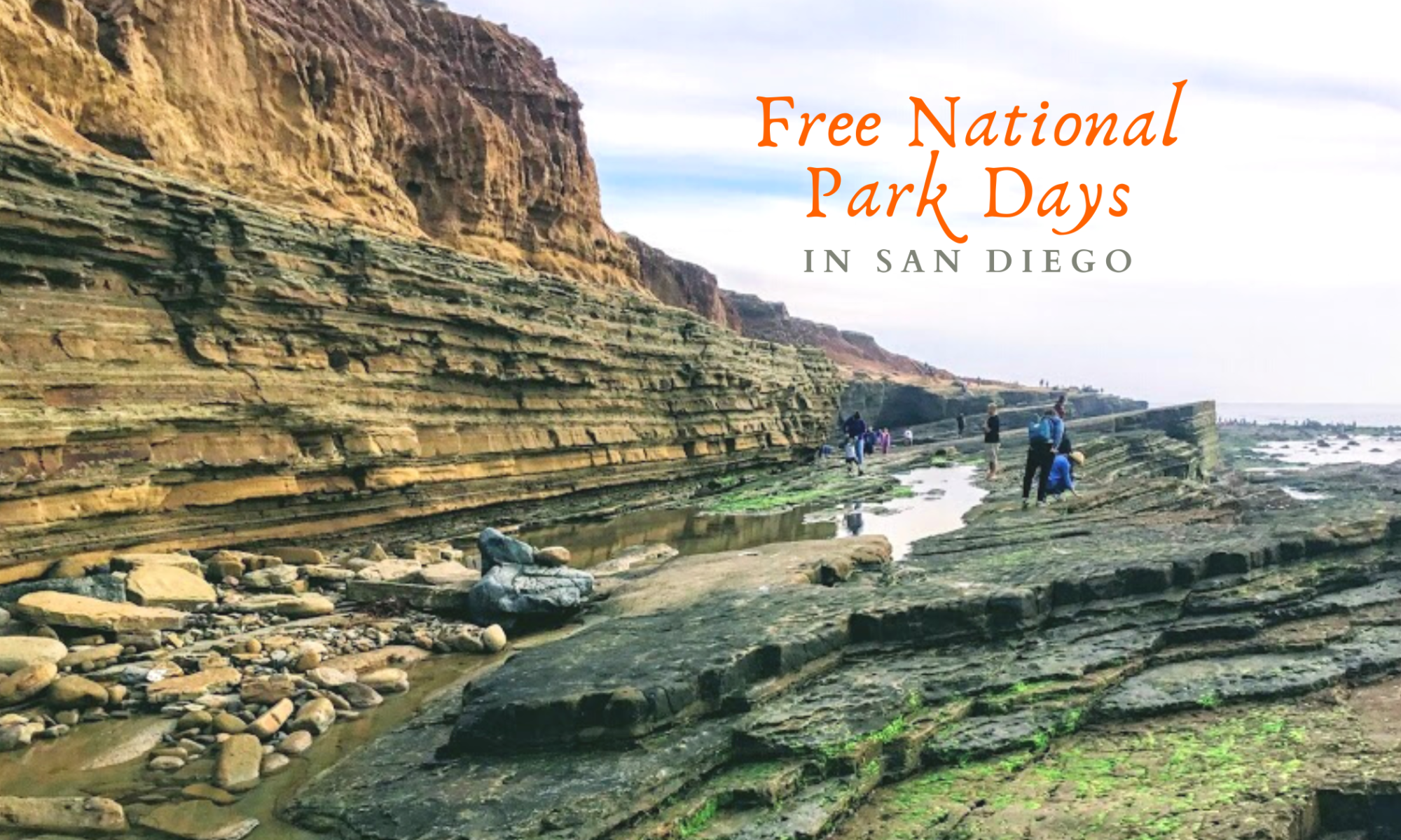
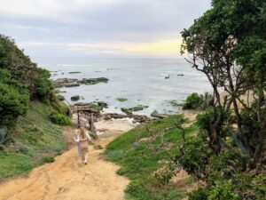
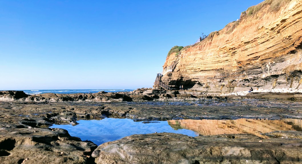
Hiking The Bayshore Trail at Cabrillo National Monument

Cabrillo National Monument Map

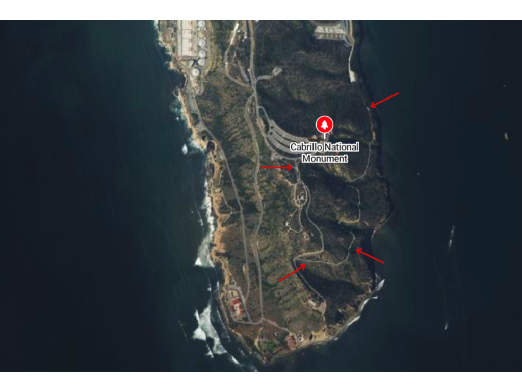
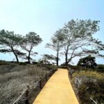
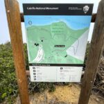
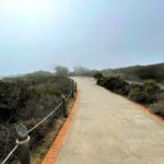
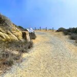
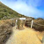
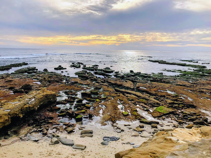
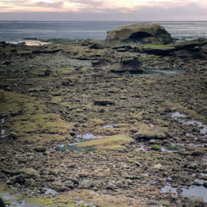
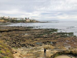
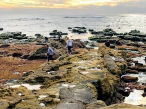
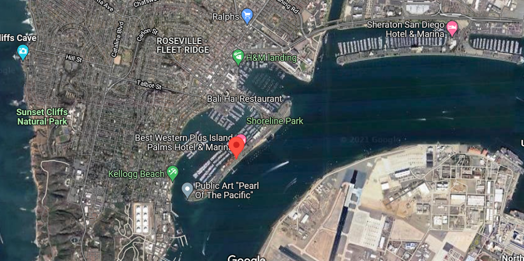
The first time I visited the Cabrillo National Monument in Point Loma, just north of the San Diego Bay Inlet, I concentrated my time at the Nature Center and the tide pools. Today that changed as I ventured south to hike right above San Diego Bay.

Continue reading “A Few More Unique San Diego Beach Hikes”

Black’s Beach Cliff Collapse- I Was There!

Blacks Beach Cliff 2018 featured image

Guess what! I was there when the cliff collapsed at Black’s Beach! I was about a mile away, checking out the bean clams on La Jolla Shores Beach.  Would you believe I didn’t even realize what had happened at 1:29 p.m. until three days later? Yes, it is true, but I am here now and have photos to share. Viewing these incredible videos, let’s look at the January 20, 2023, Black’s Beach cliff collapse! I have also researched and included every past cliff collapse at Torrey Pines State Beach for fun. Finally, I look deeper into the cliffs’ geology and try to figure out a few clues on why the cliff collapsed.

I want to say right up front that I am not a geologist and am trying my hardest, so if I get anything wrong or slightly wrong, please feel free to tell me in the comments.

Continue reading “Black’s Beach Cliff Collapse- I Was There!”

Big Waves in January

San Diego Big Waves January featured image

So did you hear about the massive storm that Southern California endured on January 6th? Did you know that there also was a Full Moon on January 6th? It sounds like a perfect combination to me. There were reports of waves reaching the insane height of over 20 feet in some spots! Unfortunately, I wasn’t able to get to the coast to have a look on that incredible weekend, but I was available on the 11th. I looked at the surf report for the second week in January, and Wednesday the 11th looked like the best bet in catching a few shots of big waves with my camera; hurray!

Join me as I journey down the coast, first Oceanside, then Carlsbad, and finally ending my adventure at Swami’s in Encinitas.

Just How Big Were the Waves on January Sixth in San Diego?

The storm came onshore in San Diego early on Thursday,  January 5th. The National Weather Service anticipated widespread coastal flooding, heavy rains, high winds (20 to 30 mph), and massive surf.

Also, the storm has been described as a ‘bomb cyclone’ because it started as a low-pressure system that rapidly intensified into a massive storm that created a west-northwest swell. So needless to say,  W to NW facing beaches experienced the largest waves.

How massive were the waves, you ask?

  • Oceanside Pier- 7 to 10 feet
  • Carlsbad State Beach- 4 to 5 feet
  • South Ponto- 5 to 7 feet
  • Encinitas- 8 to 9 feet
  • Black’s Beach- 15 to 20 feet
  • La Jolla Cove- 18 to 20 feet
  • Mission Beach- 18 feet
  • Imperial Beach- 9 to 10 feet

Continue reading “Big Waves in January”

Five Free National Park Days in 2023!

Free National Park Days San Diego Featured Image

I have good news! This year of the Lord, 2023, there will be five days to visit National Park in the United States for free! Today I am only concentrating on the San Diego County area and a few other Southern California National Parks. Let’s go!

Which Five Days Are Free?

As you probably can guess, all five days are National Holidays.

  • January 16, 2023 (Monday)- Martin Luther King Day
  • April 22, 2023 (Saturday)- First day of National Park Week
  • August 4, 2023 (Friday)- Anniversary of the Great American Outdoors Act
  • September 23, 2023 (Saturday)- National Publics Land Day
  • November 11, 2023 (Saturday)- Veterans Day

I am unfamiliar with a few of these National holidays, so for fun, let’s take a closer look at them.

What is National Park Week?

This year, National Park Week is from April 22 to April 30. So what exactly is National Park Week? Well, due to a Presidential Proclamation- National Park encourages American citizens to get out into nature and appreciate the natural world. I like this sentiment!

Continue reading “Five Free National Park Days in 2023!”

2022 Year in Review

2022 review image san diego beach secrets

Boy, oh boy! What a year 2022 was! Yes? I didn’t get to the coast as much as I had wished, but I did have many stellar moments! Today as an homage to the year, I would like to share the best of the best photography and a few moments revisited in my annual 2022 year in review.

Please bear with me as I am trying to remember everything by just looking back at the photos.

Ready?

Let’s go!

January 2022- Bird Rock La Jolla

camino tidepools bird rock la jolla

I can’t tell you how awesome it was to experience La Jolla on an extremely low tide; the views here are more than otherworldly.

Notable Moments

One thing that stuck out to me today was the number of dogs walking around on the tide pools. This area is a part of a State Marine Conservation Area, so seeing the dogs walking on the tide pools made me cringe.

I was thrilled that I was able to witness Bird Rock on a King Low Tide because the last time I experienced this was in 1990! I had a marine invertebrate zoology field trip while in college.

My only regret was that we didn’t walk further north, as I would have loved to see what Calumet Beach looked like. I love how the waves sound over there because of the large stones hitting each other.

Continue reading “2022 Year in Review”

Walking the Beaches of Solana Beach

Walking Solana Beach featured image

Hallelujah! I took the time to finally walk the beaches of Solana Beach on a glorious summer day. It was super hot inland, so I thought, what better time to go and check out the coast? I have wanted to go to Solana Beach forever, so here I am!

Solana Beach is situated between Encinitas to the North and Del Mar to the South, and the beach stretches for over 1.7 miles.

Solana Beach has also been a favorite hangout of juvenile great white sharks in the past couple of years!

Fun Fact- Solana is Spanish for “warm wind”

So here is a list of the beaches of Solana Beach that I had the pleasure of walking on, starting first from the North down to the South-

  • South Cardiff State Beach- Seaside Beach
  • Tide Park Beach
  • Fletcher Cove
  • North Seascape Surf Park
  • Del Mar Shores
  • Del Mar North Beach (Del Mar)

Let’s now look at each beach, followed by exciting facts highlighting each area.


South Cardiff State Beach- Seaside Beach

seaside beach beaches of Solana Beach

Seaside Beach is the very first beach on the northern boundary of Solana Beach. Two popular offshore surf breaks, Seaside Reef and Cardiff Reef, make South Cardiff State Beach a surfing mecca for locals and tourists alike.

Continue reading “Walking the Beaches of Solana Beach”

Walking Shoreline Park at Shelter Island

shoreline park featured image

As my girls and I walked around Famosa Slough on a clear November day, we realized that we still had a couple of hours before picking my husband up from work. So we decided to go to Shoreline Park on Shelter Island at San Diego Bay. We have been coming here for years!

I love to watch the boats in San Diego Bay. But there are so many other things to pay attention to over here, for instance, observing the jets take off and land over on Naval Air Station North Island/ Coronado or shorebird’s dive-bombing into the bay. On a clear day, you can see the Coronado Islands of Mexico (Islas Coronado.)

And how about the smells? There is nothing better than the crisp smell of saltwater, is there? I find it so refreshing!

The sounds here on Shetler Island are just as unmistakable: sea lions barking, the wind blowing through the trees, and the water lapping on the rocks after a large ship goes by. You might even hear the chattering of green parrots. Did you know that a flock of green parrots live here on Shelter Island? More on these lively parrots later.

Let’s now look at what we saw and offered here at Shoreline Park/ Shelter Island.

#Click on any small photo to see a larger version.

Exploring Shoreline Park in November

shoreline park shelter island google map

button map shelter island shoreline park

Shoreline Park is a narrow band that stretches for one mile on the bayside of Shelter Island. Dogs are welcome here but must be on a leash.

Continue reading “Walking Shoreline Park at Shelter Island”

First Day Hikes 2022

First Day Hikes 2022 Featured Image

Wow! I am so happy to write up this post in record time! You see, yesterday, I realized that the California State Parks uniquely celebrate the New Year. How is that, you may ask?
California State Park staff members, docents, and volunteers will show off the beauty and wonders of our gorgeous State Park system by leading the general public in First Day Hikes! Below is valuable information on each San Diego/ California State Park featured, plus a brief explanation of where and what is offered.
I will start north up at San Onofre State Beach and go south towards the California/Mexican Border.
It is supposed to be chilly on the coast today, with the high only 62 degrees, so please consider that!


First Day Hikes at San Onofre State Beach

Trestles November sand dunes water surfers

Where – Trestles Beach Trailhead on Cristianitos Road/ El Camino Real

Time- 2 pm

Continue reading “First Day Hikes 2022”

Carlsbad Sea Wall Trail-A Closer Look

Robert Frazee Beach Carlsbad San Diego

On the morning of April 29th, I woke up on a mission. A mission to take in some glorious sights and breathe in some crisp and clean ocean air. I wasn’t sure where to start this adventure, so I let my instincts guide me. While driving to the coast, several ideas pop in and out of my head. So today, I decided to take a closer look at the Carlsbad Sea Wall Trail, which is extremely popular in North Carlsbad.

—>Beaches of San Diego County<—

Below is an outline of the Beaches of Carlsbad. On this particular day, I visited all the beaches except South Ponto.

Carlsbad State Beach

  • Robert Frazee State Beach
  • Tamarack State Beach
  • Warm Water Jetty Beach

South Carlsbad State Beach

  • Terramar State Beach
  • North Ponto State Beach
  • South Carlsbad State Beach
  • South Ponto

Exploring the Carlsbad State Beach

Robert Frazee state beach sign

button map Robert Frazee State Beach

Today, I thought I would start over at Robert Frazee Beach, where Carlsbad State Beach’s northern boundary begins. A small parking lot is located off Oak Ave and Ocean St, but I found a parking spot right off Pine Street in the residential area.

Continue reading “Carlsbad Sea Wall Trail-A Closer Look”

Sea Caves at La Jolla Underwater Park

Cave window la jolla underwater park

Wow! Do I have some exciting information for you all? Many of you may have somewhat of an idea of my complete, somewhat obsessive love of King Tides. For all others, a King Tide is when you have the highest and lowest tides of the year (click on the link for more in-depth information.) Most attention is given to the high tide, as people enjoy seeing how far the ocean will reach on land.

I love going to the beach during the lowest tides, so I can examine what is usually covered by the ocean and have rare access to beaches that are typically not accessible. And let me tell you, today is one of those days.

Yes! My girls and I explored two caves at the La Jolla Underwater Park!

Now I must say right up front that getting to these caves is no easy feat, and you have to have tremendous balance as there is at least a quarter-mile of rocks to walk over until you reach the semi-sandy beach over at Caves Beach.

Would you like to see what we saw?

Let’s go!

Continue reading “Sea Caves at La Jolla Underwater Park”

Where to go? San Diego King Tides- Updated 2024

new break beach low tide king tides 2020

Boy, what a year! Ironically, did you know that the last time my husband and I were at the beach before this nightmare of a year was on a King Tide? We experienced the extreme low tide on January 12 at Sunset Cliffs Natural Park, which was sublime. If I had known I wouldn’t be back at the coast until May 26, I would have taken more videos! Anyway, I digress. Let’s make the best of what is left of this unprecedented year, shall we? Below are my top recommendations on the best San Diego beaches to visit and experience the highest and lowest tides left of the year, otherwise known as the last King Tides of 2020.

(Updated dates for 2021, 2022, 2023, and 2024 are below! All times refer to San Diego, so add ten more minutes if you are in the Los Angeles area.)

–>Top Ten Best San Diego Tidepools<–

The Last Lowest Tides of the Year!

November 2018 point mencinger la jolla low tide
Point Mencinger, La Jolla

So how low and high are we talking about? There are two high and two low tides per 24 hours on the West Coast of the United States.

What is the tide?

Tides are long-period waves that cross the planet, pulled back and forth from gravitational pulls due to the earth’s interaction with the moon, sun, and other heavenly bodies.

Continue reading “Where to go? San Diego King Tides- Updated 2024”

Checking Out the Cristianitos Fault

Cristianitos Fault san onofre state beach

Hey! Have you ever seen an earthquake fault line? No? Well, today is your lucky day! Referred to as the Cristianitos fault, you can walk right up to it over at San Onofre State Beach.   Now I need to state this fact upfront so there will be no confusion. I am not a geologist; therefore, please be patient with me. If I make an incorrect claim, do not hesitate to correct me in the comments at the end of the post. I love to learn new things and will not be offended at all. Several references have helped me tremendously, but I have left them below. I encourage you to check them out!

Let’s take a trip to San Onofre State Beach (my favorite beach in San Diego) and investigate the Cristianitos fault line. As a bonus, I will highlight other unique geological features here at this fabulous State Beach.

One more thing. Did you know that the San Onofre Nuclear Generating Station (SONGS) is less than 800 yards away from this earthquake fault line?

Wait, what?! A nuclear generating station? Next to a fault line?

SONGS is no longer active and has been decommissioning for several years now. But obviously, the question is, why build a nuclear power plant right next to an earthquake fault line? (Click on the above link for more detailed decommissioning information.)

#Click on any photo for a larger version

The Cristianitos Fault Line-Shake, Rattle, & Roll?

Trail one san onofre state beach
Trail One at San Onofre Bluffs Beach Campground

button map san onofre bluffs campground

Continue reading “Checking Out the Cristianitos Fault”

Hiking South of San Onofre Bluffs Campground

hiking south san onofre campground featured image

Today I would like to share with you all one of my most awe-inspiring places to go to in San Diego County. Every time I am here, I never want to leave. Wherever you look, there is something incredible to see. Even the sounds here are sweet! If you enjoy taking photos, San Onofre State Beach is THE place you must visit!   The views here are extraordinary! Situated on top of towering sandstone cliffs, San Onofre Bluffs Campground has some of the best coastal hiking trails to experience in North County, San Diego.

There are seven 1/4 mile hiking trails that lead you down to the beach, as well as countless numbers of ravines, gullies, arroyos, and barrancas.   I think you will love it here, especially if you appreciate a wild and undeveloped beach, which is my favorite type of beach!

On this particular day, my daughter and I started over at Trail Six (see map below) and set up a tent to relax.

My goal on this day was to explore vast amounts of uncharted territory by exploring a few narrow sandstone gullies and a wider barranca south of Trail Six.

Would you care to see what I experienced?

Below, I have provided a campground map to understand the terrain and location better.

–>San Onofre State Beach Bluffs Campground Map and Information<–

*Of particular note- in case you notice the pink hue in some of the photos, this is because of all of the fires that were (some still are) burning while I was here.

Continue reading “Hiking South of San Onofre Bluffs Campground”

Walking Around Guajome Lake and Regional Park

Guajome Regional Park featured image water birds cattails

In mid-January, I took my daughters and Mother-in-Law to experience Guajome Lake and Regional Park in Oceanside for a couple of hours. We constantly pass the front entrance whenever we take Highway 76 to the coast.

I have always been intrigued by what Guajome Lake looked like, so today was the day to find out!

Guajome Regional Park Map

A Bit of Guajome Regional Park History

Guajome regional park grassy picnic area

First off, here are a few statistics regarding Guajome Regional Park. The park spans 394 acres and is 8 miles inland from the coast.

Continue reading “Walking Around Guajome Lake and Regional Park”

King Tide at Sunset Cliffs Natural Park

I knew that the King Tide was due that weekend, so I thought, what better place to check out than the tide pools over at Sunset Cliffs Natural Park-Garbage Beach?

My husband and I had tickets for the ‘King’ of all concerts- Tool at  Viejas Arena SDSU (San Diego State University) on Sunday, January 12. It was a Christmas present from my sister-in-law (thank you, Tess!). My husband even made the situation sweeter by getting a hotel room. I usually work on the weekends, so you can probably imagine how excited I was to take a day off! My main objective was to make this one of the best days in San Diego (my best days are always at the beach!)

What is a King Tide?

point loma tide chart jan 11 to 13 King Tide
Point Loma Tide Chart

A spring tide occurs after a full and new moon occurs due to the moon and the sun’s gravitational pull. The result produces a very high tide and a shallow tide. In essence, a Spring Tide is when there is the most significant distance between the high tide and the low tide. The best time to experience the tide pools is during an extremely low tide and, of course, the day. In the summer months, all of the very low tides happen at night. Continue reading “King Tide at Sunset Cliffs Natural Park”