Big Waves in January

San Diego Big Waves January featured image

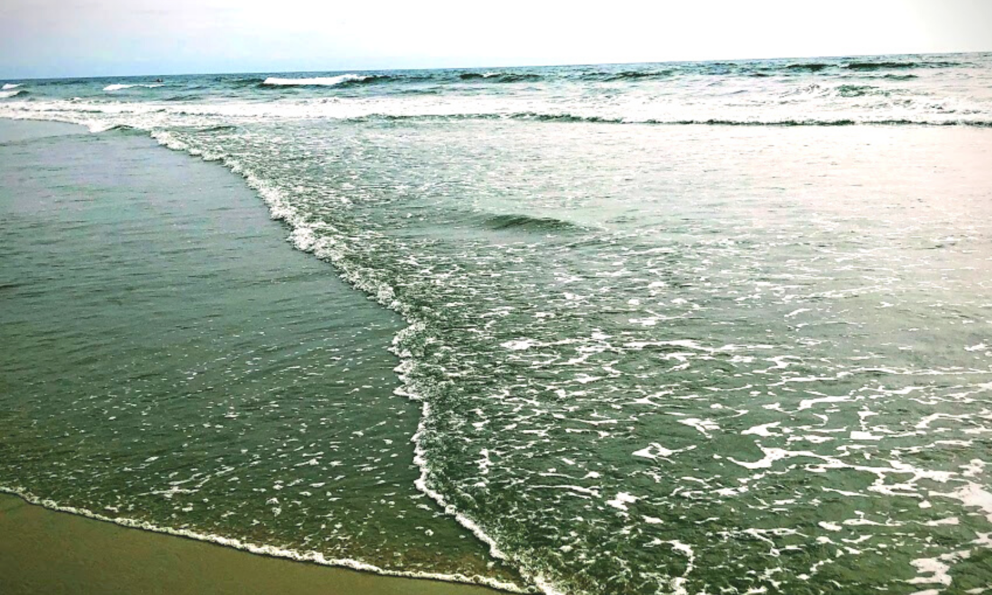
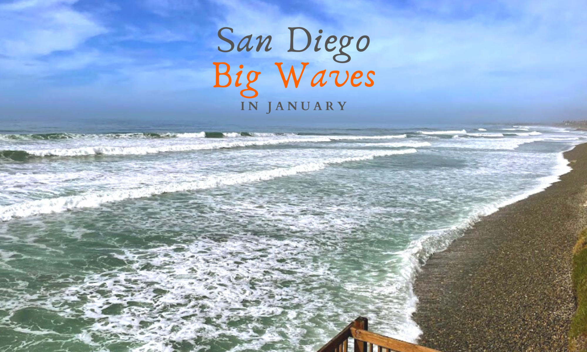
So did you hear about the massive storm that Southern California endured on January 6th? Did you know that there also was a Full Moon on January 6th? It sounds like a perfect combination to me. There were reports of waves reaching the insane height of over 20 feet in some spots! Unfortunately, I wasn’t able to get to the coast to have a look on that incredible weekend, but I was available on the 11th. I looked at the surf report for the second week in January, and Wednesday the 11th looked like the best bet in catching a few shots of big waves with my camera; hurray!

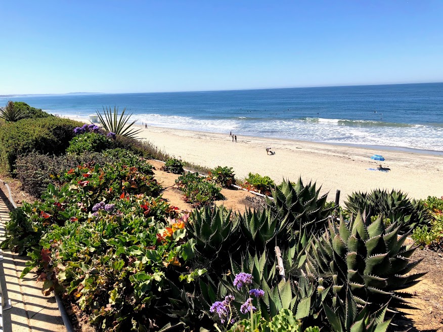
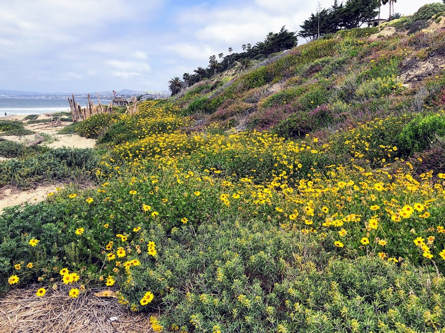
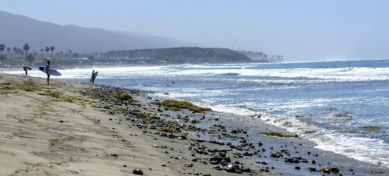
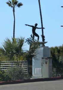
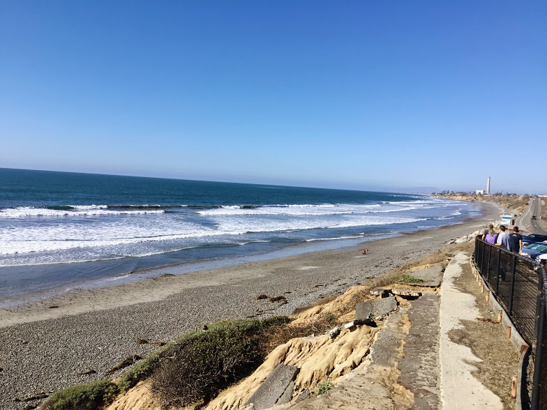
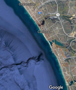
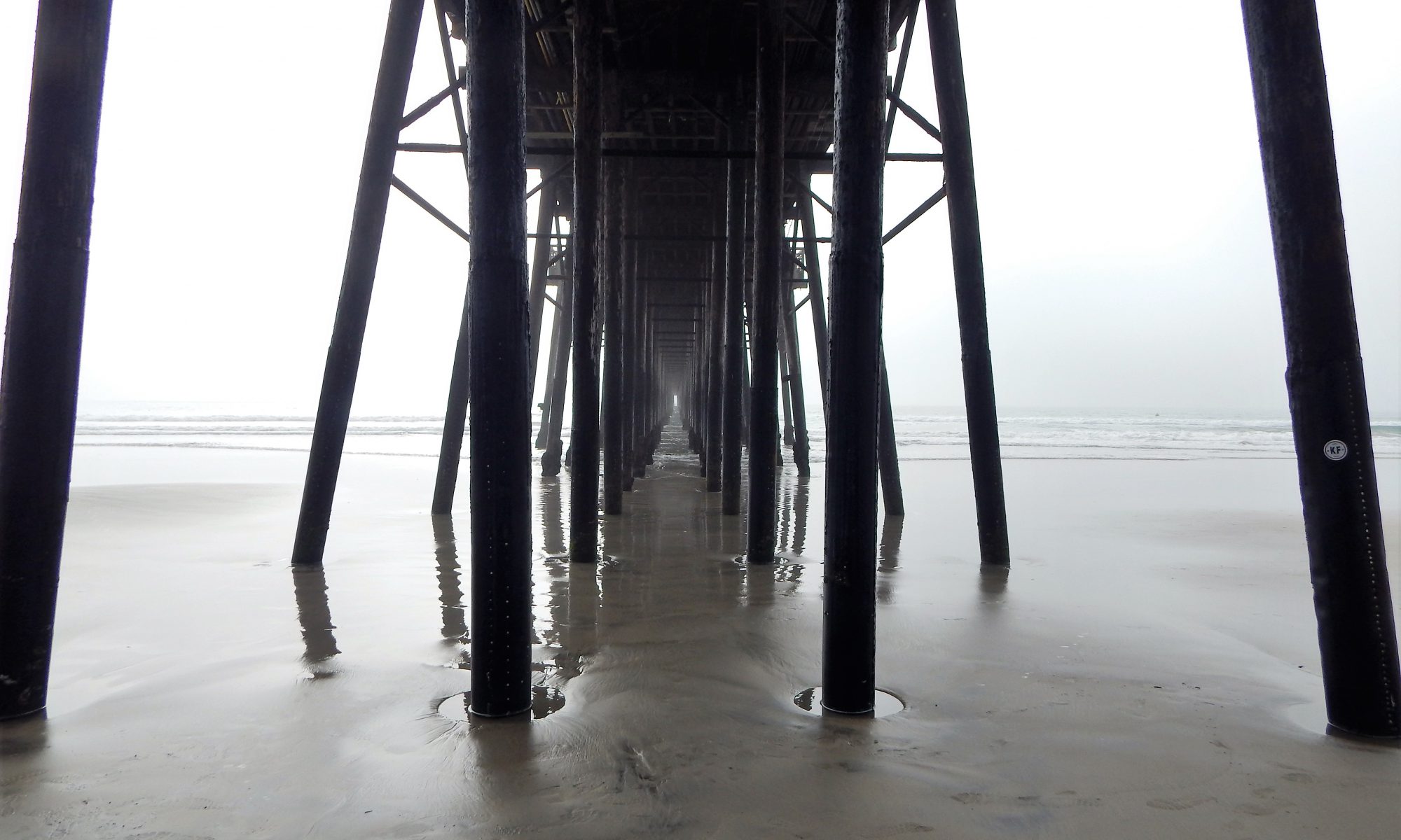
Join me as I journey down the coast, first Oceanside, then Carlsbad, and finally ending my adventure at Swami’s in Encinitas.

Just How Big Were the Waves on January Sixth in San Diego?

The storm came onshore in San Diego early on Thursday,  January 5th. The National Weather Service anticipated widespread coastal flooding, heavy rains, high winds (20 to 30 mph), and massive surf.

Also, the storm has been described as a ‘bomb cyclone’ because it started as a low-pressure system that rapidly intensified into a massive storm that created a west-northwest swell. So needless to say,  W to NW facing beaches experienced the largest waves.

How massive were the waves, you ask?

  • Oceanside Pier- 7 to 10 feet
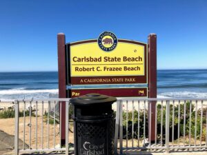
  • Carlsbad State Beach- 4 to 5 feet
  • South Ponto- 5 to 7 feet
  • Encinitas- 8 to 9 feet
  • Black’s Beach- 15 to 20 feet
  • La Jolla Cove- 18 to 20 feet
  • Mission Beach- 18 feet
  • Imperial Beach- 9 to 10 feet

Continue reading “Big Waves in January”

Carlsbad Sea Wall Trail-A Closer Look

Robert Frazee Beach Carlsbad San Diego

On the morning of April 29th, I woke up on a mission. A mission to take in some glorious sights and breathe in some crisp and clean ocean air. I wasn’t sure where to start this adventure, so I let my instincts guide me. While driving to the coast, several ideas pop in and out of my head. So today, I decided to take a closer look at the Carlsbad Sea Wall Trail, which is extremely popular in North Carlsbad.

—>Beaches of San Diego County<—

Below is an outline of the Beaches of Carlsbad. On this particular day, I visited all the beaches except South Ponto.

Carlsbad State Beach

  • Robert Frazee State Beach
  • Tamarack State Beach
  • Warm Water Jetty Beach

South Carlsbad State Beach

  • Terramar State Beach
  • North Ponto State Beach
  • South Carlsbad State Beach
  • South Ponto

Exploring the Carlsbad State Beach

Robert Frazee state beach sign

button map Robert Frazee State Beach

Today, I thought I would start over at Robert Frazee Beach, where Carlsbad State Beach’s northern boundary begins. A small parking lot is located off Oak Ave and Ocean St, but I found a parking spot right off Pine Street in the residential area.

Continue reading “Carlsbad Sea Wall Trail-A Closer Look”

Checking Out the Cristianitos Fault

Cristianitos Fault san onofre state beach

Hey! Have you ever seen an earthquake fault line? No? Well, today is your lucky day! Referred to as the Cristianitos fault, you can walk right up to it over at San Onofre State Beach.   Now I need to state this fact upfront so there will be no confusion. I am not a geologist; therefore, please be patient with me. If I make an incorrect claim, do not hesitate to correct me in the comments at the end of the post. I love to learn new things and will not be offended at all. Several references have helped me tremendously, but I have left them below. I encourage you to check them out!

Let’s take a trip to San Onofre State Beach (my favorite beach in San Diego) and investigate the Cristianitos fault line. As a bonus, I will highlight other unique geological features here at this fabulous State Beach.

One more thing. Did you know that the San Onofre Nuclear Generating Station (SONGS) is less than 800 yards away from this earthquake fault line?

Wait, what?! A nuclear generating station? Next to a fault line?

SONGS is no longer active and has been decommissioning for several years now. But obviously, the question is, why build a nuclear power plant right next to an earthquake fault line? (Click on the above link for more detailed decommissioning information.)

#Click on any photo for a larger version

The Cristianitos Fault Line-Shake, Rattle, & Roll?

Trail one san onofre state beach
Trail One at San Onofre Bluffs Beach Campground

button map san onofre bluffs campground

Continue reading “Checking Out the Cristianitos Fault”

Southern California Native Plants

Pechanga River back country stream

So what did you do during Quarantine 2020? Well, I spent many, many hours exploring the fields behind my neighborhood, and I went hunting for native plants and wildflowers! Would you like to see what I saw? Below, I have listed all of the Southern California native plants I observed from March to July.

I had a lot of time on my hands, and I thought now would be an excellent time to get more familiar with the native plants in my area. Did you know that San Diego County has the highest biodiversity in the continental United States?

Yes! California hosts over 6500 species, subspecies, and varieties of plants, with 222 of these that are designated as rare, endangered, or threatened.

I live about one mile from the San Diego Border,  so even though technically Temecula is in southwest Riverside County, let’s pretend.

So, where did I see all of these lovely plants? Behind my neighborhood is an undeveloped area that lies just outside the Pechanga Indian Reservation, and a dry riverbed runs parallel to two golf courses owned by Pechanga.

Below, I have provided a Google Map of the area that has become my second home these past five months.

Temecula plant ID trails native plants
Red Line=Observation Area

There are several biomes to explore here-

  • Grasslands
  • Coastal Sage Scrub
  • Chaparral
  • Southern Oak Woodland
  • Serpentine

Continue reading “Southern California Native Plants”

Walking Around Guajome Lake and Regional Park

Guajome Regional Park featured image water birds cattails

In mid-January, I took my daughters and Mother-in-Law to experience Guajome Lake and Regional Park in Oceanside for a couple of hours. We constantly pass the front entrance whenever we take Highway 76 to the coast.

I have always been intrigued by what Guajome Lake looked like, so today was the day to find out!

Guajome Regional Park Map

A Bit of Guajome Regional Park History

Guajome regional park grassy picnic area

First off, here are a few statistics regarding Guajome Regional Park. The park spans 394 acres and is 8 miles inland from the coast.

Continue reading “Walking Around Guajome Lake and Regional Park”

California Super Bloom at San Onofre

Trestles Beach April 2019 California Super Bloom

Over three weeks ago, I had the supreme pleasure of taking the opportunity to get out and see what was happening on the coast of North County, San Diego. Amidst all the rain we got this winter season, I was extremely excited to see how all the coast plants looked. Did the California super bloom affect the coast?

So I grabbed my backpack, filled it with plant ID books, my iPad, water, and sunscreen, and ran out the door. Well, maybe not running, but I was super excited!

My two daughters and I headed first to Trestles Beach Trail and afterward doubled back and explored Bluffs Beach at San Onofre State Beach. I have to say, what I saw, took my breath away.

San Onofre State Beach Google Map
Trestles Beach Trail to the North- San Onofre Bluff Campground south

button map trestles beach trail google map

Ok, are you ready to check out all the San Onofre State Beach plants in North County, San Diego?

Continue reading “California Super Bloom at San Onofre”

Best San Diego Hikes on the Coast

Encinitas Bluff Tree Best San Diego Hikes

San Diego County has some of the best coastlines on the entire coast of California. From the rugged seashore, with towering sandstone cliffs found in North County San Diego, all the way down to the open estuaries and sandy beaches in South County San Diego. Today I would like to list some of my favorite San Diego hikes you can experience on the coast of San Diego.

All San Diego hikes listed will be taken only with a negative low tide. Please check out the tide chart before embarking on your adventure, as some of these walks are dangerous if the tide comes upon you. A good rule of thumb would be to allow a couple of hours before the high tide comes back in. Remember, a very high tide always follows a shallow tide.

One more thing. I have previously written extensively on these sites and have linked each post appropriately, so click on the underlined links for more information.

Continue reading “Best San Diego Hikes on the Coast”

Best Surfing Beaches in San Diego

Surfing Lowers Best Surfing Beaches in San Diego

San Diego has a long history of surf culture. San Diego’s beaches are infamous because of this culture (Old Man’s, Windansea, Tourmaline Surfing Park). Today I would like to list some of the best surfing beaches in San Diego. It is important to note that I will be covering the entire San Diego County, starting North.

Swami Stooge best surfing beaches in San Diego
The ‘Cardiff Kook’ is placed right before downtown Encinitas

To add a bit of semblance to this list, I will add a linked google map to each site. I will also be specifying the wave type and direction, which swell/ wind combination works best, the reliability of the location, and any additional information that I find interesting or have written about in a prior post.

Swamis surfing sign best surfing beaches in San Diego
This sign is located right near Swami’s in Encinitas

Continue reading “Best Surfing Beaches in San Diego”

Oceanside Harbor Cruises- Get on the Water!

Oceanside Adventures Oceanside Harbor

One of the best ways to experience Oceanside Harbor up close and personal is to go on a Harbor cruise. Or even better, going out of the Harbor and exploring the coastline.  Here, I would like to present to you a list of all possible Oceanside harbor cruises.  As you are about to see, Oceanside Harbor cruises have a little bit of something for everyone. Just have a look!

I have previously written and listed all of the possible whale watching tours and all San Diego Sportfishing Party boats offered in San Diego County in two other posts. Please click on the links above for any additional information concerning whale watching or fishing tours in Oceanside.

A Variety of Oceanside Harbor Cruises

There are many cruises to choose from so let’s see what Oceanside Harbor has to offer, shall we?

Continue reading “Oceanside Harbor Cruises- Get on the Water!”

Hubbs Trail Tour at Agua Hedionda Lagoon

In Carlsbad, Agua Hedionda Lagoon is forty minutes north of downtown San Diego. The lagoon is over 400 acres and home to numerous plants and animals and a recreational playground for humans and leashed dogs!

Agua Hedionda Lagoon Google Map

There are several trails to choose from at the Agua Hedionda Lagoon. Today, we will explore the Hubbs Trail, situated closest to the Ocean at the northwestern portion of the lagoon.

Continue reading “Hubbs Trail Tour at Agua Hedionda Lagoon”

Agua Hedionda Lagoon Discovery Center

Agua Hedionda Lagoon Discovery Center

I can not tell you how excited I was to go and check out the Agua Hedionda Lagoon Discovery Center! I have always been fond of this lagoon. When I worked as a Fisheries Technician, I would find many shore anglers fishing on the western edge of this lagoon.

In San Diego, several lagoons and complimentary Nature Centers are filled with valuable information on local flora and fauna.

I have a page that lists all of these Coastal Lagoons and Nature Centers in San Diego County on my site here.

It has been my goal to visit everyone! Today is the day to check out the Agua Hedionda Lagoon Discovery Center!

Let’s go!

Continue reading “Agua Hedionda Lagoon Discovery Center”

Touring 10 Beaches-North County San Diego

North County San Diego

Living in Southern California, I have photographed many North County San Diego beaches. But I have not gotten even close to shooting every one of them!

So, it has been my mission this year to shoot every beach on the 70 miles of the San Diego coastline.

 Ok, let’s get going!

 Beaches of North County San Diego

On Jan 11, 2018, my daughter and I quickly rode to North County, San Diego, to photograph a few beaches.

—>The Beaches of San Diego County<—

Before leaving, I mapped out the ten shores we would be conquering. Our primary objective was to start at Wisconsin Street Beach in Oceanside, followed by the beaches of Carlsbad, and finally, end at Grandview Beach in Encinitas.

Oceanside Carlsbad Google Map North County San Diego
11.4 miles of coast covered

All in all, we covered 11.4 miles of San Diego’s 70 miles of coastline.

If there is one thing I have learned on the adventure, all these beaches listed below are best to visit on a mid to low-tide day, especially the beaches in Oceanside.

Continue reading “Touring 10 Beaches-North County San Diego”

Discovering Oceanside Pier CA

Oceanside Pier CA

Oceanside Pier

May 17, 2015- Oceanside Pier

Oceanside Pier is one of the largest piers in the State of California; measuring the length of 1954 feet.

This pier was first built in 1888 but was ultimately wiped out by a storm in 1890.

Eventually, it was again rebuilt in 1893 and additionally restored four more times due to heavy storms. The original location was at what is now Wisconsin Ave Beach.

Continue reading “Discovering Oceanside Pier CA”