The Brandt’s Cormorant- A Closer Look

Brandt's Cormorant featured image

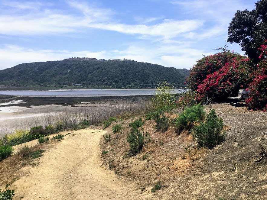
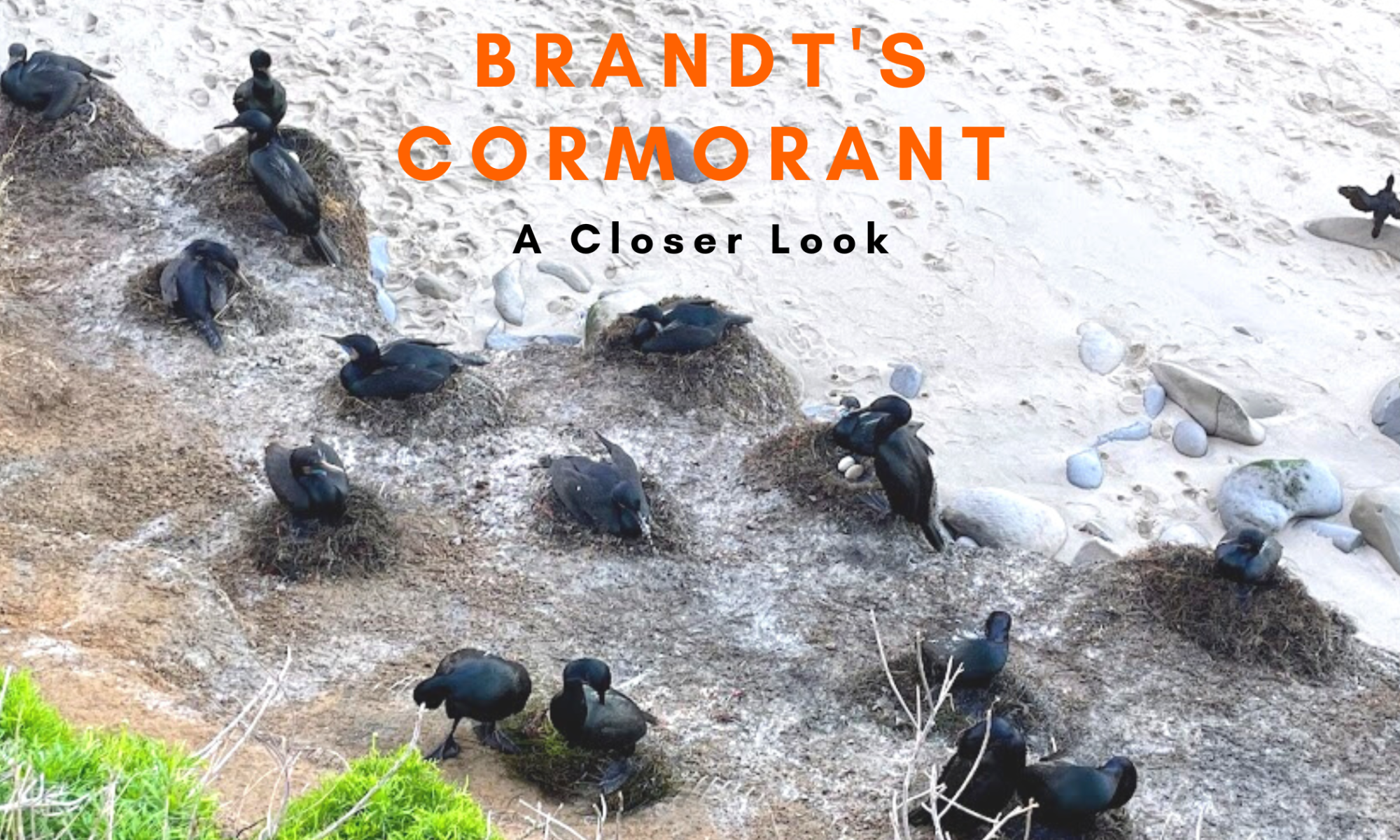
Today, I would like to take a closer look into the elusive shorebird found on the coast of San Diego, Brandt’s Cormorant. This seabird, the largest cormorant species, is located only on North America’s Pacific Coast and feeds on the California Current. La Jolla is the best place to see Brandt’s Cormorants up close. I just happened to be in the area at the end of January this year and was pleasantly surprised to see a baby cormorant and two eggs!

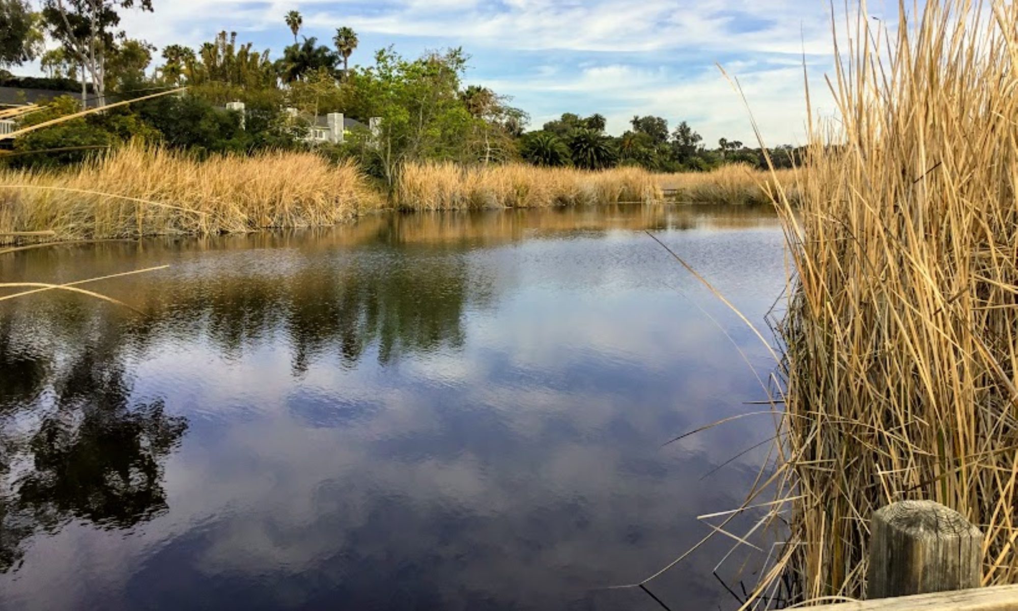
The Brandt’s Cormorant is strictly marine but is known to enter San Diego Bay. It is fascinating that it does not enter Mission Bay or any of San Diego’s coastal lagoons. Their main colonies are on The Channel Islands of Southern California and Mexico’s Los Coronados Islands.

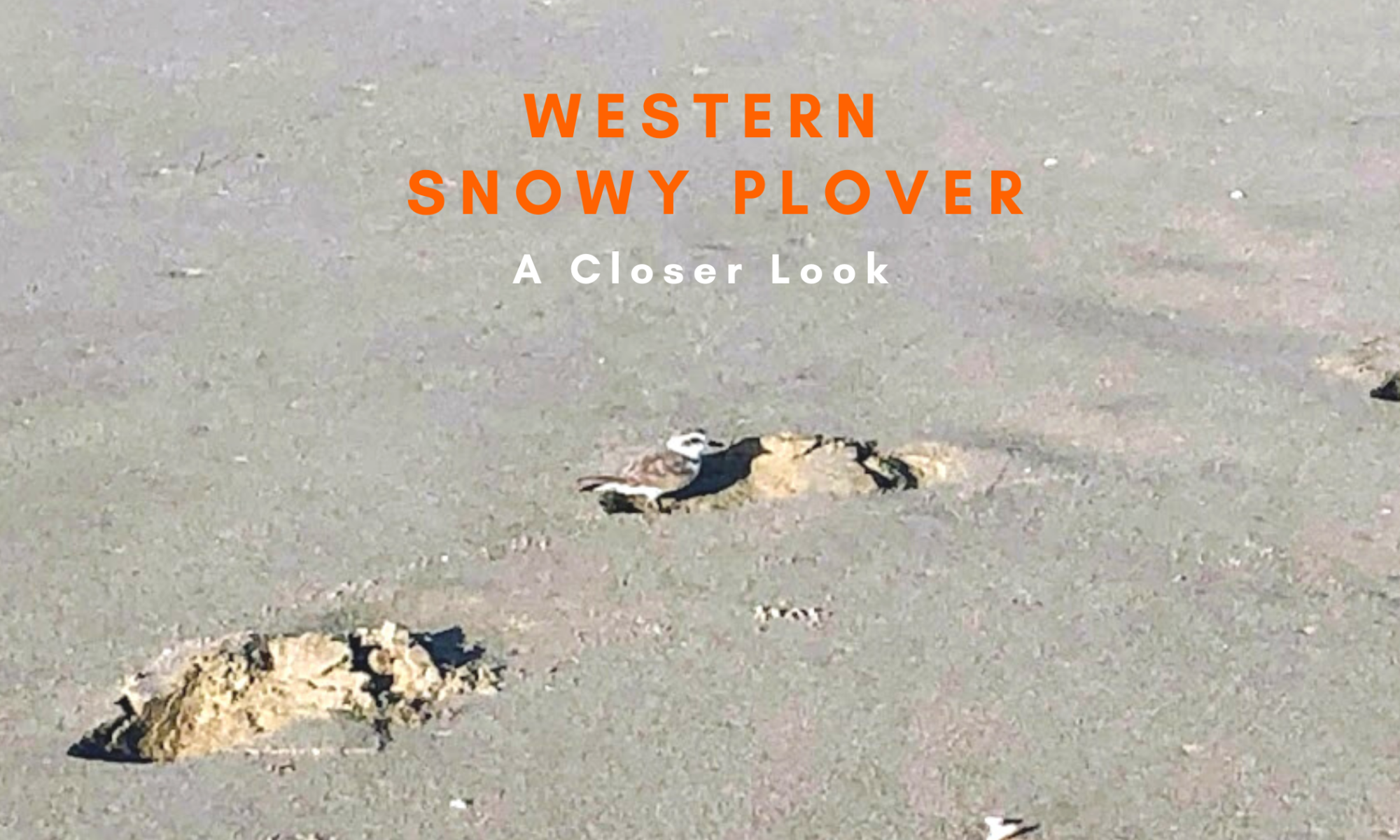
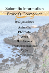
Let’s take a closer look at the Brandt’s Cormorant, shall we?

Brandt’s Cormorants Characteristics

Brandt's Cormorant scientific info breakdown

Identification

The Brandt’s Cormorant is a large, heavy-bodied, oval-shaped shorebird with a slender neck and hooked beak. The breeding adults are black with a purple sheen, have brilliant turquoise eyes, a very bright blue (gular pouch) throat patch, which fades after the breeding seasons, and whiskery white feathers on the head, neck, and shoulders.

Breeding adults jan black birds cliff ocean

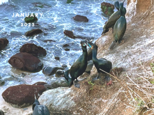
Nonbreeding birds are entirely black, and the juveniles are dark brownish with a fluffy plume around the neck.

Continue reading “The Brandt’s Cormorant- A Closer Look”

The Western Snowy Plover- A Closer Look

Today I would like to take a closer look at the Western snowy plover (Charadrius nivosus nivosus). I became inspired to learn more about this elusive bird by a very close interaction that I had with two plovers up North on the Central Coast over at Surf Beach, Lompoc (see down below for more information)

The Western snowy plover is a wader and one of the smallest shorebirds in Southern California, as it is only the size of a sparrow. The chicks are so tiny that they can easily be mistaken for cotton balls!

Bird Species of Special Conservation Concern in California

scientific classification snowy plover

Due to low population and habitat loss, the Western snowy plover was listed by the federal government as threatened on March 5, 1993. They prefer to nest on beaches, estuaries, peninsulas, bays, salt pans, and rivers in Oregon and California.

Continue reading “The Western Snowy Plover- A Closer Look”

The San Diego Bird Festival 2022

san diego bird festival featured image

I apologize for getting this information out so late, but here it is! Starting this week, the San Diego Bird Festival will be happening over at the Marina Village Conference Center in Quivira Basin, Mission Bay.

If you love birds, this conference is especially for you!

Let’s take a look at everything that the Festival has to offer- from fantastic field trips, thought-provoking lectures, as well as a prominent vendor Exhibit Hall which has everything you didn’t know that you needed!

Officially it will begin online today.

When?– February 16- February 19Marina Village Conference Center

How Much? There is a 30 dollar registration fee, and each event, unless designated as free, will have individual prices.

I looked at the registration page and came up with these prices.

Again, you will see the right price once you register.

General Fees-

  • $30- registration fee
  • $150- most bus trips
  • $50- most meet you there trips
  • $65- Birding by Bike
  • $80- Kayaking
  • $10- most lectures
  • $25- keynote talks

Continue reading “The San Diego Bird Festival 2022”

A Few Plants at Famosa Slough

famosa slough featured image

Last month, on November 23rd, my girls went to Famosa Slough because I wanted to check out and see how the plants were doing. I knew that the toyon and buckwheat were in bloom, but what other surprises were we in for? I can tell you upfront that I saw my first California boxthorn bush! Have you ever seen one in the wild?

So today, I wish to keep things casual, seeing that I have written more in-depth about almost all of these plants.

Please see the links down below if you would like further information.

A Few Famosa Slough Facts

Famosa slough map google maps

button-map-Famosa-Slough-Google-Maps

First and foremost, the Famosa Slough is a living wetland preserve and a Marine Protected Area, meaning nothing is to be touched or taken. It survives as a wetland by the tidal flow from the culvert pipes that connect it to the San Diego River Channel.

It consists of two sections: the Northern Channel, 12 acres, and the southern portion, 25 acres of mixed wetlands. The more south you go, the less saline the water.

I have been here four times and have written about Famosa Slough before, only concentrating on the southern section. Well, today, we explored both.

North Channel of Famosa Slough

famosa slough pano san diego saltmarsh

The North section connects to the San Diego River Channel north, with the southern portion just across the street.

Continue reading “A Few Plants at Famosa Slough”

Fiesta Island- A Closer Look

Fiesta Island entrance mission bay san diego

On June 15, 2021, one of my best friends and I took her two dogs to Fiesta Island at Mission Bay Park. Though I have been visiting Fiesta Island for over 30 years, today was the first time I entered the infamous leash-free dog park; this place is magical! Ironically, the next day, the California Coastal Commission formally decided that Fiesta Island Dog Park would stay the same way it had been for years- rustic and undeveloped. I had no idea this was up for a vote.

A bit more commentary on this subject later.

So as I said before, I have been coming here for years, but in 2018, I did a photoshoot of the island. I was surprised at how special it is over here. Would you care to see what I saw?

Let’s also look closely at all the things you can enjoy at Fiesta Island. As a bonus, I will include phone numbers and links to relevant websites about this area!

A Few Mission Bay and Fiesta Island Facts

mission bay map fiesta island san diego

button map fiesta island mission bay san diego

Phone Number– (619) 235-1169

Hours– 4:00 am to 10:00 pm

Click on the map below for a better idea.

—>Fiesta Island Map<—

#– Fiesta Island Dog Park is open 24 hours, seven days a week, but the island is closed to cars after 10:00 pm. You may enter, but you must park off the island and walk.

Continue reading “Fiesta Island- A Closer Look”

Walking Around Guajome Lake and Regional Park

Guajome Regional Park featured image water birds cattails

In mid-January, I took my daughters and Mother-in-Law to experience Guajome Lake and Regional Park in Oceanside for a couple of hours. We constantly pass the front entrance whenever we take Highway 76 to the coast.

I have always been intrigued by what Guajome Lake looked like, so today was the day to find out!

Guajome Regional Park Map

A Bit of Guajome Regional Park History

Guajome regional park grassy picnic area

First off, here are a few statistics regarding Guajome Regional Park. The park spans 394 acres and is 8 miles inland from the coast.

Continue reading “Walking Around Guajome Lake and Regional Park”

Coast to Crest Trail-San Dieguito Lagoon

San Dieguito River Del Mar

A couple of months ago, I went down to the San Dieguito Lagoon in Del Mar to walk on the Coast to Crest Trail. Did you know that San Diego County has six coastal lagoons? The San Dieguito Lagoon is the largest of them all.

This past year, I have been having a blast visiting all of the San Diego Lagoons and Nature Centers, and this was the last lagoon to see on my list.

Coast to Crest trail sign Del Mar

Walking the Coast to Crest Trail at the San Dieguito Lagoon

The San Dieguito Lagoon is located in North County, San Diego, 21 miles north of Downtown San Diego. The lagoon is part of the San Dieguito River Park, which spans over 92,000 acres!

Continue reading “Coast to Crest Trail-San Dieguito Lagoon”

Best San Diego Birding Hotspots

Loma Alta Creek San Diego Birding

Here I  present a comprehensive list of the best San Diego birding hotspots. I will include all of San Diego County, starting first to the north and going south. Each site will have a link to an address and habitat type, amenities,  tour information (if available), and any notable birds of Interest.

Did you know many free San Diego birding tours are offered all over San Diego County? I will also include any insider information in my research, such as prime locations within each site.

Continue reading “Best San Diego Birding Hotspots”

Walking the Batiquitos Lagoon Trail

Batiquitos Lagoon sitting bench plants lagoon hills

Are you looking for a relatively easy trail to hike on in San Diego? Well, look no further as I have found the perfect spot! The Batiquitos Lagoon is between Carlsbad and Encinitas, and it is one of the last saltwater marshes in Southern California. Today I will be taking you on a tour of the 3.14-mile Batiquitos Lagoon Trail.

Batiquitos Lagoon Map topography

Let’s go!

7380 Gabbiano Lane, Carlsbad

760-931-0800

Nature Center-9am-3pm daily

Batiquitos Lagoon Foundation Information

Batiquitos Lagoon Trail-A Photo Tour

I was so happy to come here for the first time. I have always been curious about this lagoon, as you can see from the Interstate 5 freeway. Here are a couple of references for you. The first is a map of the lagoon and a list of all possible birds seen here. Finally, I added the Self-Guided Batiquitos Trail Map, highlighting several sites.

Fun Fact- Batiquitos translates to ‘little watering hole” in Spanish.

Continue reading “Walking the Batiquitos Lagoon Trail”