A Few Plants at Famosa Slough

famosa slough featured image

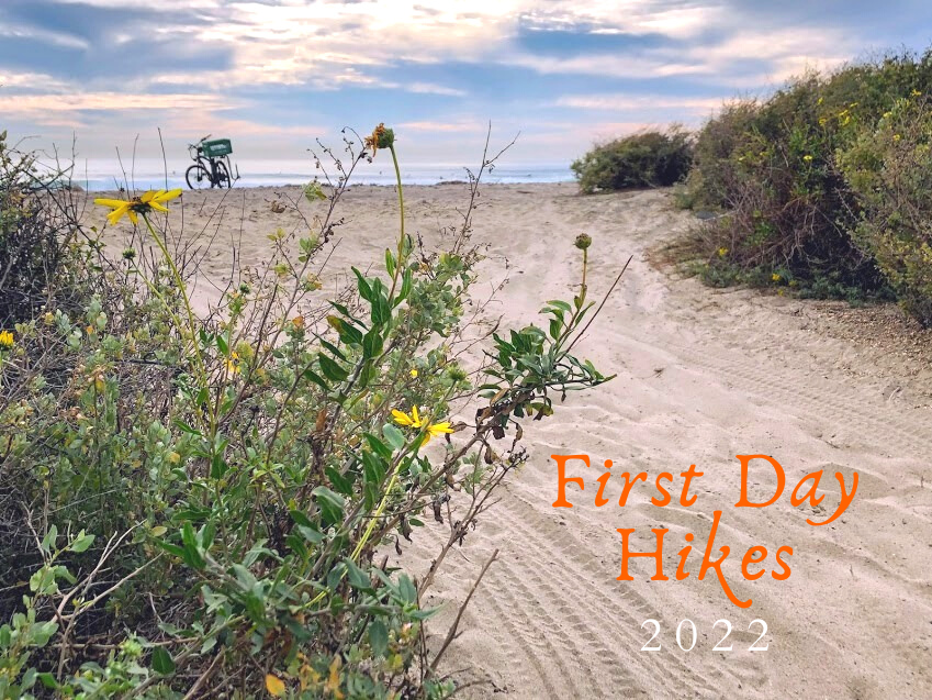
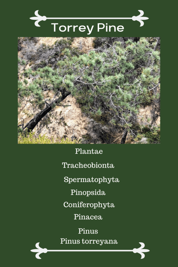
Last month, on November 23rd, my girls went to Famosa Slough because I wanted to check out and see how the plants were doing. I knew that the toyon and buckwheat were in bloom, but what other surprises were we in for? I can tell you upfront that I saw my first California boxthorn bush! Have you ever seen one in the wild?

So today, I wish to keep things casual, seeing that I have written more in-depth about almost all of these plants.

Please see the links down below if you would like further information.

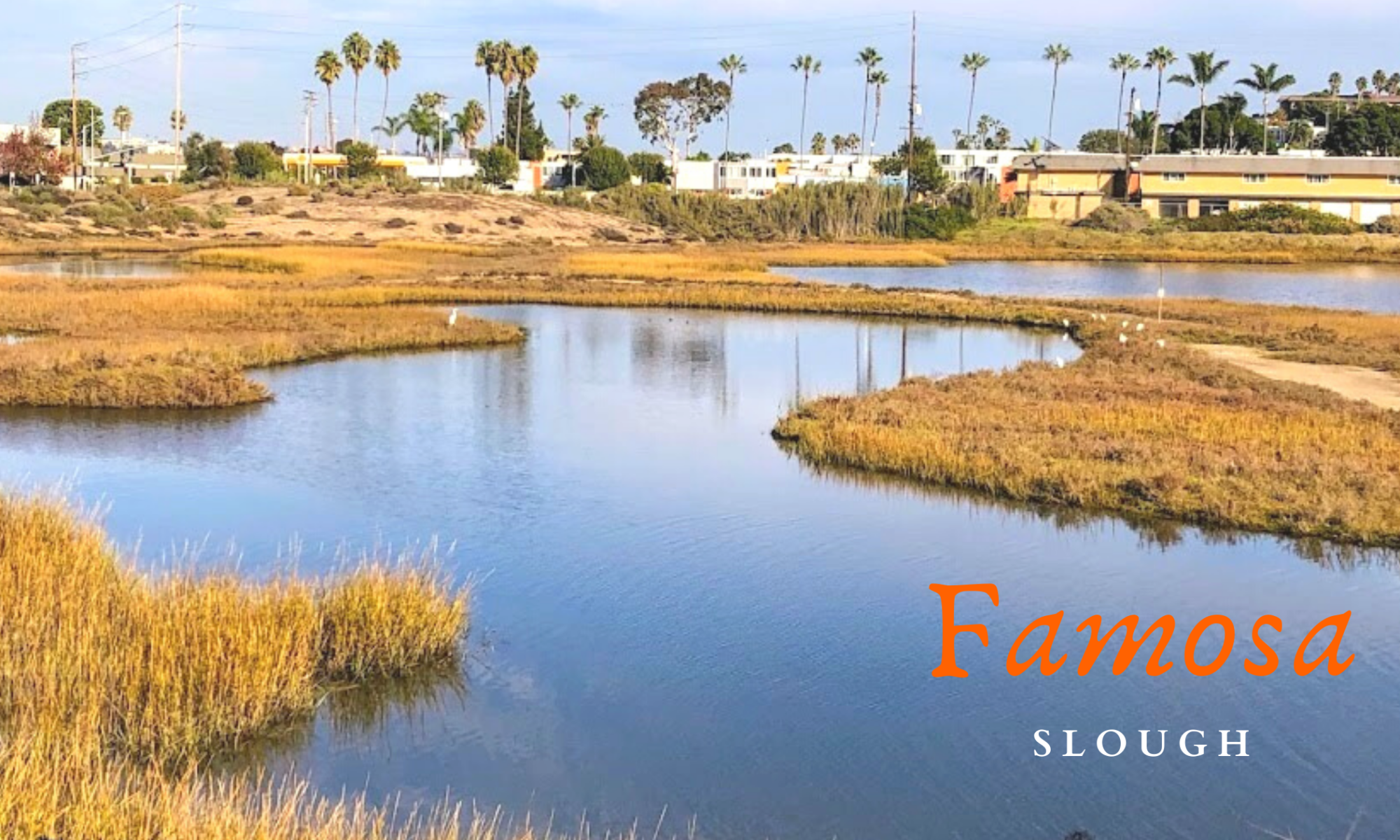
A Few Famosa Slough Facts

Famosa slough map google maps

button-map-Famosa-Slough-Google-Maps

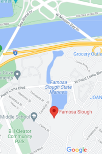
First and foremost, the Famosa Slough is a living wetland preserve and a Marine Protected Area, meaning nothing is to be touched or taken. It survives as a wetland by the tidal flow from the culvert pipes that connect it to the San Diego River Channel.

It consists of two sections: the Northern Channel, 12 acres, and the southern portion, 25 acres of mixed wetlands. The more south you go, the less saline the water.

I have been here four times and have written about Famosa Slough before, only concentrating on the southern section. Well, today, we explored both.

North Channel of Famosa Slough

famosa slough pano san diego saltmarsh

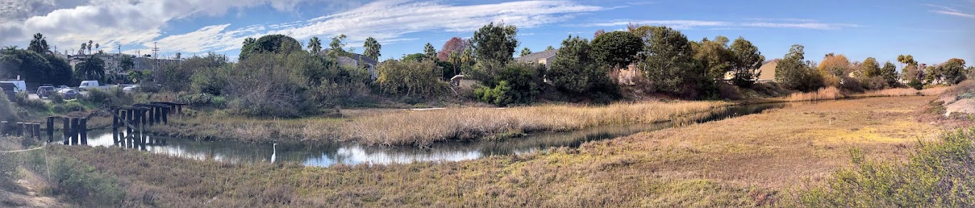
The North section connects to the San Diego River Channel north, with the southern portion just across the street.

Continue reading “A Few Plants at Famosa Slough”

First Day Hikes 2022

First Day Hikes 2022 Featured Image

Wow! I am so happy to write up this post in record time! You see, yesterday, I realized that the California State Parks uniquely celebrate the New Year. How is that, you may ask?
California State Park staff members, docents, and volunteers will show off the beauty and wonders of our gorgeous State Park system by leading the general public in First Day Hikes! Below is valuable information on each San Diego/ California State Park featured, plus a brief explanation of where and what is offered.
I will start north up at San Onofre State Beach and go south towards the California/Mexican Border.
It is supposed to be chilly on the coast today, with the high only 62 degrees, so please consider that!


First Day Hikes at San Onofre State Beach

Trestles November sand dunes water surfers

Where – Trestles Beach Trailhead on Cristianitos Road/ El Camino Real

Time- 2 pm

Continue reading “First Day Hikes 2022”

Carlsbad Sea Wall Trail-A Closer Look

Robert Frazee Beach Carlsbad San Diego

On the morning of April 29th, I woke up on a mission. A mission to take in some glorious sights and breathe in some crisp and clean ocean air. I wasn’t sure where to start this adventure, so I let my instincts guide me. While driving to the coast, several ideas pop in and out of my head. So today, I decided to take a closer look at the Carlsbad Sea Wall Trail, which is extremely popular in North Carlsbad.

—>Beaches of San Diego County<—

Below is an outline of the Beaches of Carlsbad. On this particular day, I visited all the beaches except South Ponto.

Carlsbad State Beach

  • Robert Frazee State Beach
  • Tamarack State Beach
  • Warm Water Jetty Beach

South Carlsbad State Beach

  • Terramar State Beach
  • North Ponto State Beach
  • South Carlsbad State Beach
  • South Ponto

Exploring the Carlsbad State Beach

Robert Frazee state beach sign

button map Robert Frazee State Beach

Today, I thought I would start over at Robert Frazee Beach, where Carlsbad State Beach’s northern boundary begins. A small parking lot is located off Oak Ave and Ocean St, but I found a parking spot right off Pine Street in the residential area.

Continue reading “Carlsbad Sea Wall Trail-A Closer Look”

Plants at the Beach-San Onofre

San Onofre State Beach May Trails Beach

Boy, was I excited to finally go to the beach on May 24, 2020? Is anyone else happy to get out of their houses, too? I was so pleased to go to San Onofre State Beach twice a week. Because of the lockdown in California, I could not witness the beginning of the wildflower season. So my main objective on this first day back to the beach was to see as many plants as possible! The first time we headed to Trestles, and the following Friday, I explored the southern section, just under San Onofre Campground at Bluffs Beach (or Trails Beach). Below, I would love to share with you what I saw- all the plants at the beach I encountered.

Previous to this beach adventure, I had just finished a post on Southern California Native Plants. This post has documented all the plants and wildflowers I encountered in the scrub and Southern Oak Woodland behind my neighborhood during Lock-Down in 2020. After hours and hours of research, I sure learned a tremendous amount!

Plant Names Given by San Diego Native Inhabitants 

I have recently been fascinated with Native American uses of the native plants in the area (Ethnobotany), so I thought I would continue with the same format I followed for my previous native plant post.

The Kumeyaay people were the first known original inhabitants of San Diego, with meyaay translating to ‘those who face the water from a cliff.” (Click on the link to hear the correct way to pronounce Kumeyaay)

Continue reading “Plants at the Beach-San Onofre”

Five More San Diego Hidden Gems

Ocean sunset san diego hidden gems

San Diego, otherwise known as  “America’s Finest City,” has one of the most beautiful coastlines, if I may dare say, in the world. According to the San Diego Tourism Authority, over 35 million people visited San Diego in 2018 and 36.5 million in 2019. I am afraid to see the numbers for 2020, but I digress. One of my favorite things to do on this website is introduce you all to the many, many San Diego hidden gems. I will be the first to admit that I am biased as I have been exploring the San Diego coastline for over thirty-five years. So today, I would like to share with you a few more, in fact, five more San Diego Hidden Gems, so you too can experience San Diego as a native.

When I say San Diego, I refer to the entire 70 miles of the San Diego coast. From San Onofre State Beach down to the US/Mexico border, the coast of San Diego has something for everyone!

Let us now take a look, shall we?

#Click on any photo in the gallery to view a larger image


Old Man’s Beach at San Onofre State Beach

Old Man Secret Spot Hidden gems San Diego

button map Old Mans San Onofre State Beach

I wasn’t sure if I would share this little gem because this has been my little secret for years, but here we go. Old Man’s Beach is one of my favorite places at San Onofre State Beach, and locals refer to this beach as  San O and San Onofre Surfing Beach.

Continue reading “Five More San Diego Hidden Gems”

Wardholme Tree You Took My Breath Away!

Wardholme torrey pine featured image me looking up

Last month, my husband and I could visit his family north of Santa Barbara County. I was super excited because we could stop by Carpinteria and check out the largest Torrey Pine tree in the world! The tree even has a formal name- the Wardholme Torrey Pine.

It may seem a bit dramatic, but I gasped when we approached the tree! You can not deny the presence of this giant.

Let’s take a look close and personally, shall we?

Important Information
  • Scientific Name
    • Inland Population- Pinus torreyana
    • Santa Rosa Island- Pinus torreyana var. insularis
  • Habitat
    • coastal sage scrub
    • chaparral
  • Endangered
  • One of the rarest pine trees in the world as it only grows naturally in two places in Southern California.
    • A small strip of the coastline in Del Mar and La Jolla
    • Santa Rosa Island, off the coast of Santa Barbara County
  • Very slow-growing and can live up to 100 years
  • Distinguished by the needles on the branches being in bunches of five
  • Six-inch (15 cm) pinecones

Map- 5100 Carpinteria Ave, Carpinteria, CA 93013

Continue reading “Wardholme Tree You Took My Breath Away!”

Southern California Native Plants

Pechanga River back country stream

So what did you do during Quarantine 2020? Well, I spent many, many hours exploring the fields behind my neighborhood, and I went hunting for native plants and wildflowers! Would you like to see what I saw? Below, I have listed all of the Southern California native plants I observed from March to July.

I had a lot of time on my hands, and I thought now would be an excellent time to get more familiar with the native plants in my area. Did you know that San Diego County has the highest biodiversity in the continental United States?

Yes! California hosts over 6500 species, subspecies, and varieties of plants, with 222 of these that are designated as rare, endangered, or threatened.

I live about one mile from the San Diego Border,  so even though technically Temecula is in southwest Riverside County, let’s pretend.

So, where did I see all of these lovely plants? Behind my neighborhood is an undeveloped area that lies just outside the Pechanga Indian Reservation, and a dry riverbed runs parallel to two golf courses owned by Pechanga.

Below, I have provided a Google Map of the area that has become my second home these past five months.

Temecula plant ID trails native plants
Red Line=Observation Area

There are several biomes to explore here-

  • Grasslands
  • Coastal Sage Scrub
  • Chaparral
  • Southern Oak Woodland
  • Serpentine

Continue reading “Southern California Native Plants”

Walking Around Guajome Lake and Regional Park

Guajome Regional Park featured image water birds cattails

In mid-January, I took my daughters and Mother-in-Law to experience Guajome Lake and Regional Park in Oceanside for a couple of hours. We constantly pass the front entrance whenever we take Highway 76 to the coast.

I have always been intrigued by what Guajome Lake looked like, so today was the day to find out!

Guajome Regional Park Map

A Bit of Guajome Regional Park History

Guajome regional park grassy picnic area

First off, here are a few statistics regarding Guajome Regional Park. The park spans 394 acres and is 8 miles inland from the coast.

Continue reading “Walking Around Guajome Lake and Regional Park”

Desperately Seeking Torrey Pine Trees

Desperately seeking torrey pine tree featured image

I would have a bit of fun with this post today. With all the exploring I have been doing in San Diego County, I have noticed the elusive Torrey pine trees while on my adventures.

I am so intrigued that the Torrey pine tree is endangered and is the rarest pine tree in North America. The Torrey pine tree only grows naturally on a tiny strip of land on Torrey Pines State Natural Reserve (TPSNR). Because of this, I keep noticing them wherever I go around San Diego County!

I have tried to find any information on who planted these trees, but I was ecstatic every time I saw a Torrey pine tree. So I did a little research, and let me tell you, it was not easy. There is plenty of necessary information, but other than that, not so much.

Torrey Pine Tree Information

torrey pine tree scientific information

First and foremost, the Torrey pine tree only grows naturally in Del Mar and Santa Rosa Island, off the coast of Santa Barbara, which is 175 miles away.

Continue reading “Desperately Seeking Torrey Pine Trees”